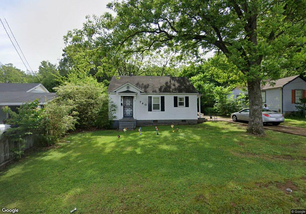
740 S High St Covington, TN 38019
Estimated Value: $95,194 - $166,000
2
Beds
1
Bath
780
Sq Ft
$159/Sq Ft
Est. Value
About This Home
This home is located at 740 S High St, Covington, TN 38019 and is currently estimated at $124,299, approximately $159 per square foot. 740 S High St is a home located in Tipton County with nearby schools including Crestview Elementary School, Crestview Middle School, and Covington High School.
Ownership History
Date
Name
Owned For
Owner Type
Purchase Details
Closed on
Jan 16, 2009
Sold by
American General Finance I
Bought by
Thomas Bret
Current Estimated Value
Purchase Details
Closed on
Oct 31, 2008
Sold by
Kirkscey David A
Bought by
American General Financial
Purchase Details
Closed on
Aug 28, 1986
Bought by
Fuqua Billy Dale and Fuqua Martha A
Purchase Details
Closed on
Jul 30, 1960
Create a Home Valuation Report for This Property
The Home Valuation Report is an in-depth analysis detailing your home's value as well as a comparison with similar homes in the area
Home Values in the Area
Average Home Value in this Area
Purchase History
| Date | Buyer | Sale Price | Title Company |
|---|---|---|---|
| Thomas Bret | $18,500 | -- | |
| American General Financial | $20,762 | -- | |
| Fuqua Billy Dale | -- | -- | |
| -- | -- | -- |
Source: Public Records
Tax History Compared to Growth
Tax History
| Year | Tax Paid | Tax Assessment Tax Assessment Total Assessment is a certain percentage of the fair market value that is determined by local assessors to be the total taxable value of land and additions on the property. | Land | Improvement |
|---|---|---|---|---|
| 2024 | $353 | $13,950 | $3,650 | $10,300 |
| 2023 | $353 | $13,950 | $3,650 | $10,300 |
| 2022 | $323 | $9,850 | $2,675 | $7,175 |
| 2021 | $323 | $9,850 | $2,675 | $7,175 |
| 2020 | $323 | $9,850 | $2,675 | $7,175 |
| 2019 | $296 | $7,875 | $2,075 | $5,800 |
| 2018 | $296 | $7,875 | $2,075 | $5,800 |
| 2017 | $296 | $7,875 | $2,075 | $5,800 |
| 2016 | $296 | $7,875 | $2,075 | $5,800 |
| 2015 | $297 | $7,925 | $2,075 | $5,850 |
| 2014 | $296 | $7,911 | $0 | $0 |
Source: Public Records
Map
Nearby Homes
- 600 W Sherrod Ave
- 714 W Sherrod Ave
- 513 Garland Ave
- 417 Lennanwood Ave
- 509 S College St
- 210 Kinney Ave
- 826 Douglas St
- 711 S Main St
- 722 S Main St
- 518 James St
- 715 S Maple St
- 1329 Herring Dr
- 830 S Main St
- 624 Fyfe St
- 111 W Washington Ave
- 0 N Munford St Unit 10156264
- 0 N Munford St Unit 10156263
- 316 Sanford Ave
- 296 E Washington Ave Unit 3
- 212 S Tipton St
- 814 S High St
- 736 S High St
- 620 W Sherrod Ave
- 449 Azalea Ln
- 502 Terrace Dr
- 447 Azalea Ln
- 618 W Sherrod Ave
- 630 W Sherrod Ave
- 445 Azalea Ln
- 612 W Sherrod Ave
- 503 Terrace Dr
- 508 Terrace Dr
- 446 Azalea Ln
- 444 Azalea Ln
- 634 W Sherrod Ave
- 507 Terrace Dr
- 442 Azalea Ln
- 514 Terrace Dr
- 632 S High St
- 821 S High St