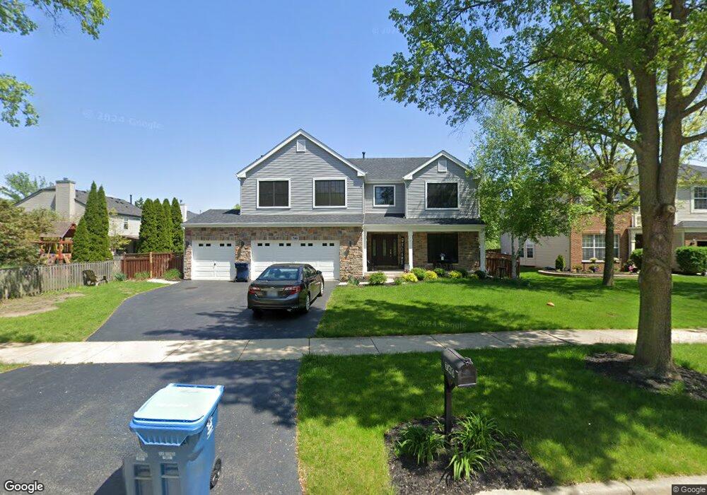
740 Sumac Dr Aurora, IL 60506
Blackberry Countryside NeighborhoodEstimated Value: $488,445 - $529,000
4
Beds
3
Baths
3,500
Sq Ft
$144/Sq Ft
Est. Value
About This Home
This home is located at 740 Sumac Dr, Aurora, IL 60506 and is currently estimated at $503,111, approximately $143 per square foot. 740 Sumac Dr is a home located in Kane County with nearby schools including Kaneland Mcdole Elementary School, Harter Middle School, and Kaneland Senior High School.
Ownership History
Date
Name
Owned For
Owner Type
Purchase Details
Closed on
Mar 23, 2007
Sold by
Jarvis Robert and Campobasso Lucia
Bought by
Groble Michael J and Groble Sharon M
Current Estimated Value
Home Financials for this Owner
Home Financials are based on the most recent Mortgage that was taken out on this home.
Original Mortgage
$272,000
Outstanding Balance
$164,096
Interest Rate
6.2%
Mortgage Type
Purchase Money Mortgage
Estimated Equity
$339,015
Purchase Details
Closed on
Jul 24, 2003
Sold by
Lindens Venture Llc
Bought by
Jarvis Robert B and Campobasso Lucia
Home Financials for this Owner
Home Financials are based on the most recent Mortgage that was taken out on this home.
Original Mortgage
$308,450
Interest Rate
5.31%
Mortgage Type
Purchase Money Mortgage
Create a Home Valuation Report for This Property
The Home Valuation Report is an in-depth analysis detailing your home's value as well as a comparison with similar homes in the area
Home Values in the Area
Average Home Value in this Area
Purchase History
| Date | Buyer | Sale Price | Title Company |
|---|---|---|---|
| Groble Michael J | $340,000 | Chicago Title Insurance Co | |
| Jarvis Robert B | $343,000 | First American Title |
Source: Public Records
Mortgage History
| Date | Status | Borrower | Loan Amount |
|---|---|---|---|
| Open | Groble Michael J | $272,000 | |
| Previous Owner | Jarvis Robert B | $308,450 |
Source: Public Records
Tax History Compared to Growth
Tax History
| Year | Tax Paid | Tax Assessment Tax Assessment Total Assessment is a certain percentage of the fair market value that is determined by local assessors to be the total taxable value of land and additions on the property. | Land | Improvement |
|---|---|---|---|---|
| 2024 | $11,495 | $132,435 | $30,252 | $102,183 |
| 2023 | $11,092 | $119,440 | $27,284 | $92,156 |
| 2022 | $10,720 | $110,266 | $25,188 | $85,078 |
| 2021 | $10,388 | $104,935 | $23,970 | $80,965 |
| 2020 | $10,305 | $102,697 | $23,459 | $79,238 |
| 2019 | $10,198 | $99,339 | $22,692 | $76,647 |
| 2018 | $10,035 | $96,404 | $22,726 | $73,678 |
| 2017 | $9,784 | $92,068 | $21,704 | $70,364 |
| 2016 | $9,555 | $88,011 | $20,748 | $67,263 |
| 2015 | -- | $81,886 | $19,304 | $62,582 |
| 2014 | -- | $84,949 | $18,459 | $66,490 |
| 2013 | -- | $85,842 | $18,653 | $67,189 |
Source: Public Records
Map
Nearby Homes
- 888 Summerhill Dr Unit 2
- 2451 Roseglen Way
- 2091 Jericho Rd
- 2315 Wyckwood Dr
- 425 Cottrell Ln
- 399 S Constitution Dr
- Napa Plan at Prairie Meadows
- Siena Plan at Prairie Meadows
- Sonoma Plan at Prairie Meadows
- Rutherford Plan at Prairie Meadows
- 405 S Constitution Dr
- 381 S Constitution Dr
- 375 S Constitution Dr
- 369 S Constitution Dr
- 342 S Constitution Dr
- 336 S Constitution Dr
- 27 S Canterbury Rd
- 977 Lindenwood Dr
- 2091 School House Ln
- 1031 Lindenwood Dr
- 752 Sumac Dr
- 768 Meadowsedge Ln
- 780 Meadowsedge Ln Unit 5
- 756 Meadowsedge Ln
- 764 Sumac Dr Unit 5
- 751 Sumac Dr Unit 5
- 739 Sumac Dr Unit 5
- 744 Meadowsedge Ln
- 776 Sumac Dr
- 763 Sumac Dr
- 775 Sumac Dr Unit 5
- 715 Sumac Dr
- 732 Meadowsedge Ln
- 788 Sumac Dr Unit 5
- 769 Meadowsedge Ln
- 781 Meadowsedge Ln
- 757 Meadowsedge Ln
- 703 Sumac Dr
- 787 Sumac Dr
- 709 Meadowsedge Ln