Estimated Value: $305,923 - $347,000
3
Beds
2
Baths
1,507
Sq Ft
$219/Sq Ft
Est. Value
About This Home
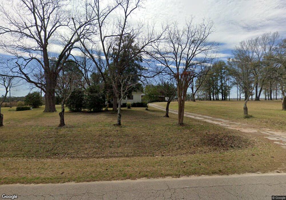
This home is located at 7400 Buckeye Rd, Perry, GA 31069 and is currently estimated at $330,308, approximately $219 per square foot. 7400 Buckeye Rd is a home located in Peach County with nearby schools including Kay Road Elementary School, Fort Valley Middle School, and Peach County High School.
Ownership History
Date
Name
Owned For
Owner Type
Purchase Details
Closed on
Aug 18, 2011
Sold by
Batchelor Rickey M and Batchelor Ricky M
Bought by
Batchelor Rickey M and Batchelor Marlene Roberts
Current Estimated Value
Purchase Details
Closed on
Sep 28, 2000
Sold by
Batchelor Karan Den
Bought by
Batchelor Ricky Milton
Purchase Details
Closed on
Apr 14, 1993
Bought by
Batchelor Ricky Milton and Batchelor Karan D
Purchase Details
Closed on
May 13, 1988
Bought by
Batchelor Rickey Milton
Create a Home Valuation Report for This Property
The Home Valuation Report is an in-depth analysis detailing your home's value as well as a comparison with similar homes in the area
Home Values in the Area
Average Home Value in this Area
Purchase History
| Date | Buyer | Sale Price | Title Company |
|---|---|---|---|
| Batchelor Rickey M | -- | -- | |
| Batchelor Ricky Milton | -- | -- | |
| Batchelor Ricky Milton | -- | -- | |
| Batchelor Rickey Milton | -- | -- |
Source: Public Records
Tax History Compared to Growth
Tax History
| Year | Tax Paid | Tax Assessment Tax Assessment Total Assessment is a certain percentage of the fair market value that is determined by local assessors to be the total taxable value of land and additions on the property. | Land | Improvement |
|---|---|---|---|---|
| 2024 | $1,203 | $72,040 | $43,240 | $28,800 |
| 2023 | $1,055 | $54,640 | $28,840 | $25,800 |
| 2022 | $974 | $51,696 | $28,840 | $22,856 |
| 2021 | $939 | $46,720 | $28,840 | $17,880 |
| 2020 | $1,162 | $53,920 | $28,840 | $25,080 |
| 2019 | $1,140 | $53,120 | $28,840 | $24,280 |
| 2018 | $1,143 | $53,120 | $28,840 | $24,280 |
| 2017 | $980 | $53,120 | $28,840 | $24,280 |
| 2016 | $975 | $53,120 | $28,840 | $24,280 |
| 2015 | -- | $47,880 | $23,600 | $24,280 |
| 2014 | $973 | $47,880 | $23,600 | $24,280 |
| 2013 | -- | $47,880 | $23,600 | $24,280 |
Source: Public Records
Map
Nearby Homes
- 0 Todd Rd Unit 253674
- 309 Bermuda Ridge
- 207 Greylock Dr
- 2360 U S 41
- 218 Walton Chase
- 124 Lake Lillian Dr
- 2327 Us Hwy 41
- 2327 U S 41
- 502 Arons Ct
- 150 MacK Thompson Rd
- 0 MacK Thompson Rd Unit 253661
- 149 MacK Thompson Road Common
- 103 Waldorf Dr
- 12754 State Route 96
- 0 Airport Rd Unit 250304
- 2XX Airport Rd
- 0 Hwy 41 & Langston Rd Unit M170042
- 0 Langston Rd Unit 16828609
- 206 Overton Dr
- 161 Overton Dr
- 7314 Buckeye Rd
- 0 Buckeye Rd Unit PAR C 3185634
- 0 Buckeye Rd Unit L2A,AC9000 7439580
- 0 Buckeye Rd Unit L2b 8048500
- 0 Buckeye Rd Unit 8065245
- 0 Buckeye Rd Unit 214166
- 0 Buckeye Rd Unit Tract A 8079804
- 0 Buckeye Rd Unit 8743521
- 0 Buckeye Rd Unit M136761
- 0 Buckeye Rd Unit M137165
- 0 Buckeye Rd Unit 8743545
- 0 Buckeye Rd Unit 201195
- 0 Buckeye Rd Unit 7154042
- 0 Buckeye Rd Unit 7160976
- 0 Buckeye Rd Unit 7260877
- 0 Buckeye Rd Unit 8053061
- 0 Buckeye Rd Unit 122838
- 0 Buckeye Rd Unit Parcel D 185411
- 7409 Buckeye Rd
- 281 Todd Rd