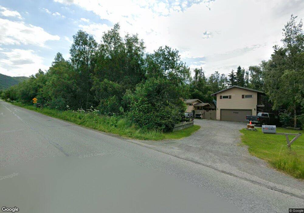
7400 Upper de Armoun Rd Anchorage, AK 99516
Rabbit Creek NeighborhoodEstimated Value: $435,000 - $603,000
3
Beds
2
Baths
1,760
Sq Ft
$295/Sq Ft
Est. Value
About This Home
This home is located at 7400 Upper de Armoun Rd, Anchorage, AK 99516 and is currently estimated at $518,847, approximately $294 per square foot. 7400 Upper de Armoun Rd is a home located in Anchorage Municipality with nearby schools including Bear Valley Elementary School, Goldenview Middle School, and South Anchorage High School.
Ownership History
Date
Name
Owned For
Owner Type
Purchase Details
Closed on
Apr 26, 2024
Sold by
Barron Ladonna
Bought by
Barron Ladonna and Barron Rachel
Current Estimated Value
Create a Home Valuation Report for This Property
The Home Valuation Report is an in-depth analysis detailing your home's value as well as a comparison with similar homes in the area
Home Values in the Area
Average Home Value in this Area
Purchase History
| Date | Buyer | Sale Price | Title Company |
|---|---|---|---|
| Barron Ladonna | -- | None Listed On Document |
Source: Public Records
Tax History
| Year | Tax Paid | Tax Assessment Tax Assessment Total Assessment is a certain percentage of the fair market value that is determined by local assessors to be the total taxable value of land and additions on the property. | Land | Improvement |
|---|---|---|---|---|
| 2025 | $2,233 | $421,000 | $125,300 | $295,700 |
| 2024 | $2,233 | $389,400 | $119,100 | $270,300 |
| 2023 | $5,020 | $354,800 | $109,900 | $244,900 |
| 2022 | $2,269 | $358,700 | $109,900 | $248,800 |
| 2021 | $5,179 | $334,800 | $109,900 | $224,900 |
| 2020 | $1,676 | $327,700 | $109,900 | $217,800 |
| 2019 | $1,686 | $322,600 | $109,900 | $212,700 |
| 2018 | $1,503 | $309,400 | $106,400 | $203,000 |
| 2017 | $1,961 | $315,900 | $101,900 | $214,000 |
| 2016 | $3,233 | $314,900 | $101,900 | $213,000 |
| 2015 | $3,233 | $304,600 | $97,200 | $207,400 |
| 2014 | $3,233 | $289,400 | $94,800 | $194,600 |
Source: Public Records
Map
Nearby Homes
- 000 de Palatis Cir
- 13492 de Palatis Cir
- 12801 Midori Dr
- 12800 Foster Rd
- 6820 Gunnison Dr
- 000 von Scheben Dr
- 14351 Equestrian Cir
- 14310 Pickett St
- 14474 Rockingham Cir
- 13675 Canyon Rd
- L1 B1 E Klatt Rd
- 11100 Hideaway Trail
- L2A Snow Flake Dr
- L5 Snow Flake Cir
- 13851 Canyon Rd
- 14115 Canyon Rd
- L5 Mountain Air Dr
- L4 & L5 Mountain Air Dr
- 12610 Glen Alps Rd
- 12650 Glen Alps Rd
- 8120 Rabbit Creek Rd
- 13145 Hillside Dr
- 7435 Upper de Armoun Rd
- 13140 Midori Dr
- 13101 Hillside Dr Unit 1
- 7301 de Armoun Rd
- 000 Upper Dearmoun
- 7501 Cox Dr
- 7300 de Armoun Rd
- 13120 Midori Dr
- 13120 Hillside Dr
- 7540 Upper de Armoun Rd
- 7540 de Armoun Rd
- 13045 Hillside Dr
- 7401 Twolots Cir
- 7541 Cox Dr
- 13141 Midori Dr
- 13340 Lamb Dr
- 7600 Upper de Armoun Rd
- 13140 Saunders Rd
Your Personal Tour Guide
Ask me questions while you tour the home.