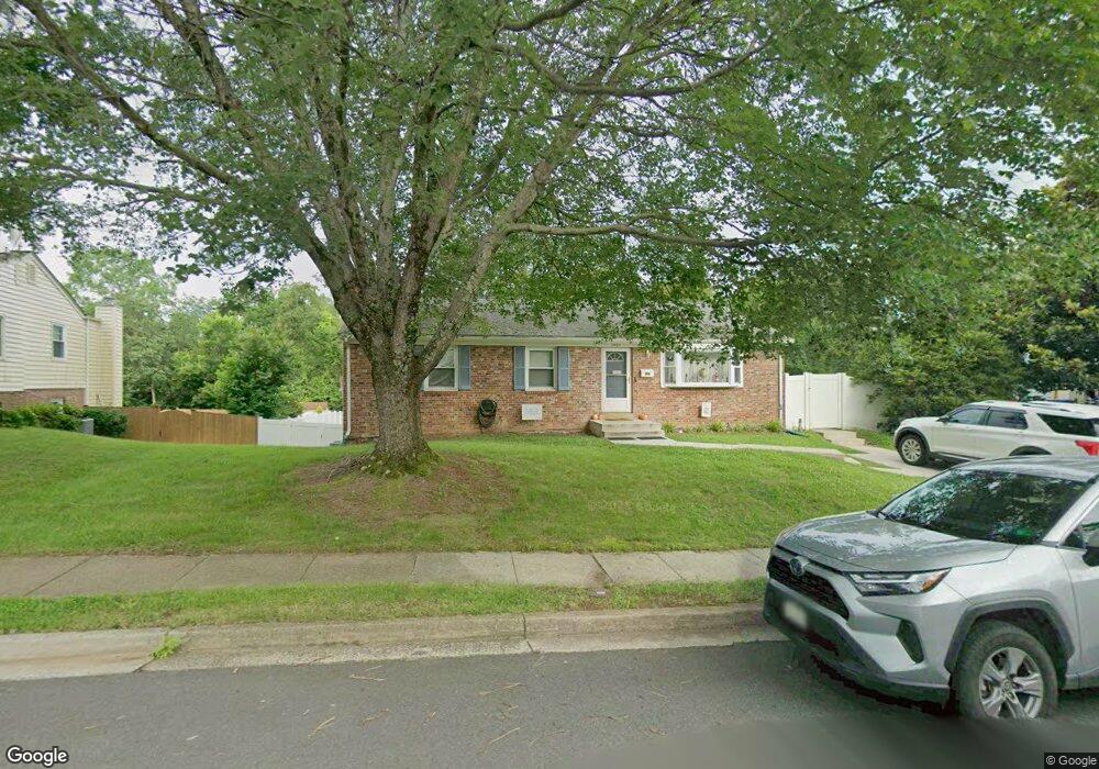
7402 Castle Rd Unit 174 Manassas, VA 20109
Estimated Value: $508,000 - $557,000
3
Beds
3
Baths
1,144
Sq Ft
$464/Sq Ft
Est. Value
About This Home
This home is located at 7402 Castle Rd Unit 174, Manassas, VA 20109 and is currently estimated at $530,799, approximately $463 per square foot. 7402 Castle Rd Unit 174 is a home located in Prince William County with nearby schools including Sudley Elementary School, Unity Braxton Middle School, and Unity Reed High School.
Ownership History
Date
Name
Owned For
Owner Type
Purchase Details
Closed on
Apr 4, 2002
Sold by
Cagle Harold
Bought by
Jamerson Debra
Current Estimated Value
Home Financials for this Owner
Home Financials are based on the most recent Mortgage that was taken out on this home.
Original Mortgage
$201,750
Outstanding Balance
$83,814
Interest Rate
6.84%
Mortgage Type
New Conventional
Estimated Equity
$446,985
Purchase Details
Closed on
Dec 15, 1999
Sold by
Oor Gerald W
Bought by
Jamerson Debra and Jamerson Eagle,Harold E
Home Financials for this Owner
Home Financials are based on the most recent Mortgage that was taken out on this home.
Original Mortgage
$169,550
Interest Rate
7.81%
Create a Home Valuation Report for This Property
The Home Valuation Report is an in-depth analysis detailing your home's value as well as a comparison with similar homes in the area
Home Values in the Area
Average Home Value in this Area
Purchase History
| Date | Buyer | Sale Price | Title Company |
|---|---|---|---|
| Jamerson Debra | $83,750 | -- | |
| Jamerson Debra | $171,000 | -- |
Source: Public Records
Mortgage History
| Date | Status | Borrower | Loan Amount |
|---|---|---|---|
| Open | Jamerson Debra | $201,750 | |
| Previous Owner | Jamerson Debra | $169,550 |
Source: Public Records
Tax History Compared to Growth
Tax History
| Year | Tax Paid | Tax Assessment Tax Assessment Total Assessment is a certain percentage of the fair market value that is determined by local assessors to be the total taxable value of land and additions on the property. | Land | Improvement |
|---|---|---|---|---|
| 2025 | $4,153 | $439,000 | $141,500 | $297,500 |
| 2024 | $4,153 | $417,600 | $130,600 | $287,000 |
| 2023 | $4,164 | $400,200 | $125,800 | $274,400 |
| 2022 | $4,347 | $392,500 | $125,800 | $266,700 |
| 2021 | $4,416 | $359,600 | $114,500 | $245,100 |
| 2020 | $5,205 | $335,800 | $114,500 | $221,300 |
| 2019 | $4,951 | $319,400 | $114,500 | $204,900 |
| 2018 | $3,757 | $311,100 | $114,500 | $196,600 |
| 2017 | $3,713 | $298,600 | $114,500 | $184,100 |
| 2016 | $3,485 | $282,500 | $101,100 | $181,400 |
| 2015 | $3,103 | $275,100 | $97,600 | $177,500 |
| 2014 | $3,103 | $245,200 | $86,300 | $158,900 |
Source: Public Records
Map
Nearby Homes
- 7530 Campbell Ct
- 7506 Todd Place
- 7608 Bland Dr
- 7518 Quail Run Ln
- 7398 Barbados Ln
- 10502 Oronoco Ln
- 7823 Brookview Ct
- 7498 Tangier Way
- 7416 Rokeby Dr
- 7699 Callan Dr
- 7832 Brookview Ct
- 7546 Belle Grae Dr Unit 1
- 10407 Paradise Ct
- 9724 Copeland Dr
- 9732 Copeland Dr
- 10524 Falkirk Way
- 10581 Linden Lake Plaza
- 9613 King George Dr
- 7905 Brighton Way
- Matisse Plan at Lomond Village - Condos