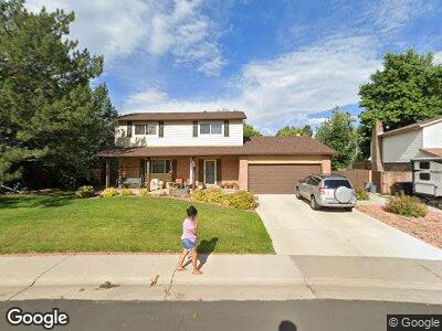
7403 Coors Dr Arvada, CO 80005
Ralston Valley NeighborhoodEstimated Value: $616,000 - $729,000
4
Beds
5
Baths
1,937
Sq Ft
$353/Sq Ft
Est. Value
About This Home
This home is located at 7403 Coors Dr, Arvada, CO 80005 and is currently estimated at $684,635, approximately $353 per square foot. 7403 Coors Dr is a home located in Jefferson County with nearby schools including Van Arsdale Elementary School, Oberon Junior High School, and Ralston Valley Senior High School.
Ownership History
Date
Name
Owned For
Owner Type
Purchase Details
Closed on
Dec 7, 2016
Sold by
Mcdougal Michael W and Mcdougal Kathleen A
Bought by
Mcdouglas Matthew and Mcdouglas Kevin
Current Estimated Value
Purchase Details
Closed on
Jan 13, 1999
Sold by
Mcdougal Michael W and Mcdougal Kathleen A
Bought by
Mcdougal Michael W and Mcdougal Kathy A
Home Financials for this Owner
Home Financials are based on the most recent Mortgage that was taken out on this home.
Original Mortgage
$145,600
Interest Rate
6.68%
Create a Home Valuation Report for This Property
The Home Valuation Report is an in-depth analysis detailing your home's value as well as a comparison with similar homes in the area
Home Values in the Area
Average Home Value in this Area
Purchase History
| Date | Buyer | Sale Price | Title Company |
|---|---|---|---|
| Mcdougal Michael W | -- | -- |
Source: Public Records
Mortgage History
| Date | Status | Borrower | Loan Amount |
|---|---|---|---|
| Closed | Mcdougal Michael W | $50,000 | |
| Closed | Mcdougal Michael W | $170,000 | |
| Closed | Mcdougal Michael W | $32,000 | |
| Closed | Mcdougal Michael W | $30,000 | |
| Closed | Mcdougal Michael W | $145,600 | |
| Closed | Mcdougal Michael W | $128,000 | |
| Closed | Mcdougal Michael W | $124,000 | |
| Closed | Mcdougal Michael W | $84,173 |
Source: Public Records
Tax History Compared to Growth
Tax History
| Year | Tax Paid | Tax Assessment Tax Assessment Total Assessment is a certain percentage of the fair market value that is determined by local assessors to be the total taxable value of land and additions on the property. | Land | Improvement |
|---|---|---|---|---|
| 2024 | $3,078 | $38,436 | $19,081 | $19,355 |
| 2023 | $3,078 | $38,436 | $19,081 | $19,355 |
| 2022 | $2,598 | $33,479 | $14,031 | $19,448 |
| 2021 | $2,641 | $34,443 | $14,435 | $20,008 |
| 2020 | $2,505 | $33,105 | $14,134 | $18,971 |
| 2019 | $2,471 | $33,105 | $14,134 | $18,971 |
| 2018 | $2,280 | $30,483 | $9,520 | $20,963 |
| 2017 | $2,087 | $30,483 | $9,520 | $20,963 |
| 2016 | $2,413 | $25,359 | $6,908 | $18,451 |
| 2015 | $2,441 | $25,359 | $6,908 | $18,451 |
| 2014 | $2,041 | $20,155 | $5,731 | $14,424 |
Source: Public Records
Map
Nearby Homes
- 7350 Devinney Ct
- 7367 Coors St
- 13778 W 71st Place
- 7181 Beech St
- 13113 W 73rd Ave
- 13866 W 76th Place
- 12940 W 75th Ave
- 7800 Indiana St
- 12941 W 75th Ave
- 13871 W 68th Way
- 13773 W 68th Ave
- 13833 W 68th Ave
- 13784 W 67th Way
- 7587 Wright Ct
- 6731 Devinney St
- 14533 W 69th Place
- 7750 Indiana St
- 15345 W 69th Dr
- 6687 Devinney Ct
- 7054 Welch Ct