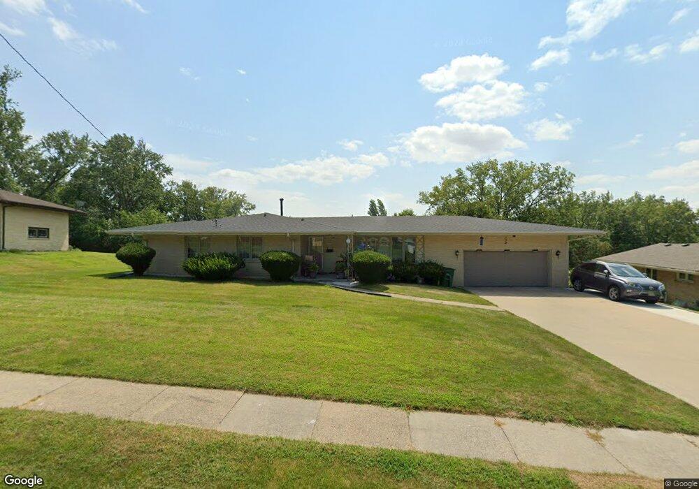
7410 Oak Brook Dr Urbandale, IA 50322
Estimated Value: $308,000 - $345,846
4
Beds
3
Baths
1,770
Sq Ft
$186/Sq Ft
Est. Value
About This Home
This home is located at 7410 Oak Brook Dr, Urbandale, IA 50322 and is currently estimated at $329,462, approximately $186 per square foot. 7410 Oak Brook Dr is a home located in Polk County with nearby schools including Karen Acres Elementary School, Valerius Elementary School, and Urbandale Middle School.
Ownership History
Date
Name
Owned For
Owner Type
Purchase Details
Closed on
Nov 6, 2024
Sold by
Vantong Han and Tran Lan Thi
Bought by
Han Tong And Lan Tran Family Trust and Tong
Current Estimated Value
Purchase Details
Closed on
Oct 17, 2003
Sold by
Marks Robert J
Bought by
Vanvantong Han Van and Tran Lan Thi Huong
Home Financials for this Owner
Home Financials are based on the most recent Mortgage that was taken out on this home.
Original Mortgage
$100,000
Interest Rate
5.48%
Mortgage Type
Purchase Money Mortgage
Create a Home Valuation Report for This Property
The Home Valuation Report is an in-depth analysis detailing your home's value as well as a comparison with similar homes in the area
Home Values in the Area
Average Home Value in this Area
Purchase History
| Date | Buyer | Sale Price | Title Company |
|---|---|---|---|
| Han Tong And Lan Tran Family Trust | -- | None Listed On Document | |
| Han Tong And Lan Tran Family Trust | -- | None Listed On Document | |
| Vanvantong Han Van | $188,500 | -- |
Source: Public Records
Mortgage History
| Date | Status | Borrower | Loan Amount |
|---|---|---|---|
| Previous Owner | Vanvantong Han Van | $100,000 |
Source: Public Records
Tax History Compared to Growth
Tax History
| Year | Tax Paid | Tax Assessment Tax Assessment Total Assessment is a certain percentage of the fair market value that is determined by local assessors to be the total taxable value of land and additions on the property. | Land | Improvement |
|---|---|---|---|---|
| 2025 | $4,732 | $370,800 | $89,800 | $281,000 |
| 2024 | $4,732 | $335,700 | $80,300 | $255,400 |
| 2023 | $4,718 | $335,700 | $80,300 | $255,400 |
| 2022 | $4,656 | $277,400 | $69,300 | $208,100 |
| 2021 | $4,554 | $277,400 | $69,300 | $208,100 |
| 2020 | $4,482 | $257,700 | $64,200 | $193,500 |
| 2019 | $4,204 | $257,700 | $64,200 | $193,500 |
| 2018 | $4,036 | $232,300 | $56,800 | $175,500 |
| 2017 | $4,074 | $232,300 | $56,800 | $175,500 |
| 2016 | $3,970 | $212,300 | $50,900 | $161,400 |
| 2015 | $3,970 | $212,300 | $50,900 | $161,400 |
| 2014 | $3,706 | $204,100 | $48,200 | $155,900 |
Source: Public Records
Map
Nearby Homes
- 7201 Maple Dr
- 7051 Oak Brook Dr
- 7100 Holcomb Ave
- 8037 Cobblestone Ct
- 8073 Cobblestone Rd
- 7204 Douglas Ave
- 2548 Pine Cir
- 8024 Cobblestone Rd
- 8008 Cobblestone Rd
- 3206 68th St
- 3808 72nd St
- 2405 81st Cir
- 2708 68th St
- 8112 Cobblestone Rd
- 3233 68th St
- 2250 70th St
- 3907 73rd St
- 2218 70th St
- 6717 Roseland Dr
- 6620 Boston Ave
- 7414 Oak Brook Dr
- 7406 Oak Brook Dr
- 7501 Bryn Mawr Dr
- 7409 Bryn Mawr Dr
- 7418 Oak Brook Dr
- 7402 Oak Brook Dr
- 7405 Bryn Mawr Dr
- 7409 Oak Brook Dr
- 7415 Oak Brook Dr
- 2905 Ashwood Dr
- 7405 Oak Brook Dr
- 7505 Bryn Mawr Dr
- 2909 Ashwood Dr
- 7422 Oak Brook Dr
- 7418 Beechwood Dr
- 3009 Ashwood Dr
- 7401 Oak Brook Dr
- 7401 Bryn Mawr Dr
- 7414 Beechwood Dr
- 2901 Ashwood Dr