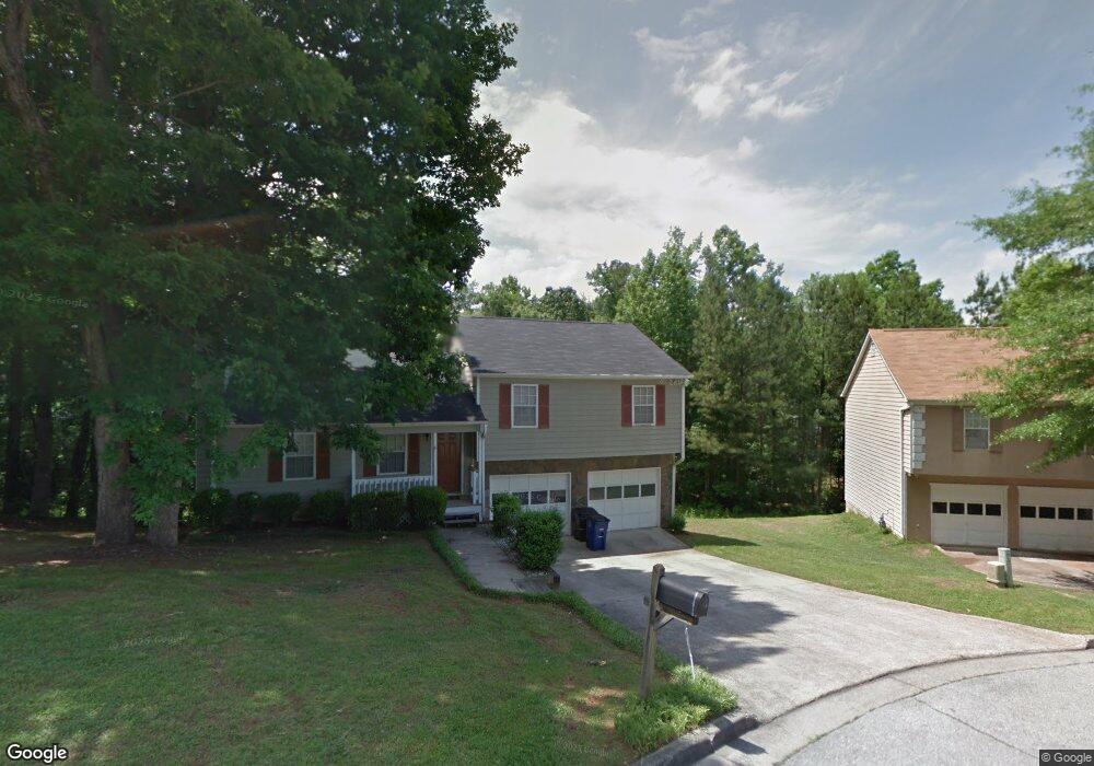
7415 Bristol Cir Douglasville, GA 30134
Estimated Value: $207,000 - $275,000
3
Beds
2
Baths
1,269
Sq Ft
$189/Sq Ft
Est. Value
About This Home
This home is located at 7415 Bristol Cir, Douglasville, GA 30134 and is currently estimated at $239,714, approximately $188 per square foot. 7415 Bristol Cir is a home located in Douglas County with nearby schools including Eastside Elementary School, Stewart Middle School, and Lithia Springs Comprehensive High School.
Ownership History
Date
Name
Owned For
Owner Type
Purchase Details
Closed on
Sep 24, 2024
Sold by
Baf Assets Llc
Bought by
Baf 4 Llc
Current Estimated Value
Purchase Details
Closed on
Jun 18, 2020
Sold by
Us Sfe Asset Co 3 Llc
Bought by
Baf Assets Llc
Purchase Details
Closed on
Mar 16, 2015
Sold by
Downing Malcolm
Bought by
Jeff 1 Llc
Purchase Details
Closed on
May 12, 2000
Sold by
Fears Danny
Bought by
Downing Malcolm
Home Financials for this Owner
Home Financials are based on the most recent Mortgage that was taken out on this home.
Original Mortgage
$101,618
Interest Rate
8.12%
Mortgage Type
FHA
Purchase Details
Closed on
Apr 30, 1998
Sold by
Price Timothy
Bought by
Fears Danny
Home Financials for this Owner
Home Financials are based on the most recent Mortgage that was taken out on this home.
Original Mortgage
$79,110
Interest Rate
7.21%
Mortgage Type
New Conventional
Create a Home Valuation Report for This Property
The Home Valuation Report is an in-depth analysis detailing your home's value as well as a comparison with similar homes in the area
Home Values in the Area
Average Home Value in this Area
Purchase History
| Date | Buyer | Sale Price | Title Company |
|---|---|---|---|
| Baf 4 Llc | $222,400 | None Listed On Document | |
| Baf Assets Llc | $1,795,421 | -- | |
| Jeff 1 Llc | $72,500 | -- | |
| Downing Malcolm | $103,000 | -- | |
| Fears Danny | $87,900 | -- |
Source: Public Records
Mortgage History
| Date | Status | Borrower | Loan Amount |
|---|---|---|---|
| Previous Owner | Downing Malcolm | $101,618 | |
| Previous Owner | Fears Danny | $79,110 |
Source: Public Records
Tax History Compared to Growth
Tax History
| Year | Tax Paid | Tax Assessment Tax Assessment Total Assessment is a certain percentage of the fair market value that is determined by local assessors to be the total taxable value of land and additions on the property. | Land | Improvement |
|---|---|---|---|---|
| 2024 | $3,899 | $93,800 | $24,640 | $69,160 |
| 2023 | $3,899 | $93,800 | $24,640 | $69,160 |
| 2022 | $2,749 | $67,760 | $17,600 | $50,160 |
| 2021 | $1,977 | $57,120 | $15,520 | $41,600 |
| 2020 | $1,940 | $46,760 | $9,720 | $37,040 |
| 2019 | $1,782 | $45,360 | $9,720 | $35,640 |
| 2018 | $1,804 | $45,600 | $9,960 | $35,640 |
| 2017 | $1,441 | $36,040 | $8,720 | $27,320 |
| 2016 | $1,180 | $29,000 | $7,276 | $21,724 |
| 2015 | $1,085 | $25,880 | $6,640 | $19,240 |
| 2014 | $885 | $21,560 | $5,920 | $15,640 |
| 2013 | -- | $21,320 | $5,920 | $15,400 |
Source: Public Records
Map
Nearby Homes
- 7420 Bristol Cir
- 6215 Grovener Ave
- 6292 Hampstead Ln
- 6298 Hampstead Ln
- 1121 Grove Trail Pass
- 7407 Stone Bluff Dr
- 7712 Autry Cir Unit 617
- 7712 Autry Cir Unit 701
- 7712 Autry Cir Unit 7-721
- 7712 Autry Cir Unit 305
- 6615 Bluffview Dr
- 7687 Greenridge Ct
- 6904 Oak Valley Dr
- 6900 Oak Valley Dr
- 995 Old Dallas Hwy
- 7835 Teton Trail Unit 1
- 1160 Pleasant Oak Ln
- 6592 Malone Rd
- 7415 Bristol Cir Unit 646
- 7415 Bristol Cir
- 7425 Bristol Cir
- 7425 Bristol Cir Unit 28
- 7405 Bristol Cir Unit 1
- 6383 Cardiff Ln
- 6385 Cardiff Ln
- 6300 Holborne Ln
- 6320 Holborne Ln
- 7353 Earls Ct Unit 2
- 7430 Bristol Cir Unit 1
- 6384 Cardiff Ln Unit 4
- 7351 Earls Ct
- 7351 Earls Ct Unit 49
- 6330 Holborne Ln Unit 1
- 7351R Earls Ct
- 6387 Cardiff Ln
- 6386 Cardiff Ln Unit 72
- 6386 Cardiff Ln
- 7350 Earls Ct Unit 2