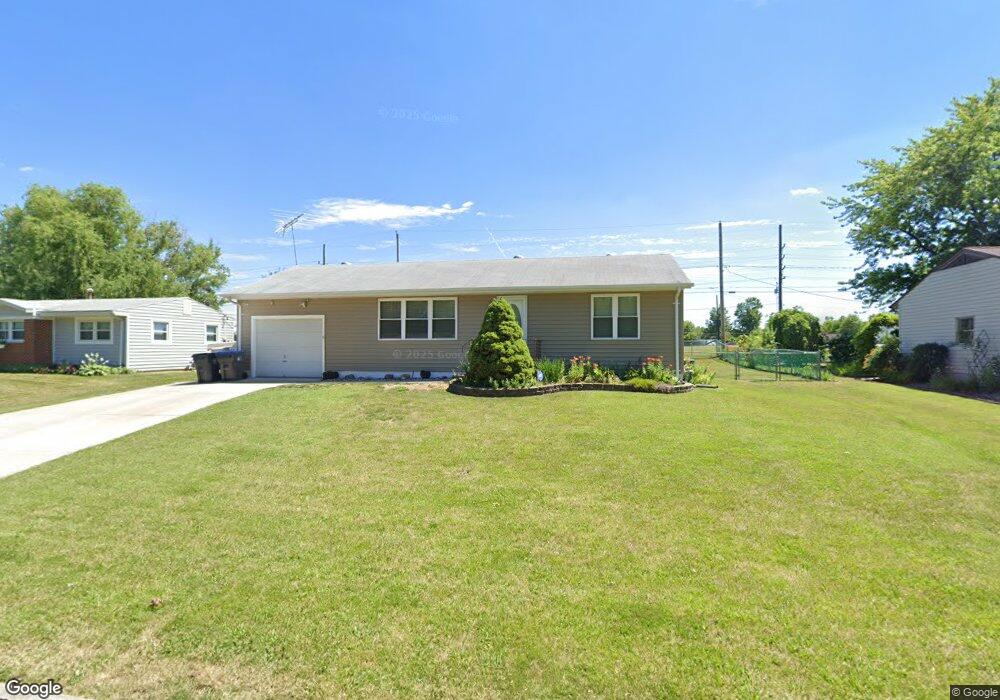
742 Danny Ln O Fallon, MO 63366
Estimated Value: $231,000 - $240,000
2
Beds
2
Baths
988
Sq Ft
$239/Sq Ft
Est. Value
About This Home
This home is located at 742 Danny Ln, O Fallon, MO 63366 and is currently estimated at $236,335, approximately $239 per square foot. 742 Danny Ln is a home located in St. Charles County with nearby schools including Joseph L. Mudd Elementary School, Forest Park Elementary School, and Fort Zumwalt North Middle School.
Ownership History
Date
Name
Owned For
Owner Type
Purchase Details
Closed on
Apr 18, 2023
Sold by
Klein David P and Dairda Sue E
Bought by
Klein David P
Current Estimated Value
Home Financials for this Owner
Home Financials are based on the most recent Mortgage that was taken out on this home.
Original Mortgage
$136,305
Outstanding Balance
$132,375
Interest Rate
6.6%
Mortgage Type
New Conventional
Estimated Equity
$103,960
Purchase Details
Closed on
Jan 4, 2002
Sold by
Hindman Darrell W and Hindman Shaley
Bought by
Klein David P and Dairda Sue E
Home Financials for this Owner
Home Financials are based on the most recent Mortgage that was taken out on this home.
Original Mortgage
$72,000
Interest Rate
6.8%
Purchase Details
Closed on
Jul 26, 2001
Sold by
Grelle Margaret W
Bought by
Hindman Darrell W
Create a Home Valuation Report for This Property
The Home Valuation Report is an in-depth analysis detailing your home's value as well as a comparison with similar homes in the area
Home Values in the Area
Average Home Value in this Area
Purchase History
| Date | Buyer | Sale Price | Title Company |
|---|---|---|---|
| Klein David P | -- | None Listed On Document | |
| Klein David P | $90,000 | -- | |
| Hindman Darrell W | -- | -- |
Source: Public Records
Mortgage History
| Date | Status | Borrower | Loan Amount |
|---|---|---|---|
| Open | Klein David P | $136,305 | |
| Previous Owner | Klein David P | $72,000 |
Source: Public Records
Tax History
| Year | Tax Paid | Tax Assessment Tax Assessment Total Assessment is a certain percentage of the fair market value that is determined by local assessors to be the total taxable value of land and additions on the property. | Land | Improvement |
|---|---|---|---|---|
| 2025 | $2,190 | $35,553 | -- | -- |
| 2024 | $2,190 | $32,829 | -- | -- |
| 2023 | $2,191 | $32,829 | -- | -- |
| 2022 | $1,841 | $25,579 | $0 | $0 |
| 2021 | $1,842 | $25,579 | $0 | $0 |
| 2020 | $1,691 | $22,799 | $0 | $0 |
| 2019 | $1,695 | $22,799 | $0 | $0 |
| 2018 | $1,678 | $21,553 | $0 | $0 |
| 2017 | $1,647 | $21,553 | $0 | $0 |
| 2016 | $1,424 | $18,558 | $0 | $0 |
| 2015 | $1,324 | $18,558 | $0 | $0 |
| 2014 | $1,392 | $19,197 | $0 | $0 |
Source: Public Records
Map
Nearby Homes
- 0 Montbrook Dr
- 302 Birmingham Dr
- 151 N Wellington St
- 962 Midpoint Dr
- 11 Southern Hills Ct
- 10 Southern Hills Ct
- 734 Sunset Ln
- 1234 Pinehurst Club Ct
- 1117 Turtle Creek Dr
- 24 Hawthorne Ct
- 3 Pinehurst Forest Ct
- 8 Winter Forest Ct
- 713 Plaza Dr
- 309 E Pitman St
- 205 E Elm St
- 116 Columbia Meadows Ln
- 849 Elaine Dr
- 5 Challenger Ct
- 127 Columbia Meadows Ln
- 512 Sonderen St
Your Personal Tour Guide
Ask me questions while you tour the home.