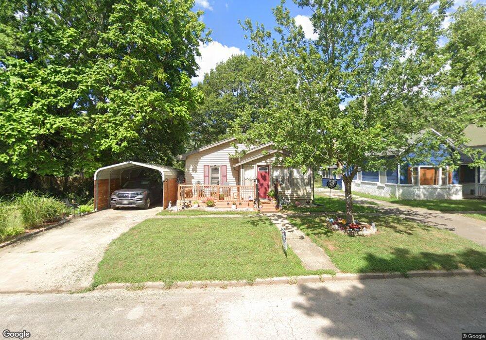
742 S Clark St Fort Scott, KS 66701
Estimated Value: $68,000 - $84,000
2
Beds
1
Bath
1,068
Sq Ft
$71/Sq Ft
Est. Value
About This Home
This home is located at 742 S Clark St, Fort Scott, KS 66701 and is currently estimated at $75,347, approximately $70 per square foot. 742 S Clark St is a home located in Bourbon County with nearby schools including Winfield Scott Elementary School, Eugene Ware Elementary School, and Fort Scott Middle School.
Ownership History
Date
Name
Owned For
Owner Type
Purchase Details
Closed on
Sep 2, 2014
Sold by
Kathleen Nations G
Bought by
Felt Dena D and Felt Kenneth P
Current Estimated Value
Home Financials for this Owner
Home Financials are based on the most recent Mortgage that was taken out on this home.
Original Mortgage
$41,850
Outstanding Balance
$13,822
Interest Rate
4.17%
Mortgage Type
New Conventional
Estimated Equity
$61,525
Create a Home Valuation Report for This Property
The Home Valuation Report is an in-depth analysis detailing your home's value as well as a comparison with similar homes in the area
Home Values in the Area
Average Home Value in this Area
Purchase History
| Date | Buyer | Sale Price | Title Company |
|---|---|---|---|
| Felt Dena D | $52,312 | Security First Title |
Source: Public Records
Mortgage History
| Date | Status | Borrower | Loan Amount |
|---|---|---|---|
| Open | Felt Dena D | $41,850 |
Source: Public Records
Tax History Compared to Growth
Tax History
| Year | Tax Paid | Tax Assessment Tax Assessment Total Assessment is a certain percentage of the fair market value that is determined by local assessors to be the total taxable value of land and additions on the property. | Land | Improvement |
|---|---|---|---|---|
| 2025 | -- | $5,571 | $213 | $5,358 |
| 2024 | $903 | $5,256 | $207 | $5,049 |
| 2023 | $838 | $4,877 | $219 | $4,658 |
| 2022 | $0 | $4,876 | $207 | $4,669 |
| 2021 | $924 | $4,876 | $207 | $4,669 |
| 2020 | $904 | $4,742 | $224 | $4,518 |
| 2019 | $991 | $5,129 | $224 | $4,905 |
| 2018 | $988 | $5,130 | $196 | $4,934 |
| 2017 | $994 | $5,130 | $196 | $4,934 |
| 2016 | -- | $5,129 | $217 | $4,912 |
| 2015 | -- | $4,449 | $217 | $4,232 |
| 2014 | -- | $4,427 | $217 | $4,210 |
Source: Public Records
Map
Nearby Homes
- 606 S Hill St
- 603 S Judson St
- 622 S Little St
- 523 S Judson St
- 830 S Judson St
- 735 S Crawford St
- 223 S Hill St
- 316 Saint Marys St
- 419 S Eddy St
- 409 S Eddy St
- 1301 S Ransom St
- 709 E 1st St
- 0 S Madison St Unit HMS2558732
- 223 S Eddy St
- 608 S Lowman St
- 1238 S Judson St
- 502 Osbun St
- 20 S Crawford St
- 402 Lees Circle Dr
- 716 Osbun St
- 736 S Clark St
- 754 S Clark St
- 734 S Clark St
- 732 S Clark St
- 756 S Clark St
- 735 S Ransom St
- 733 S Ransom St
- 741 S Clark St
- 728 S Clark St
- 758 S Clark St
- 745 S Clark St
- 753 S Clark St
- 761 S Ransom St
- 724 S Clark St
- 760 S Clark St
- 725 S Clark St
- 719 S Ransom St
- 759 S Clark St
- 718 S Clark St
- 730 S Ransom St