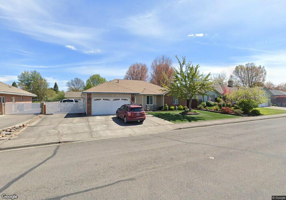
742 Vincent Ave Central Point, OR 97502
Estimated Value: $455,000 - $481,084
3
Beds
2
Baths
1,700
Sq Ft
$276/Sq Ft
Est. Value
About This Home
This home is located at 742 Vincent Ave, Central Point, OR 97502 and is currently estimated at $470,021, approximately $276 per square foot. 742 Vincent Ave is a home located in Jackson County with nearby schools including Richardson Elementary School, Scenic Middle School, and Crater High School.
Ownership History
Date
Name
Owned For
Owner Type
Purchase Details
Closed on
Jul 21, 2009
Sold by
Carlson Kenneth L
Bought by
Carlson Kenneth L and Carlson Janice V
Current Estimated Value
Purchase Details
Closed on
Mar 9, 2009
Sold by
Carlson Faye L
Bought by
Carlson Kenneth L
Create a Home Valuation Report for This Property
The Home Valuation Report is an in-depth analysis detailing your home's value as well as a comparison with similar homes in the area
Home Values in the Area
Average Home Value in this Area
Purchase History
| Date | Buyer | Sale Price | Title Company |
|---|---|---|---|
| Carlson Kenneth L | -- | None Available | |
| Carlson Kenneth L | -- | None Available |
Source: Public Records
Tax History Compared to Growth
Tax History
| Year | Tax Paid | Tax Assessment Tax Assessment Total Assessment is a certain percentage of the fair market value that is determined by local assessors to be the total taxable value of land and additions on the property. | Land | Improvement |
|---|---|---|---|---|
| 2025 | $5,074 | $305,160 | $105,350 | $199,810 |
| 2024 | $5,074 | $296,280 | $102,280 | $194,000 |
| 2023 | $4,910 | $287,660 | $99,300 | $188,360 |
| 2022 | $4,796 | $287,660 | $99,300 | $188,360 |
| 2021 | $4,659 | $279,290 | $96,410 | $182,880 |
| 2020 | $4,523 | $271,160 | $93,610 | $177,550 |
| 2019 | $4,412 | $255,610 | $88,240 | $167,370 |
| 2018 | $4,277 | $248,170 | $85,670 | $162,500 |
| 2017 | $4,170 | $248,170 | $85,670 | $162,500 |
| 2016 | $4,048 | $233,940 | $80,750 | $153,190 |
| 2015 | $3,879 | $233,940 | $80,750 | $153,190 |
| 2014 | $3,780 | $220,520 | $76,110 | $144,410 |
Source: Public Records
Map
Nearby Homes
- 871 Holley Way
- 895 Holley Way
- 3364 Snowy Butte Ln
- 487 Creekside Cir
- 659 Jackson Creek Dr
- 465 Creekside Cir
- 21 Hickory Ln
- 349 W Pine St
- 739 S Haskell St
- 114 Cedar St
- 570 Bachand Cir
- 887 Silver Fox Dr
- 619 Palo Verde Way
- 420 Mayberry Ln
- 429 Mayberry Ln
- 755 S 4th St
- 350 Alder St
- 3642 Oak Pine Way
- 407 Silver Creek Dr
- 531 Bush St
- 730 Vincent Ave
- 794 Vincent Ave
- 105 Justin Ct
- 735 Vincent Ave
- 726 Vincent Ave
- 797 Vincent Ave
- 117 Justin Ct
- 707 Vincent Ave
- 704 Vincent Ave
- 149 Josephine Ct
- 124 Justin Ct
- 127 Josephine Ct
- 162 Tiffany Ave
- 207 Tiffany Ave
- 129 Justin Ct
- 214 Tiffany Ave Unit 3
- 203 Tiffany Ave
- 213 Tiffany Ave
- 699 Vincent Ave
- 175 Josephine Ct