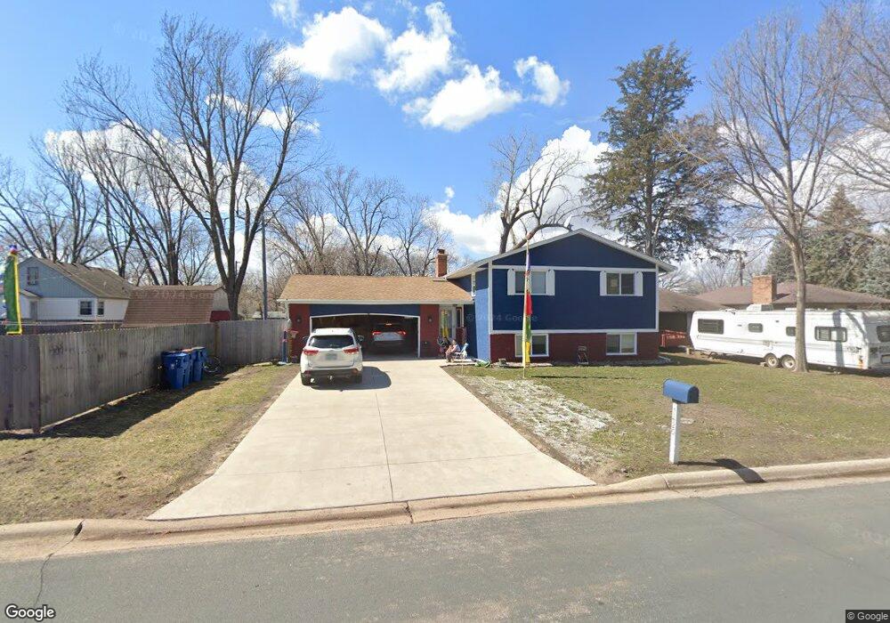
7420 Bacon Dr NE Minneapolis, MN 55432
Estimated Value: $365,000 - $372,775
4
Beds
2
Baths
1,115
Sq Ft
$330/Sq Ft
Est. Value
About This Home
This home is located at 7420 Bacon Dr NE, Minneapolis, MN 55432 and is currently estimated at $368,194, approximately $330 per square foot. 7420 Bacon Dr NE is a home located in Anoka County with nearby schools including Park Terrace Elementary School, Westwood Intermediate and Middle School, and Avail Academy High School.
Ownership History
Date
Name
Owned For
Owner Type
Purchase Details
Closed on
Apr 19, 2019
Sold by
Oudomsay James
Bought by
Chomphel Tsering and Dolkar Tsering
Current Estimated Value
Home Financials for this Owner
Home Financials are based on the most recent Mortgage that was taken out on this home.
Original Mortgage
$202,400
Outstanding Balance
$177,584
Interest Rate
4.2%
Mortgage Type
New Conventional
Estimated Equity
$190,610
Purchase Details
Closed on
May 17, 2006
Sold by
Sommer Pam R
Bought by
Oudomsay James and Oudomsay Stephen
Create a Home Valuation Report for This Property
The Home Valuation Report is an in-depth analysis detailing your home's value as well as a comparison with similar homes in the area
Home Values in the Area
Average Home Value in this Area
Purchase History
| Date | Buyer | Sale Price | Title Company |
|---|---|---|---|
| Chomphel Tsering | $253,000 | Results Title | |
| Oudomsay James | $241,400 | -- |
Source: Public Records
Mortgage History
| Date | Status | Borrower | Loan Amount |
|---|---|---|---|
| Open | Chomphel Tsering | $202,400 |
Source: Public Records
Tax History Compared to Growth
Tax History
| Year | Tax Paid | Tax Assessment Tax Assessment Total Assessment is a certain percentage of the fair market value that is determined by local assessors to be the total taxable value of land and additions on the property. | Land | Improvement |
|---|---|---|---|---|
| 2025 | $3,585 | $354,200 | $102,400 | $251,800 |
| 2024 | $3,585 | $315,600 | $93,300 | $222,300 |
| 2023 | $3,556 | $320,900 | $86,400 | $234,500 |
| 2022 | $3,008 | $318,800 | $75,600 | $243,200 |
| 2021 | $3,024 | $244,200 | $56,300 | $187,900 |
| 2020 | $2,833 | $241,800 | $67,700 | $174,100 |
| 2019 | $3,083 | $220,600 | $54,600 | $166,000 |
| 2018 | $2,853 | $214,900 | $0 | $0 |
| 2017 | $2,923 | $191,000 | $0 | $0 |
| 2016 | $2,609 | $171,400 | $0 | $0 |
| 2014 | -- | $155,200 | $43,900 | $111,300 |
Source: Public Records
Map
Nearby Homes
- 1494 Onondaga St NE
- 7343 Hayes St NE
- 1390 76th Ave NE
- 1601 Onondaga St NE
- 1324 Crown Oaks Dr
- 3032 County Road H2
- 1215 Norton Ave NE
- 7310 Taylor St NE
- 7446 Oakley St NE Unit D446
- 7317 West Cir NE Unit K317
- 1010 North Cir NE
- 3001 Woodale Dr
- 7324 West Cir NE Unit K324
- 8009 Garfield St NE
- 8018 Hayes St NE
- 1270 80th Ave NE
- 1240 80th Ave NE
- 8000 Benjamin St NE
- 1503 S Timber Ridge
- 7717 Able St NE
- 1467 Onondaga St NE
- 7426 Bacon Dr NE
- 1465 Onondaga St NE
- 1420 Fireside Dr NE
- 7455 Hayes St NE
- 7425 Bacon Dr NE
- 1469 Onondaga St NE
- 1425 Onondaga St NE
- 7432 Bacon Dr NE
- 1400 Fireside Dr NE
- 7469 Hayes St NE
- 1473 Onondaga St NE
- 1405 Onondaga St NE
- 7486 Bacon Dr NE
- 7395 Hayes St NE
- 7481 Hayes St NE
- 1398 Fireside Dr NE
- 1434 Onondaga St NE
- 1466 Onondaga St NE
- 1395 Onondaga St NE