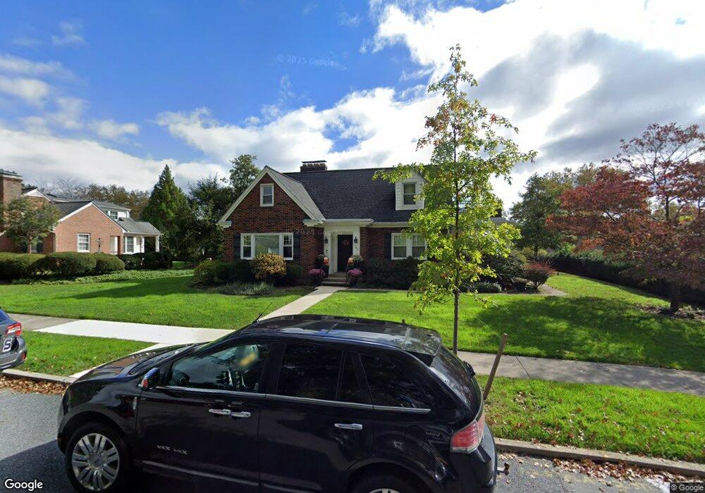
743 Linden Rd Hershey, PA 17033
Estimated Value: $607,288 - $849,000
3
Beds
2
Baths
2,675
Sq Ft
$262/Sq Ft
Est. Value
About This Home
This home is located at 743 Linden Rd, Hershey, PA 17033 and is currently estimated at $700,322, approximately $261 per square foot. 743 Linden Rd is a home located in Dauphin County with nearby schools including Hershey Elementary School, Hershey Primary Elementary School, and Hershey Middle School.
Ownership History
Date
Name
Owned For
Owner Type
Purchase Details
Closed on
Apr 29, 2021
Sold by
Fox Randy C and Wilson Fox Carol
Bought by
Fox Randy C and Wilson Fox Carol
Current Estimated Value
Home Financials for this Owner
Home Financials are based on the most recent Mortgage that was taken out on this home.
Original Mortgage
$326,400
Interest Rate
3.1%
Mortgage Type
New Conventional
Create a Home Valuation Report for This Property
The Home Valuation Report is an in-depth analysis detailing your home's value as well as a comparison with similar homes in the area
Home Values in the Area
Average Home Value in this Area
Purchase History
| Date | Buyer | Sale Price | Title Company |
|---|---|---|---|
| Fox Randy C | -- | Accommodation |
Source: Public Records
Mortgage History
| Date | Status | Borrower | Loan Amount |
|---|---|---|---|
| Closed | Fox Randy C | $326,400 |
Source: Public Records
Tax History
| Year | Tax Paid | Tax Assessment Tax Assessment Total Assessment is a certain percentage of the fair market value that is determined by local assessors to be the total taxable value of land and additions on the property. | Land | Improvement |
|---|---|---|---|---|
| 2025 | $6,122 | $195,900 | $35,300 | $160,600 |
| 2024 | $5,754 | $195,900 | $35,300 | $160,600 |
| 2023 | $5,652 | $195,900 | $35,300 | $160,600 |
| 2022 | $5,526 | $195,900 | $35,300 | $160,600 |
| 2021 | $5,526 | $195,900 | $35,300 | $160,600 |
| 2020 | $5,526 | $195,900 | $35,300 | $160,600 |
| 2019 | $5,427 | $195,900 | $35,300 | $160,600 |
| 2018 | $5,283 | $195,900 | $35,300 | $160,600 |
| 2017 | $5,062 | $195,900 | $35,300 | $160,600 |
| 2016 | $0 | $187,700 | $35,300 | $152,400 |
| 2015 | -- | $187,700 | $35,300 | $152,400 |
| 2014 | -- | $187,700 | $35,300 | $152,400 |
Source: Public Records
Map
Nearby Homes
- 15 W Governor Rd
- 155 Oak Ln
- 147 Elm Ave
- 118 Elm Ave
- 29 Almond Dr
- 319 Cedar Ave
- 420 Cedar Ave
- 236 W Granada Ave
- 229 Cocoa Ave
- 81 Locust Ave
- 519 Cedar Ave
- 310 W Caracas Ave
- 406 W Caracas Ave
- 72 Leearden Rd
- 24 Glasgow Ct
- 104 Cambridge Dr
- 819 3rd Ave
- 962 W Areba Ave
- 626 Sand Hill Rd
- 0 Stauffers Church Rd Unit PADA2052308