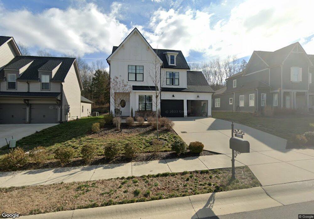
743 Plowson Rd Mount Juliet, TN 37122
Estimated Value: $570,452 - $638,000
--
Bed
3
Baths
2,152
Sq Ft
$284/Sq Ft
Est. Value
About This Home
This home is located at 743 Plowson Rd, Mount Juliet, TN 37122 and is currently estimated at $610,113, approximately $283 per square foot. 743 Plowson Rd is a home located in Wilson County with nearby schools including Stoner Creek Elementary School, West Wilson Middle School, and Mt. Juliet High School.
Ownership History
Date
Name
Owned For
Owner Type
Purchase Details
Closed on
Feb 20, 2019
Sold by
Jackson Hills Partners Llc
Bought by
Daniel Robert C and Daniel Ashley V
Current Estimated Value
Home Financials for this Owner
Home Financials are based on the most recent Mortgage that was taken out on this home.
Original Mortgage
$321,070
Outstanding Balance
$281,702
Interest Rate
4.4%
Mortgage Type
New Conventional
Estimated Equity
$328,411
Purchase Details
Closed on
Aug 16, 2018
Sold by
Propst Realty Nashville Llc
Bought by
Jackson Hills Partners Llc
Create a Home Valuation Report for This Property
The Home Valuation Report is an in-depth analysis detailing your home's value as well as a comparison with similar homes in the area
Home Values in the Area
Average Home Value in this Area
Purchase History
| Date | Buyer | Sale Price | Title Company |
|---|---|---|---|
| Daniel Robert C | $369,046 | Windmill Title Llc | |
| Jackson Hills Partners Llc | $427,500 | Windmill Tilte Llc |
Source: Public Records
Mortgage History
| Date | Status | Borrower | Loan Amount |
|---|---|---|---|
| Open | Daniel Robert C | $321,070 |
Source: Public Records
Tax History Compared to Growth
Tax History
| Year | Tax Paid | Tax Assessment Tax Assessment Total Assessment is a certain percentage of the fair market value that is determined by local assessors to be the total taxable value of land and additions on the property. | Land | Improvement |
|---|---|---|---|---|
| 2024 | $1,826 | $95,675 | $20,000 | $75,675 |
| 2022 | $1,826 | $95,675 | $20,000 | $75,675 |
| 2021 | $1,932 | $95,675 | $20,000 | $75,675 |
| 2020 | $2,050 | $95,675 | $20,000 | $75,675 |
| 2019 | $409 | $76,325 | $16,250 | $60,075 |
| 2018 | $409 | $16,250 | $16,250 | $0 |
Source: Public Records
Map
Nearby Homes
- 247 Croft Way
- 243 Croft Way
- 270 Croft Way
- 1012 Zane Dr
- 1010 Zane Dr
- 1019 Zane Dr
- Weston Plan at Bradshaw Farms - Estates
- Ansley Plan at Bradshaw Farms - Estates
- Buchanan Plan at Bradshaw Farms - Estates
- Kingston Plan at Bradshaw Farms - Estates
- Ashford Plan at Bradshaw Farms - Estates
- 701 Plowson Rd
- 1015 Zane Dr
- 1101 Codah Dr
- 1014 Zane Dr
- 1018 Zane Dr
- 1107 Codah Dr
- 1022 Zane Dr
- 1109 Codah Dr
- 1113 Codah Dr
- 743 Plowson Rd Unit 541
- 741 Plowson Rd
- 745 Plowson Rd
- 741 Plowson Rd Unit 540
- 741 Plowson Rd
- 745 Plowson Rd Unit 542
- 745 Plowson Rd
- 744 Plowson Rd
- 739 Plowson Rd Unit 539
- 739 Plowson Rd
- 739 Plowson Rd
- 747 Plowson Rd Unit 543
- 747 Plowson Rd
- 742 Plowson Rd Unit 503
- 742 Plowson Rd
- 744 Plowson Rd Unit 502
- 742 Plowson Rd
- 746 Plowson Rd
- 740 Plowson Rd Unit 504
- 740 Plowson Rd