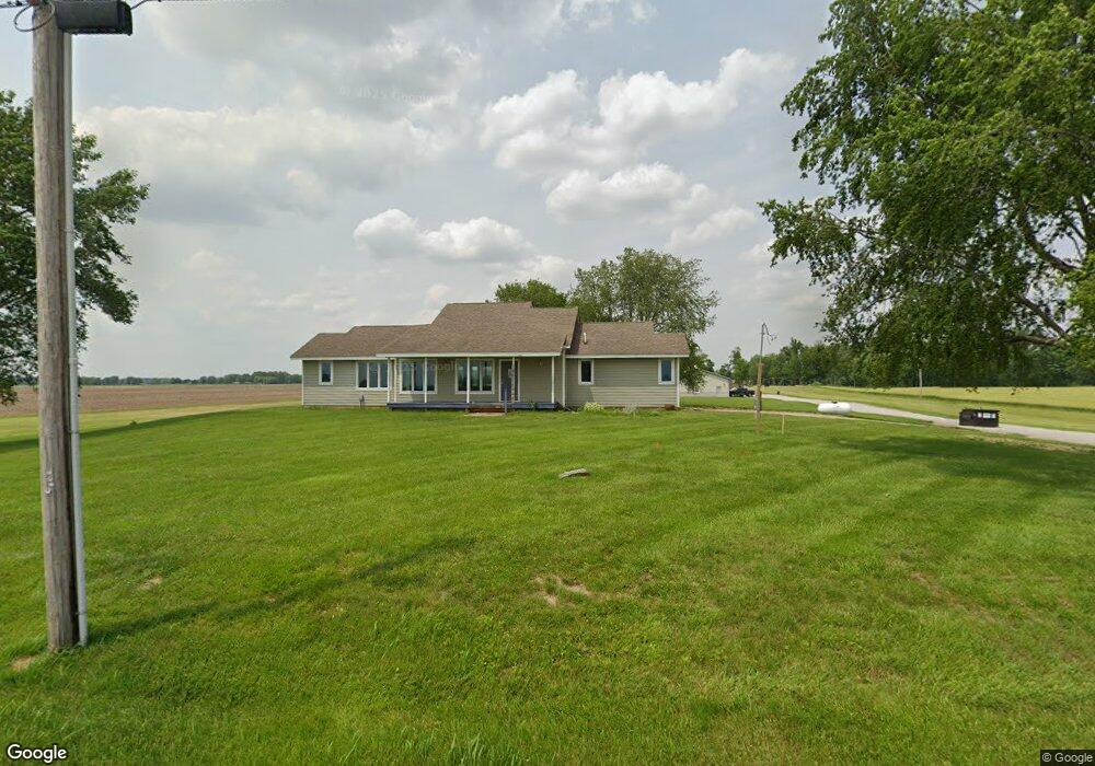
7430 E Division Rd Franklin, IN 46131
Estimated Value: $387,000 - $451,000
2
Beds
2
Baths
1,358
Sq Ft
$311/Sq Ft
Est. Value
About This Home
This home is located at 7430 E Division Rd, Franklin, IN 46131 and is currently estimated at $422,064, approximately $310 per square foot. 7430 E Division Rd is a home located in Johnson County with nearby schools including Needham Elementary School, Franklin Community Middle School, and Custer Baker Intermediate School.
Ownership History
Date
Name
Owned For
Owner Type
Purchase Details
Closed on
Aug 26, 2022
Sold by
Maynard Jones James
Bought by
Jdt Properties Llc and Thompson Family Enterprises Llc
Current Estimated Value
Home Financials for this Owner
Home Financials are based on the most recent Mortgage that was taken out on this home.
Original Mortgage
$600,000
Outstanding Balance
$538,466
Interest Rate
5.3%
Mortgage Type
Credit Line Revolving
Estimated Equity
-$173,407
Purchase Details
Closed on
Mar 8, 2021
Sold by
Jones Bruce A
Bought by
Jones James Maynard
Purchase Details
Closed on
Jul 22, 2005
Sold by
Jones James Maynard and Jones Maynard
Bought by
Jones James Manard
Create a Home Valuation Report for This Property
The Home Valuation Report is an in-depth analysis detailing your home's value as well as a comparison with similar homes in the area
Home Values in the Area
Average Home Value in this Area
Purchase History
| Date | Buyer | Sale Price | Title Company |
|---|---|---|---|
| Jdt Properties Llc | -- | Geese Larry J | |
| Jones James Maynard | -- | None Available | |
| Jones James Manard | -- | None Available |
Source: Public Records
Mortgage History
| Date | Status | Borrower | Loan Amount |
|---|---|---|---|
| Open | Jdt Properties Llc | $600,000 |
Source: Public Records
Tax History
| Year | Tax Paid | Tax Assessment Tax Assessment Total Assessment is a certain percentage of the fair market value that is determined by local assessors to be the total taxable value of land and additions on the property. | Land | Improvement |
|---|---|---|---|---|
| 2025 | $5,077 | $326,300 | $58,500 | $267,800 |
| 2024 | $5,077 | $267,300 | $60,200 | $207,100 |
| 2023 | $5,164 | $259,300 | $52,200 | $207,100 |
| 2022 | $1,567 | $261,000 | $52,200 | $208,800 |
| 2021 | $1,391 | $201,200 | $45,100 | $156,100 |
| 2020 | $1,303 | $177,900 | $41,000 | $136,900 |
| 2019 | $1,308 | $178,100 | $43,800 | $134,300 |
| 2018 | $1,766 | $170,800 | $44,400 | $126,400 |
| 2017 | $1,941 | $177,300 | $46,800 | $130,500 |
| 2016 | $2,018 | $171,900 | $47,900 | $124,000 |
| 2014 | $1,943 | $174,300 | $48,800 | $125,500 |
| 2013 | $1,943 | $172,500 | $45,900 | $126,600 |
Source: Public Records
Map
Nearby Homes
- W S 900 W
- 6227 E State Road 44
- 5495 E Greensburg Rd
- 409 Paris Dr
- 2080 Fairway Lakes Dr
- 863 S 450 E
- 150 E South St
- 1810 E Jefferson St
- 3366 S 800 E
- 1083 Beechtree Ln
- 1185 Beechtree Ln
- 1682 Millpond Ln
- 1636 Millpond Ln
- 1679 Millpond Ln
- 1663 Millpond Ln
- 1640 Millpond Ln
- 1650 Millpond Ln
- 1660 Millpond Ln
- 1653 Millpond Ln
- 1686 Millpond Ln
- 7605 E Division Rd
- 7294 E Division Rd
- 0 E 700 N Unit 2900400
- 0 E 700 N Unit 21110584
- 0 E 700 N Unit MBR2673444
- 0 E 700 N Unit MBR2613259
- 0 E 700 N Unit MBR2610401
- 0 E 700 N Unit MBR2610416
- 151 S 700 E
- 00 S 700 E
- 0 S 700east Rd
- 0 S 700 E
- 0 S 700east Rd Unit 21431323
- 98 S 700 E
- 7557 E 50 N
- 285 S 700 E
- 0 E 50 N Unit 2852254
- 190 S 700 E
- 7492 E 50 N
- 7492 E 50 N
Your Personal Tour Guide
Ask me questions while you tour the home.