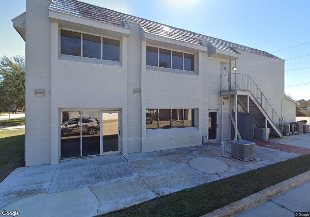
7434 Picardy Ave Baton Rouge, LA 70808
Bocage NeighborhoodEstimated Value: $284,000 - $366,000
--
Bed
--
Bath
4,514
Sq Ft
$72/Sq Ft
Est. Value
About This Home
This home is located at 7434 Picardy Ave, Baton Rouge, LA 70808 and is currently estimated at $325,879, approximately $72 per square foot. 7434 Picardy Ave is a home located in East Baton Rouge Parish with nearby schools including Westminster Elementary School, Westdale Middle School, and Tara High School.
Ownership History
Date
Name
Owned For
Owner Type
Purchase Details
Closed on
Nov 30, 2019
Sold by
Miller Rodney and Miller Debra
Bought by
3253 O Neal Llc
Current Estimated Value
Purchase Details
Closed on
Dec 14, 2018
Sold by
Peterson Rucgard K
Bought by
Miller Rodney and Miller Debra
Home Financials for this Owner
Home Financials are based on the most recent Mortgage that was taken out on this home.
Original Mortgage
$170,037
Interest Rate
4.8%
Mortgage Type
New Conventional
Purchase Details
Closed on
Oct 21, 2003
Sold by
Saamia Development
Bought by
Peterson Richard
Home Financials for this Owner
Home Financials are based on the most recent Mortgage that was taken out on this home.
Original Mortgage
$144,000
Interest Rate
6.42%
Mortgage Type
New Conventional
Create a Home Valuation Report for This Property
The Home Valuation Report is an in-depth analysis detailing your home's value as well as a comparison with similar homes in the area
Home Values in the Area
Average Home Value in this Area
Purchase History
| Date | Buyer | Sale Price | Title Company |
|---|---|---|---|
| 3253 O Neal Llc | -- | None Available | |
| Miller Rodney | $226,716 | Commerce Title & Abstract Co | |
| Peterson Richard | $180,000 | -- |
Source: Public Records
Mortgage History
| Date | Status | Borrower | Loan Amount |
|---|---|---|---|
| Previous Owner | Miller Rodney | $170,037 | |
| Previous Owner | Peterson Richard | $144,000 |
Source: Public Records
Tax History Compared to Growth
Tax History
| Year | Tax Paid | Tax Assessment Tax Assessment Total Assessment is a certain percentage of the fair market value that is determined by local assessors to be the total taxable value of land and additions on the property. | Land | Improvement |
|---|---|---|---|---|
| 2024 | $2,765 | $23,850 | $1,000 | $22,850 |
| 2023 | $2,765 | $21,500 | $1,000 | $20,500 |
| 2022 | $2,444 | $21,500 | $1,000 | $20,500 |
| 2021 | $2,397 | $21,500 | $1,000 | $20,500 |
| 2020 | $2,428 | $21,500 | $1,000 | $20,500 |
| 2019 | $2,531 | $21,540 | $1,000 | $20,540 |
| 2018 | $2,385 | $20,550 | $1,000 | $19,550 |
| 2017 | $2,385 | $20,550 | $1,000 | $19,550 |
| 2016 | $1,561 | $13,708 | $1,000 | $12,708 |
| 2015 | $2,324 | $20,550 | $1,000 | $19,550 |
| 2014 | $2,274 | $20,550 | $1,000 | $19,550 |
| 2013 | -- | $20,550 | $1,000 | $19,550 |
Source: Public Records
Map
Nearby Homes
- 7248 Perkins Rd Unit 203
- 7248 Perkins Rd Unit 209
- 7248 Perkins Rd Unit 205
- 7248 Perkins Rd Unit 208
- 7721 Silverside Dr
- 7638 Silverside Dr
- 7614 Silverside Dr
- 7619 Silverside Dr
- 7311 Japonica Ct
- 8024 Picardy Ave Unit E
- 1925 Camellia Trace Dr
- 1728 Seawolf Dr
- 8061 Pennth Ave Unit A, B, C, D
- 1715 Seawolf Dr
- 1811 Seawolf Dr
- 1824 Longfin Dr
- 7615 Whitetip Ave
- 1342 Applewood Rd
- 9280 Samoa Ave
- 5323 Blair Ln Unit V201
- 7434 Picardy Ave
- 7434 Picardy Ave
- 7444 Picardy Ave
- 7423 Picardy Ave Unit A
- 7091 Perkins Place Ct Unit 7091
- 7091 Perkins Place Ct Unit 7011
- 7091 Perkins Place Ct
- 5329 Dijon Dr
- 5329 Dijon Dr Unit 105-B
- 5329 Dijon Dr Unit 103 & 104
- 5329 Dijon Dr Unit 101-B
- 5329 Dijon Dr Unit 102-B
- 7081 Perkins Place Ct Unit C
- 7081 Perkins Place Ct Unit D
- 7081 Perkins Place Ct Unit B
- 7081 Perkins Place Ct Unit A
- 7081 Perkins Place Ct
- 7081 One Perkins Place Dr
- 7071 Perkins Place Ct Unit D
- 7071 Perkins Place Ct Unit B