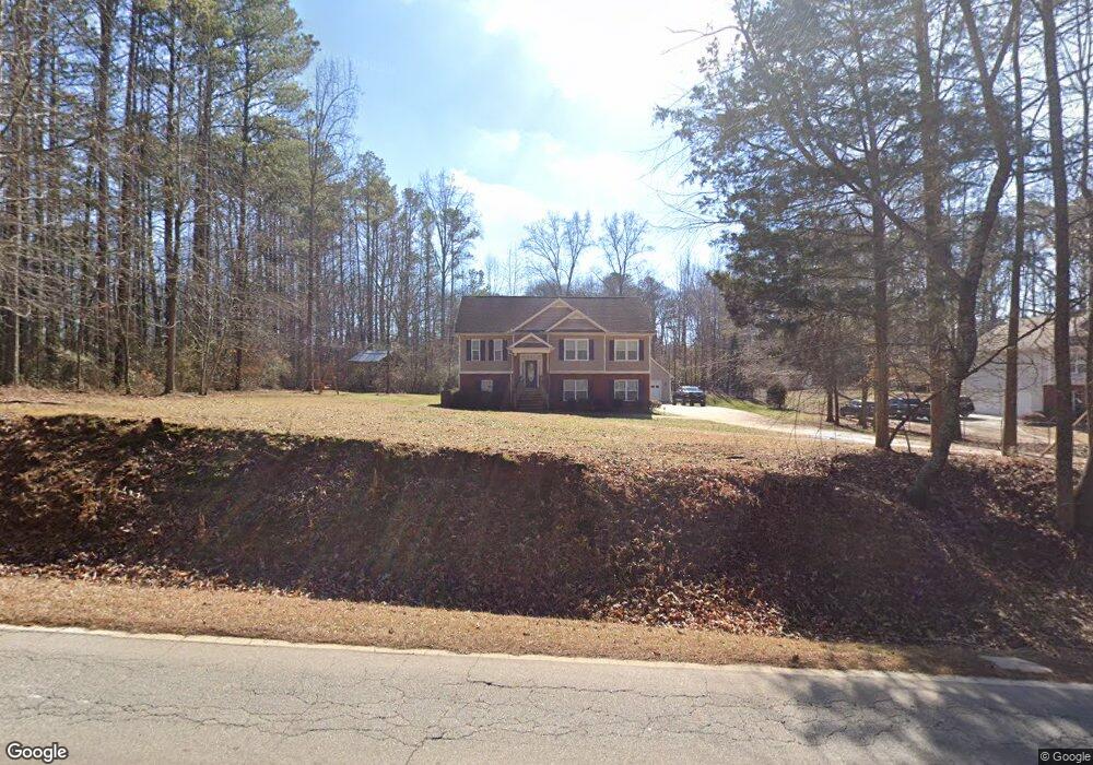
7439 Cedar Mountain Rd Douglasville, GA 30134
Winston NeighborhoodEstimated Value: $276,000 - $350,000
3
Beds
3
Baths
1,541
Sq Ft
$204/Sq Ft
Est. Value
About This Home
This home is located at 7439 Cedar Mountain Rd, Douglasville, GA 30134 and is currently estimated at $314,938, approximately $204 per square foot. 7439 Cedar Mountain Rd is a home located in Douglas County with nearby schools including Winston Elementary School, Mason Creek Middle School, and Douglas County High School.
Ownership History
Date
Name
Owned For
Owner Type
Purchase Details
Closed on
Sep 21, 2007
Sold by
Laurio Michael and Laurio Kathy
Bought by
Watson Bobby E and Watson Shirley P
Current Estimated Value
Home Financials for this Owner
Home Financials are based on the most recent Mortgage that was taken out on this home.
Original Mortgage
$151,650
Outstanding Balance
$95,620
Interest Rate
6.49%
Mortgage Type
New Conventional
Estimated Equity
$219,318
Purchase Details
Closed on
Jul 24, 2006
Sold by
Holland Jerry E
Bought by
Laurio Michael
Create a Home Valuation Report for This Property
The Home Valuation Report is an in-depth analysis detailing your home's value as well as a comparison with similar homes in the area
Home Values in the Area
Average Home Value in this Area
Purchase History
| Date | Buyer | Sale Price | Title Company |
|---|---|---|---|
| Watson Bobby E | $168,500 | -- | |
| Laurio Michael | $18,000 | -- |
Source: Public Records
Mortgage History
| Date | Status | Borrower | Loan Amount |
|---|---|---|---|
| Open | Watson Bobby E | $151,650 |
Source: Public Records
Tax History Compared to Growth
Tax History
| Year | Tax Paid | Tax Assessment Tax Assessment Total Assessment is a certain percentage of the fair market value that is determined by local assessors to be the total taxable value of land and additions on the property. | Land | Improvement |
|---|---|---|---|---|
| 2024 | $3,110 | $122,360 | $11,480 | $110,880 |
| 2023 | $3,110 | $122,360 | $11,480 | $110,880 |
| 2022 | $2,674 | $95,320 | $8,200 | $87,120 |
| 2021 | $2,347 | $78,800 | $8,200 | $70,600 |
| 2020 | $2,390 | $78,800 | $8,200 | $70,600 |
| 2019 | $2,214 | $77,000 | $8,200 | $68,800 |
| 2018 | $2,185 | $75,080 | $8,200 | $66,880 |
| 2017 | $1,994 | $66,160 | $7,760 | $58,400 |
| 2016 | $1,815 | $59,560 | $7,240 | $52,320 |
| 2015 | $1,601 | $53,000 | $7,240 | $45,760 |
| 2014 | $1,601 | $51,000 | $9,040 | $41,960 |
| 2013 | -- | $35,000 | $9,040 | $25,960 |
Source: Public Records
Map
Nearby Homes
- 1795 Hampton Pass
- 1670 Harvest Hill Unit 2
- 1837 Independence Dr
- 7683 Franklin Dr
- 1668 Independence Dr
- 0 Richardson Rd Unit 6979235
- 7780 Poppy Dr
- 8265 High Point Rd
- 6470 Cedar Mountain Rd
- 2771 Mann Rd
- 7911 Conners Rd
- 1855 S Flat Rock Rd
- 2575 Hamrick Rd
- 2625 Hamrick Rd
- 6854 John West Rd
- 51 Bedford Ct
- 6024 Locklear Way
- 6034 Locklear Way
- 7441 Cedar Mountain Rd
- 7435 Cedar Mountain Rd
- 1865 Hampton Pass
- 1855 Hampton Pass
- 7327 Corn Crib Loop N Unit 13
- 7327 Corn Crib Loop N
- 7445 Cedar Mountain Rd
- 0 Corn Crib Loop N Unit 7145870
- 0 Corn Crib Loop N Unit 7191194
- 0 Corn Crib Loop N Unit 7196664
- 0 Corn Crib Loop N Unit 7367965
- 0 Corn Crib Loop N Unit 7413892
- 0 Corn Crib Loop N Unit 7442185
- 0 Corn Crib Loop N Unit 7620743
- 0 Corn Crib Loop N
- 1850 Hampton Pass
- 7490 Cedar Mountain Rd
- 7429 Cedar Mountain Rd
- 7317 Corn Crib Loop N
- 1845 Hampton Pass