Estimated Value: $67,858 - $200,000
2
Beds
1
Bath
783
Sq Ft
$155/Sq Ft
Est. Value
About This Home
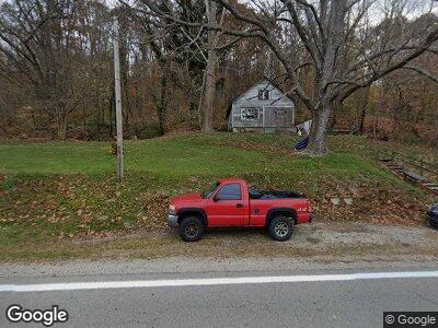
This home is located at 7439 State Route 73, Otway, OH 45657 and is currently estimated at $121,215, approximately $154 per square foot. 7439 State Route 73 is a home located in Scioto County with nearby schools including Northwest Elementary School, Northwest Middle School, and Northwest High School.
Ownership History
Date
Name
Owned For
Owner Type
Purchase Details
Closed on
Oct 10, 2008
Sold by
Groves Albert R and Groves Linda
Bought by
Euton Ronnie L
Current Estimated Value
Purchase Details
Closed on
Apr 17, 2003
Bought by
Groves Albert + Linda
Purchase Details
Closed on
Dec 3, 2001
Sold by
Vanhoose Claude
Bought by
Vanhoose Roy Anson
Purchase Details
Closed on
Feb 14, 2000
Sold by
Pennington Anita
Bought by
Vanhoose Claude
Purchase Details
Closed on
Jan 31, 2000
Sold by
Vanhoose Jeffrey D + Rose
Bought by
Pennington Anita
Purchase Details
Closed on
Sep 26, 1996
Sold by
Rachford Garry S
Bought by
Vanhoose Jeffrey D + Rose
Create a Home Valuation Report for This Property
The Home Valuation Report is an in-depth analysis detailing your home's value as well as a comparison with similar homes in the area
Home Values in the Area
Average Home Value in this Area
Purchase History
| Date | Buyer | Sale Price | Title Company |
|---|---|---|---|
| Euton Ronnie L | -- | -- | |
| Groves Albert + Linda | $4,100 | -- | |
| Vanhoose Roy Anson | -- | -- | |
| Vanhoose Claude | $2,500 | -- | |
| Pennington Anita | $2,500 | -- | |
| Vanhoose Jeffrey D + Rose | $2,500 | -- |
Source: Public Records
Tax History Compared to Growth
Tax History
| Year | Tax Paid | Tax Assessment Tax Assessment Total Assessment is a certain percentage of the fair market value that is determined by local assessors to be the total taxable value of land and additions on the property. | Land | Improvement |
|---|---|---|---|---|
| 2024 | $106 | $2,310 | $1,570 | $740 |
| 2023 | $106 | $2,310 | $1,570 | $740 |
| 2022 | $104 | $2,310 | $1,570 | $740 |
| 2021 | $90 | $2,030 | $1,380 | $650 |
| 2020 | $90 | $2,030 | $1,380 | $650 |
| 2019 | $91 | $1,860 | $1,250 | $610 |
| 2018 | $84 | $1,860 | $1,250 | $610 |
| 2017 | $89 | $1,860 | $1,250 | $610 |
| 2016 | $306 | $1,700 | $1,150 | $550 |
| 2015 | $79 | $1,700 | $1,150 | $550 |
| 2013 | $75 | $1,700 | $1,150 | $550 |
Source: Public Records
Map
Nearby Homes
- 7686 Ohio 73
- A Enley Rd
- 4345 Mt Unger Rd
- 6642A Big Spruce-Little Bear Rd
- 12961 Ohio 73
- 13863 State Route 73
- 0 Sedan Crabtree Rd
- 0 Rarden Hazelbaker Rd Unit 1815457
- 12808 Ohio 348
- 1099 Mohawk Dr
- 3000 Beech Fork Rd
- 0 Dry Run Rd
- 948 Big Bear Creek Rd
- 0 Bear Creek Rarden Rd
- 8163 Bear Creek Rarden Rd
- 3931 Mt Unger Rd
- 16 Dodds Rd
- 325 Edwards Rd
- 268 Nauvoo-Pond Creek Rd
- 268 B Nauvoo Pond Creek