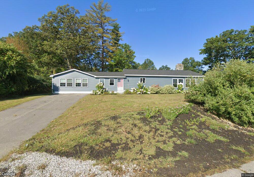
744 Daniel Webster Hwy MerriMacK, NH 03054
Estimated Value: $577,000 - $666,000
3
Beds
1
Bath
2,291
Sq Ft
$264/Sq Ft
Est. Value
About This Home
This home is located at 744 Daniel Webster Hwy, MerriMacK, NH 03054 and is currently estimated at $605,297, approximately $264 per square foot. 744 Daniel Webster Hwy is a home located in Hillsborough County with nearby schools including Reeds Ferry School, James Mastricola Upper Elementary School, and Merrimack Middle School.
Ownership History
Date
Name
Owned For
Owner Type
Purchase Details
Closed on
Mar 17, 2022
Sold by
746 Dwh Llc
Bought by
Black Diamond Hldg Llc
Current Estimated Value
Home Financials for this Owner
Home Financials are based on the most recent Mortgage that was taken out on this home.
Original Mortgage
$2,500,000
Outstanding Balance
$2,317,011
Interest Rate
3.55%
Mortgage Type
Purchase Money Mortgage
Estimated Equity
-$1,711,714
Purchase Details
Closed on
Oct 21, 2010
Sold by
Tea Party Properties L
Bought by
744 Dwh Llc
Purchase Details
Closed on
Oct 14, 2005
Sold by
Merrimack Woodstock and Merrimack Pr
Bought by
Tea Party Props Llc
Home Financials for this Owner
Home Financials are based on the most recent Mortgage that was taken out on this home.
Original Mortgage
$900,000
Interest Rate
5.78%
Mortgage Type
Purchase Money Mortgage
Create a Home Valuation Report for This Property
The Home Valuation Report is an in-depth analysis detailing your home's value as well as a comparison with similar homes in the area
Home Values in the Area
Average Home Value in this Area
Purchase History
| Date | Buyer | Sale Price | Title Company |
|---|---|---|---|
| Black Diamond Hldg Llc | $2,200,000 | None Available | |
| 744 Dwh Llc | $475,000 | -- | |
| Tea Party Props Llc | $300,000 | -- |
Source: Public Records
Mortgage History
| Date | Status | Borrower | Loan Amount |
|---|---|---|---|
| Open | Black Diamond Hldg Llc | $2,500,000 | |
| Previous Owner | Tea Party Props Llc | $200,000 | |
| Previous Owner | Tea Party Props Llc | $900,000 |
Source: Public Records
Tax History Compared to Growth
Tax History
| Year | Tax Paid | Tax Assessment Tax Assessment Total Assessment is a certain percentage of the fair market value that is determined by local assessors to be the total taxable value of land and additions on the property. | Land | Improvement |
|---|---|---|---|---|
| 2024 | $8,166 | $394,700 | $203,800 | $190,900 |
| 2023 | $7,484 | $384,800 | $203,800 | $181,000 |
| 2022 | $5,058 | $291,000 | $199,600 | $91,400 |
| 2021 | $8,540 | $497,400 | $370,600 | $126,800 |
| 2020 | $8,262 | $343,400 | $256,900 | $86,500 |
| 2019 | $8,286 | $343,400 | $256,900 | $86,500 |
| 2018 | $7,984 | $343,400 | $256,900 | $86,500 |
| 2017 | $7,883 | $337,300 | $228,300 | $109,000 |
| 2016 | $7,687 | $337,300 | $228,300 | $109,000 |
| 2015 | $11,757 | $475,600 | $377,900 | $97,700 |
| 2014 | $11,457 | $475,600 | $377,900 | $97,700 |
| 2013 | $11,372 | $475,600 | $377,900 | $97,700 |
Source: Public Records
Map
Nearby Homes
- 769 Daniel Webster Hwy
- 4543 Brown Ave
- 4481 Brown Ave
- 53 Pine Ave
- 67 Pullman St
- 4243 Brown Ave
- 29 Watts Landing Unit 24
- 9 Mustang Dr Unit C
- 9 Mustang Dr Unit B
- 7 Mustang Dr Unit C
- 7 Mustang Dr Unit END UNIT-A
- 3-C Mustang Dr Unit MODEL
- 22 Kimberly Dr
- 15 Tamarack Ct
- 490 Charles Bancroft Hwy
- 34 Chatham Dr
- 8 Iroquois Cir
- 29 Bedford Rd
- 18 Horizon Dr
- 1 Pleasant St
- 744 Daniel Webster Hwy
- 744 Daniel Webster Hwy Unit 1
- 1 Crosswoods Path Blvd
- 747 Daniel Webster Hwy
- 740 Daniel Webster Hwy
- 5 Bernard`s Road #27 (Rental)
- 5 Bernards Rd Unit 2
- 5-34 Crosswoods Path Blvd Unit 34
- 5 Crosswoods Path Blvd Unit 24
- 7 Chocorua Ln
- 9 Crosswoods Path Blvd
- 9 Crosswoods Path Blvd Unit 34
- 9 Crosswoods Path Blvd Unit 33
- 9 Crosswoods Path Blvd Unit 32
- 9 Crosswoods Path Blvd Unit 31
- 9 Crosswoods Path Blvd
- 9 Crosswoods Path Blvd Unit 23
- 9 Crosswoods Path Blvd Unit 22
- 9 Crosswoods Path Blvd Unit 21
- 9 Crosswoods Path Blvd Unit 14