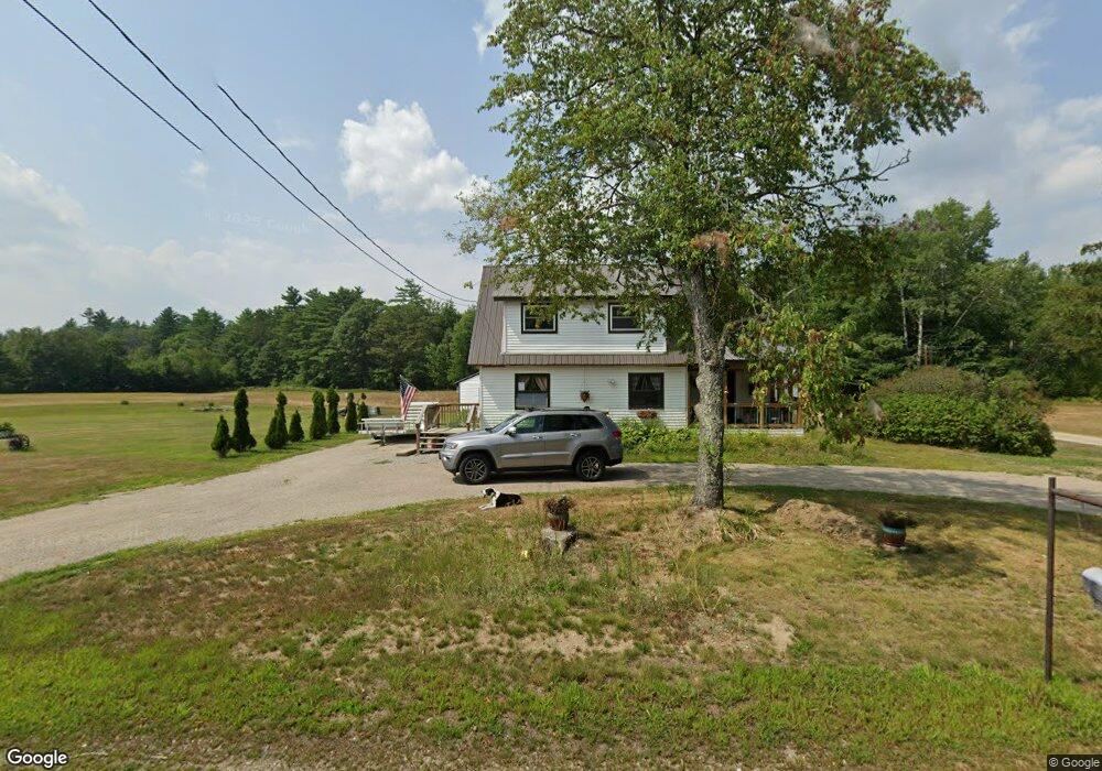
744 E Conway Rd Center Conway, NH 03813
Estimated Value: $336,000 - $379,471
2
Beds
2
Baths
1,192
Sq Ft
$304/Sq Ft
Est. Value
About This Home
This home is located at 744 E Conway Rd, Center Conway, NH 03813 and is currently estimated at $362,618, approximately $304 per square foot. 744 E Conway Rd is a home located in Carroll County with nearby schools including A. Crosby Kennett Middle School, Kennett High School, and Robert Frost Charter School.
Ownership History
Date
Name
Owned For
Owner Type
Purchase Details
Closed on
May 30, 2018
Sold by
Mason Ft
Bought by
Swaim Richard D
Current Estimated Value
Home Financials for this Owner
Home Financials are based on the most recent Mortgage that was taken out on this home.
Original Mortgage
$114,400
Outstanding Balance
$97,773
Interest Rate
3.99%
Mortgage Type
Purchase Money Mortgage
Estimated Equity
$264,846
Create a Home Valuation Report for This Property
The Home Valuation Report is an in-depth analysis detailing your home's value as well as a comparison with similar homes in the area
Home Values in the Area
Average Home Value in this Area
Purchase History
| Date | Buyer | Sale Price | Title Company |
|---|---|---|---|
| Swaim Richard D | $143,000 | -- |
Source: Public Records
Mortgage History
| Date | Status | Borrower | Loan Amount |
|---|---|---|---|
| Open | Swaim Richard D | $114,400 |
Source: Public Records
Tax History Compared to Growth
Tax History
| Year | Tax Paid | Tax Assessment Tax Assessment Total Assessment is a certain percentage of the fair market value that is determined by local assessors to be the total taxable value of land and additions on the property. | Land | Improvement |
|---|---|---|---|---|
| 2024 | $4,209 | $371,800 | $65,100 | $306,700 |
| 2023 | $3,818 | $347,700 | $65,100 | $282,600 |
| 2022 | $3,666 | $200,200 | $59,100 | $141,100 |
| 2021 | $3,270 | $200,100 | $59,100 | $141,000 |
| 2020 | $2,991 | $174,200 | $59,100 | $115,100 |
| 2019 | $8,651 | $174,200 | $59,100 | $115,100 |
| 2018 | $8,433 | $153,800 | $58,800 | $95,000 |
| 2017 | $3,073 | $153,800 | $58,800 | $95,000 |
| 2016 | $8,963 | $153,800 | $58,800 | $95,000 |
| 2015 | $2,936 | $153,800 | $58,800 | $95,000 |
| 2014 | $2,901 | $153,800 | $58,800 | $95,000 |
| 2013 | $2,827 | $158,300 | $58,800 | $99,500 |
Source: Public Records
Map
Nearby Homes
- 1139 E Conway Rd
- 158 Fox Hill Ln
- 169 Mountainvale Dr
- 24 Loon Mountain Ln
- 14 Goldfinch Ln
- 43 Wildwood Way
- 63 Mill St
- 1049 E Main St
- 25 Singer Ln
- 574 Old Mill Rd
- 106 Pemigewasset Dr
- 19 Saco St Unit 92
- 19 Saco St Unit 59
- 19 Saco St Unit 58
- 48 Sands Cir Unit 48D
- 301 Redstone St
- 33 Sands Cir
- 928 Eastman Rd
- 00 Stritch Rd Unit 58
- 0 Bonita's Way Unit 5
- 708 E Conway Rd
- 788 E Conway Rd
- 814 E Conway Rd
- 671 E Conway Rd
- 649 E Conway Rd
- 840 E Conway Rd
- 636 E Conway Rd
- 819 E Conway Rd
- 59 Horseshoe Dr
- 597 E Conway Rd
- 33 Southview Loop
- 93 Southview Loop
- 51 Southview Loop
- 134 Vfw St
- 581 E Conway Rd
- 571 E Conway Rd
- 561 E Conway Rd
- 915 E Conway Rd
- 21 Kenwood Cir
- 8 Turkey Trott Rd