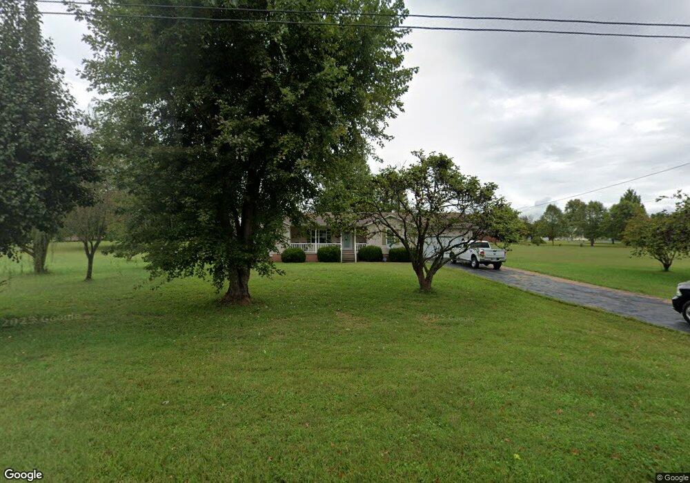
744 James Austin Rd Sparta, TN 38583
Estimated Value: $283,368 - $305,000
--
Bed
2
Baths
1,416
Sq Ft
$211/Sq Ft
Est. Value
About This Home
This home is located at 744 James Austin Rd, Sparta, TN 38583 and is currently estimated at $298,592, approximately $210 per square foot. 744 James Austin Rd is a home located in White County with nearby schools including Northfield Elementary School, White County Middle School, and White County High School.
Ownership History
Date
Name
Owned For
Owner Type
Purchase Details
Closed on
Jan 13, 2024
Sold by
Prater Tim
Bought by
Berger Robert
Current Estimated Value
Purchase Details
Closed on
Mar 20, 2000
Sold by
Berger Robert P
Bought by
Dunham Gregory N
Purchase Details
Closed on
Mar 16, 2000
Sold by
Berger Robert P
Bought by
Berger Robert P
Purchase Details
Closed on
Oct 7, 1999
Bought by
Ward Wesley
Purchase Details
Closed on
Jul 16, 1999
Bought by
Ray Maples and Jolley Ronnie
Create a Home Valuation Report for This Property
The Home Valuation Report is an in-depth analysis detailing your home's value as well as a comparison with similar homes in the area
Home Values in the Area
Average Home Value in this Area
Purchase History
| Date | Buyer | Sale Price | Title Company |
|---|---|---|---|
| Berger Robert | $20,000 | None Listed On Document | |
| Dunham Gregory N | $102,400 | -- | |
| Berger Robert P | $77,500 | -- | |
| Ward Wesley | $15,000 | -- | |
| Ray Maples | $19,200 | -- |
Source: Public Records
Tax History Compared to Growth
Tax History
| Year | Tax Paid | Tax Assessment Tax Assessment Total Assessment is a certain percentage of the fair market value that is determined by local assessors to be the total taxable value of land and additions on the property. | Land | Improvement |
|---|---|---|---|---|
| 2024 | $816 | $39,800 | $8,875 | $30,925 |
| 2023 | $816 | $39,800 | $8,875 | $30,925 |
| 2022 | $816 | $39,800 | $8,875 | $30,925 |
| 2021 | $816 | $39,800 | $8,875 | $30,925 |
| 2020 | $816 | $39,800 | $8,875 | $30,925 |
| 2019 | $666 | $32,475 | $7,500 | $24,975 |
| 2018 | $666 | $32,475 | $7,500 | $24,975 |
| 2017 | $666 | $32,475 | $7,500 | $24,975 |
| 2016 | $666 | $32,475 | $7,500 | $24,975 |
| 2015 | $601 | $32,475 | $7,500 | $24,975 |
| 2014 | -- | $32,475 | $7,500 | $24,975 |
| 2013 | -- | $31,925 | $7,500 | $24,425 |
Source: Public Records
Map
Nearby Homes
- 159 Rustling Oaks Dr
- 191 Rustling Oaks Dr
- 00 Milk Plant Rd
- 0 Saylor Rd
- 00 Saylor Rd
- 00 Oakcrest Dr
- 1045 Mullican Rd
- 366 S Bunker Hill Rd
- lot 7 James Holman Rd
- lot 6 James Holman Rd
- 147 Bob White Dr
- 3660 Burgess Falls Rd
- 221 Magnolia Rd
- 130 Mallard Dr
- 1236 Swamp Rd
- 1298 S Bunker Hill Rd
- 2110 Almyra Rd
- 470 Black Oak Rd
- 133 Prosperity Dr
- 747 James Austin Rd
- 227 Brook Dr
- 191 Brook Dr
- 16 Brook Dr
- lot 16 Brook Dr
- 0 Brook Dr
- 792 James Austin Rd
- 773 James Austin Rd
- 160 Serenity Dr
- 22 Serenity Dr
- 144 Brook Dr
- 162 Brook Dr
- 148 Prosperity Dr
- 238 Brook Dr
- 178 Brook Dr
- 659 James Austin Rd
- 142 Brook Dr
- 121 Serenity Dr
- 12 Serenity Dr