K
Seller's Agent in 2025
Kristin Metoyer
LPT Realty LLC
(323) 836-1111
1 in this area
11 Total Sales
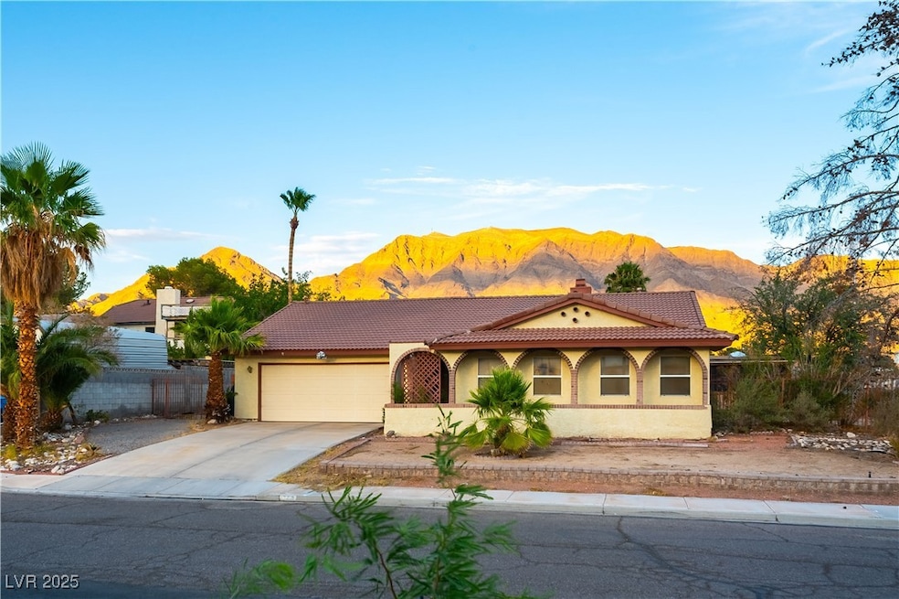
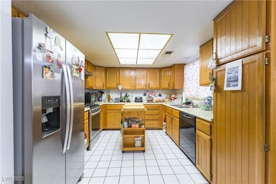
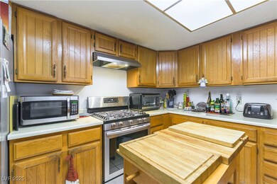
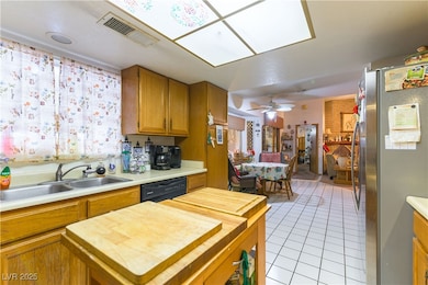
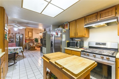
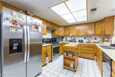
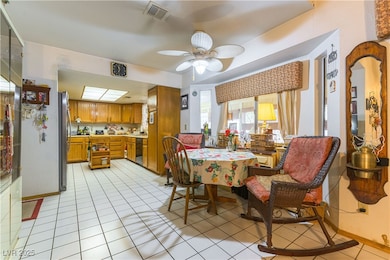
Welcome to this charming 3-bedroom, 2-bathroom home nestled on a spacious corner lot at the end of a quiet cul-de-sac in Sunrise Manor. Offering both privacy and breathtaking views of the mountains and the iconic Las Vegas Sphere, this home is a rare find that blends comfort, convenience, and character. Step inside to discover an inviting open layout with abundant natural light and a cozy yet spacious feel throughout. The kitchen features ample cabinetry and seamlessly connects to the dining and living areas—perfect for both daily living and entertaining.
A standout feature is the sunroom (approx. 300 sq ft of additional space not reflected in tax records), ideal for a home office, playroom, or tranquil retreat with stunning vistas.
Enjoy quiet mornings with mountain views and sparkling city lights by night—all from the comfort of your own home.
Don’t miss the chance to make this one-of-a-kind Sunrise Manor beauty yours.
Last Agent to Sell the Property
LPT Realty LLC License #S.0187157 Listed on: 07/06/2025

| Date | Type | Sale Price | Title Company |
|---|---|---|---|
| Bargain Sale Deed | $400,000 | Magnus Title Agency | |
| Quit Claim Deed | -- | -- | |
| Interfamily Deed Transfer | -- | -- | |
| Bargain Sale Deed | $143,000 | Lawyers Title | |
| Trustee Deed | $131,108 | Land Title |
| Date | Status | Loan Amount | Loan Type |
|---|---|---|---|
| Open | $392,755 | FHA |
| Date | Event | Price | List to Sale | Price per Sq Ft |
|---|---|---|---|---|
| 09/02/2025 09/02/25 | Sold | $400,000 | -5.9% | $215 / Sq Ft |
| 08/04/2025 08/04/25 | Pending | -- | -- | -- |
| 07/06/2025 07/06/25 | For Sale | $425,000 | -- | $228 / Sq Ft |
| Year | Tax Paid | Tax Assessment Tax Assessment Total Assessment is a certain percentage of the fair market value that is determined by local assessors to be the total taxable value of land and additions on the property. | Land | Improvement |
|---|---|---|---|---|
| 2026 | $1,648 | $74,603 | $37,450 | $37,153 |
| 2025 | $1,525 | $78,002 | $39,550 | $38,452 |
| 2024 | $1,413 | $78,002 | $39,550 | $38,452 |
| 2023 | $1,413 | $75,416 | $37,800 | $37,616 |
| 2022 | $1,309 | $64,611 | $29,750 | $34,861 |
| 2021 | $1,212 | $60,904 | $27,300 | $33,604 |
| 2020 | $1,122 | $59,968 | $26,250 | $33,718 |
| 2019 | $1,052 | $57,125 | $23,450 | $33,675 |
| 2018 | $1,004 | $52,071 | $19,250 | $32,821 |
| 2017 | $1,520 | $51,821 | $18,200 | $33,621 |
| 2016 | $941 | $50,323 | $16,100 | $34,223 |
| 2015 | $938 | $41,851 | $8,750 | $33,101 |
| 2014 | -- | $30,118 | $8,750 | $21,368 |
K
Seller's Agent in 2025
Kristin Metoyer
LPT Realty LLC
(323) 836-1111
1 in this area
11 Total Sales
G
Buyer's Agent in 2025
Gabriel Ortega
United Realty Group
(702) 576-2240
3 in this area
18 Total Sales
Source: Las Vegas REALTORS®
MLS Number: 2698717
APN: 140-34-110-080
Disclaimer: Certain information contained herein is derived from information provided by parties other than Homes.com. All information provided is deemed reliable, but is not guaranteed to be accurate and should be independently verified.
![]() The data relating to real estate for sale on this web site comes in part from the INTERNET DATA EXCHANGE Program of the Greater Las Vegas Association of REALTORS® MLS. Real estate listings held by brokerage firms other than this site owner are marked with the IDX logo. Information is deemed reliable but not guaranteed. Copyright 2026 of the Greater Las Vegas Association of REALTORS® MLS. All rights reserved.
The data relating to real estate for sale on this web site comes in part from the INTERNET DATA EXCHANGE Program of the Greater Las Vegas Association of REALTORS® MLS. Real estate listings held by brokerage firms other than this site owner are marked with the IDX logo. Information is deemed reliable but not guaranteed. Copyright 2026 of the Greater Las Vegas Association of REALTORS® MLS. All rights reserved.
Ask me questions while you tour the home.