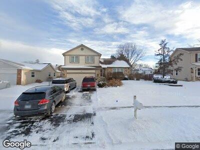
744 N Brookdale Dr Schaumburg, IL 60194
West Schaumburg NeighborhoodEstimated Value: $461,548 - $528,000
3
Beds
3
Baths
1,956
Sq Ft
$251/Sq Ft
Est. Value
About This Home
This home is located at 744 N Brookdale Dr, Schaumburg, IL 60194 and is currently estimated at $491,637, approximately $251 per square foot. 744 N Brookdale Dr is a home located in Cook County with nearby schools including Hoover Math And Science Academy, Helen Keller Junior High School, and Schaumburg High School.
Ownership History
Date
Name
Owned For
Owner Type
Purchase Details
Closed on
Jul 11, 2003
Sold by
Romme Jack R and Romme Janis M
Bought by
Pierson Grant W and Pierson Wendy A
Current Estimated Value
Home Financials for this Owner
Home Financials are based on the most recent Mortgage that was taken out on this home.
Original Mortgage
$200,000
Interest Rate
5.3%
Mortgage Type
Unknown
Create a Home Valuation Report for This Property
The Home Valuation Report is an in-depth analysis detailing your home's value as well as a comparison with similar homes in the area
Home Values in the Area
Average Home Value in this Area
Purchase History
| Date | Buyer | Sale Price | Title Company |
|---|---|---|---|
| Pierson Grant W | $322,500 | Attorneys Title Guaranty Fun |
Source: Public Records
Mortgage History
| Date | Status | Borrower | Loan Amount |
|---|---|---|---|
| Open | Pierson Grant W | $227,000 | |
| Closed | Pierson Grant W | $65,000 | |
| Closed | Pierson Grant W | $245,000 | |
| Closed | Pierson Grant W | $75,000 | |
| Closed | Pierson Grant W | $32,500 | |
| Closed | Pierson Grant W | $25,000 | |
| Closed | Pierson Grant W | $200,000 |
Source: Public Records
Tax History Compared to Growth
Tax History
| Year | Tax Paid | Tax Assessment Tax Assessment Total Assessment is a certain percentage of the fair market value that is determined by local assessors to be the total taxable value of land and additions on the property. | Land | Improvement |
|---|---|---|---|---|
| 2024 | $7,811 | $34,913 | $8,683 | $26,230 |
| 2023 | $7,811 | $34,913 | $8,683 | $26,230 |
| 2022 | $7,811 | $34,913 | $8,683 | $26,230 |
| 2021 | $7,110 | $29,452 | $5,941 | $23,511 |
| 2020 | $8,259 | $30,827 | $5,941 | $24,886 |
| 2019 | $8,262 | $34,253 | $5,941 | $28,312 |
| 2018 | $8,596 | $32,078 | $5,027 | $27,051 |
| 2017 | $8,478 | $32,078 | $5,027 | $27,051 |
| 2016 | $8,171 | $32,078 | $5,027 | $27,051 |
| 2015 | $7,074 | $26,268 | $4,341 | $21,927 |
| 2014 | $7,012 | $26,268 | $4,341 | $21,927 |
| 2013 | $6,815 | $26,268 | $4,341 | $21,927 |
Source: Public Records
Map
Nearby Homes
- 730 N Hundley St
- 804 Mansfield Ct Unit 2
- 810 Bishop Ct
- 1560 W Hundley St
- 1574 Crowfoot Cir N
- 938 Cardiff Ct Unit 3
- 1324 Elmhurst Ln
- 2110 Primrose Ln
- 1712 Sutton Ln
- 640 Yardley Ln
- 719 Brian Ave
- 2123 Primrose Ln
- 910 N Dovington Dr
- 907 Banbury Ct
- 1760 Pebble Beach Dr
- 618 Newton Ct Unit 1
- 634 Newton Ct Unit 1
- 2235 Denton Ct Unit 1
- 2232 Glenview Ct Unit 2232
- 2134 Northwind Cir
- 744 N Brookdale Dr
- 738 N Brookdale Dr
- 748 N Brookdale Dr
- 1632 Stratton Pond Ln
- 1628 Stratton Pond Ln
- 1704 Stratton Pond Ln
- 752 N Brookdale Dr
- 734 N Brookdale Dr
- 749 N Brookdale Dr
- 1624 Stratton Pond Ln
- 1708 Stratton Pond Ln
- 745 N Brookdale Dr
- 1620 Stratton Pond Ln
- 756 N Brookdale Dr
- 1712 Stratton Pond Ln
- 753 N Brookdale Dr
- 1616 Stratton Pond Ln
- 741 N Brookdale Dr
- 717 Clarendon Springs Ct
- 1716 Stratton Pond Ln