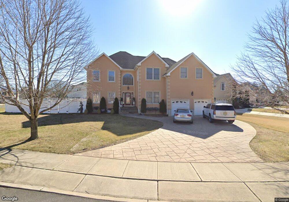
744 Opatut Ct Toms River, NJ 08753
Estimated Value: $888,918 - $1,021,000
4
Beds
3
Baths
5,095
Sq Ft
$191/Sq Ft
Est. Value
About This Home
This home is located at 744 Opatut Ct, Toms River, NJ 08753 and is currently estimated at $970,730, approximately $190 per square foot. 744 Opatut Ct is a home located in Ocean County with nearby schools including St Joseph Grade School, Ambassador Christian Academy, and Donovan Catholic High School.
Ownership History
Date
Name
Owned For
Owner Type
Purchase Details
Closed on
Aug 20, 2018
Sold by
Tashman Yehoshua
Bought by
Laird John R and Laird Giovanna
Current Estimated Value
Home Financials for this Owner
Home Financials are based on the most recent Mortgage that was taken out on this home.
Original Mortgage
$515,000
Outstanding Balance
$447,257
Interest Rate
4.5%
Mortgage Type
VA
Estimated Equity
$523,473
Purchase Details
Closed on
Mar 26, 2018
Sold by
Ocean County Sheriff
Bought by
Tashman Yehoshua
Purchase Details
Closed on
Jan 31, 2006
Sold by
Morrison Martin J
Bought by
Fortler James and Fortler Jerilyn
Home Financials for this Owner
Home Financials are based on the most recent Mortgage that was taken out on this home.
Original Mortgage
$634,388
Interest Rate
5.5%
Mortgage Type
Construction
Create a Home Valuation Report for This Property
The Home Valuation Report is an in-depth analysis detailing your home's value as well as a comparison with similar homes in the area
Home Values in the Area
Average Home Value in this Area
Purchase History
| Date | Buyer | Sale Price | Title Company |
|---|---|---|---|
| Laird John R | $515,000 | None Available | |
| Tashman Yehoshua | $356,000 | -- | |
| Fortler James | $660,000 | None Available |
Source: Public Records
Mortgage History
| Date | Status | Borrower | Loan Amount |
|---|---|---|---|
| Open | Laird John R | $515,000 | |
| Previous Owner | Fortler James | $634,388 |
Source: Public Records
Tax History Compared to Growth
Tax History
| Year | Tax Paid | Tax Assessment Tax Assessment Total Assessment is a certain percentage of the fair market value that is determined by local assessors to be the total taxable value of land and additions on the property. | Land | Improvement |
|---|---|---|---|---|
| 2025 | $12,845 | $705,400 | $289,000 | $416,400 |
| 2024 | $12,210 | $705,400 | $289,000 | $416,400 |
| 2023 | $11,421 | $684,300 | $289,000 | $395,300 |
| 2022 | $11,421 | $684,300 | $289,000 | $395,300 |
| 2021 | $12,560 | $501,400 | $99,500 | $401,900 |
| 2020 | $12,505 | $501,400 | $99,500 | $401,900 |
| 2019 | $11,963 | $501,400 | $99,500 | $401,900 |
| 2018 | $11,803 | $501,400 | $99,500 | $401,900 |
| 2017 | $11,703 | $501,400 | $99,500 | $401,900 |
| 2016 | $11,397 | $501,400 | $99,500 | $401,900 |
| 2015 | $10,966 | $501,400 | $99,500 | $401,900 |
| 2014 | $10,439 | $501,400 | $99,500 | $401,900 |
Source: Public Records
Map
Nearby Homes
- 696 Schoolhouse Ln
- 883 Astoria Dr
- 308 Tradewinds Ave
- 918 Briar Ave
- 837 Naryshkin Way
- 625 Greenwich Ct
- 855 Derry Dr
- 856 Somerset Dr
- 886 Ocean View Dr
- 612 Greenwich Ct
- 837 Raleigh Dr
- 600 Brookside Dr
- 308 Cedar Grove Rd
- 977 Stafford Dr
- 891 Raleigh Dr
- 919 Somerset Dr
- 830 Brookside Dr
- 241 Lester Rd
- 984 Westminster Dr
- 1004 Sheila Dr