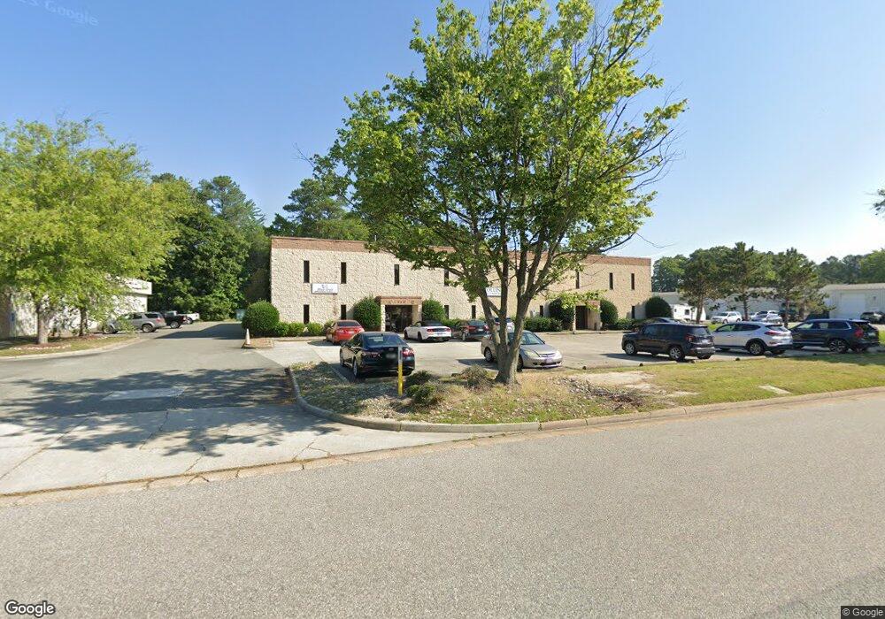
745 Bluecrab Rd Newport News, VA 23606
Estimated Value: $1,560,423
--
Bed
--
Bath
16,080
Sq Ft
$97/Sq Ft
Est. Value
About This Home
This home is located at 745 Bluecrab Rd, Newport News, VA 23606 and is currently estimated at $1,560,423, approximately $97 per square foot. 745 Bluecrab Rd is a home located in Newport News City with nearby schools including L.F. Palmer Elementary School, Homer L. Hines Middle School, and Warwick High School.
Ownership History
Date
Name
Owned For
Owner Type
Purchase Details
Closed on
May 2, 2023
Sold by
Ypm Associates
Bought by
Ashe Land Investments Llc
Current Estimated Value
Home Financials for this Owner
Home Financials are based on the most recent Mortgage that was taken out on this home.
Original Mortgage
$1,225,000
Outstanding Balance
$1,003,616
Interest Rate
6.28%
Mortgage Type
Seller Take Back
Estimated Equity
$556,807
Create a Home Valuation Report for This Property
The Home Valuation Report is an in-depth analysis detailing your home's value as well as a comparison with similar homes in the area
Home Values in the Area
Average Home Value in this Area
Purchase History
| Date | Buyer | Sale Price | Title Company |
|---|---|---|---|
| Ashe Land Investments Llc | $1,375,000 | Chicago Title |
Source: Public Records
Mortgage History
| Date | Status | Borrower | Loan Amount |
|---|---|---|---|
| Open | Ashe Land Investments Llc | $1,225,000 |
Source: Public Records
Tax History Compared to Growth
Tax History
| Year | Tax Paid | Tax Assessment Tax Assessment Total Assessment is a certain percentage of the fair market value that is determined by local assessors to be the total taxable value of land and additions on the property. | Land | Improvement |
|---|---|---|---|---|
| 2024 | $18,171 | $1,539,900 | $229,500 | $1,310,400 |
| 2023 | $21,478 | $1,539,900 | $229,500 | $1,310,400 |
| 2022 | $21,786 | $1,539,900 | $229,500 | $1,310,400 |
| 2021 | $16,840 | $1,380,300 | $229,500 | $1,150,800 |
| 2020 | $20,147 | $1,380,300 | $229,500 | $1,150,800 |
| 2019 | $18,498 | $1,254,000 | $229,500 | $1,024,500 |
| 2018 | $18,431 | $1,254,000 | $229,500 | $1,024,500 |
| 2017 | $18,431 | $1,254,000 | $229,500 | $1,024,500 |
| 2016 | $18,336 | $1,254,000 | $229,500 | $1,024,500 |
| 2015 | $18,201 | $1,254,000 | $229,500 | $1,024,500 |
| 2014 | $13,373 | $1,215,700 | $191,200 | $1,024,500 |
Source: Public Records
Map
Nearby Homes
- 670 Town Center Dr Unit 406
- 670 Town Center Dr
- 670 Town Center Dr Unit 418
- 106 Deep Water Cove
- 103 Wreck Shoal Dr
- 103 Nantucket Place
- 135 Wreck Shoal Dr
- 332 Nantucket Place
- 101 Nantucket Place
- 230 Nat Turner Blvd S Unit 4003
- 230 Nat Turner Blvd S
- 230 Nat Turner Blvd S Unit 2004
- 230 Nat Turner Blvd S Unit 2013
- 1001 Willow Green Dr
- 286 Walt Whitman Ave
- 296 Walt Whitman Ave
- 94 F Scott Fitzgerald S
- 318 Walt Whitman Ave
- 1080 Willow Green Dr
- 26 Rugby Rd
- 741 Bluecrab Rd
- 11841-A Canon Blvd
- 11839-B Canon Blvd
- 11839-A Canon Blvd
- 11843-A Canon Blvd
- 11839-C Canon Blvd
- 11843-B Canon Blvd
- 11843-C Canon Blvd
- 11835 Canon Blvd
- 737 Bluecrab Rd
- 742 Bluecrab Rd
- 748 Bluecrab Rd
- 740 Bluecrab Rd
- 736 City Center Blvd
- 750 City Center Blvd
- 744 City Center Blvd
- 11842 Canon Blvd
- 734-D City Center Blvd
- 734-C City Center Blvd
- 734-B City Center Blvd