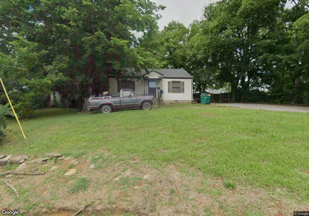
745 Jones Cir Lewisburg, TN 37091
Estimated Value: $99,677 - $174,000
--
Bed
1
Bath
816
Sq Ft
$165/Sq Ft
Est. Value
About This Home
This home is located at 745 Jones Cir, Lewisburg, TN 37091 and is currently estimated at $134,419, approximately $164 per square foot. 745 Jones Cir is a home located in Marshall County with nearby schools including Oak Grove Elementary School, Marshall Elementary School, and Westhills Elementary School.
Ownership History
Date
Name
Owned For
Owner Type
Purchase Details
Closed on
Jul 11, 2017
Sold by
Harris Vickie
Bought by
Tears Joan Althea
Current Estimated Value
Home Financials for this Owner
Home Financials are based on the most recent Mortgage that was taken out on this home.
Original Mortgage
$22,800
Outstanding Balance
$18,953
Interest Rate
3.91%
Mortgage Type
New Conventional
Estimated Equity
$115,466
Purchase Details
Closed on
Nov 17, 2006
Sold by
Farrow Patricia B
Bought by
Vickie Harris
Home Financials for this Owner
Home Financials are based on the most recent Mortgage that was taken out on this home.
Original Mortgage
$20,737
Interest Rate
6.33%
Purchase Details
Closed on
Feb 24, 1998
Sold by
Sowell James M
Bought by
Patricia Farrow
Create a Home Valuation Report for This Property
The Home Valuation Report is an in-depth analysis detailing your home's value as well as a comparison with similar homes in the area
Home Values in the Area
Average Home Value in this Area
Purchase History
| Date | Buyer | Sale Price | Title Company |
|---|---|---|---|
| Tears Joan Althea | $28,500 | -- | |
| Vickie Harris | $25,000 | -- | |
| Patricia Farrow | $15,000 | -- |
Source: Public Records
Mortgage History
| Date | Status | Borrower | Loan Amount |
|---|---|---|---|
| Open | Tears Joan Althea | $22,800 | |
| Previous Owner | Patricia Farrow | $20,737 |
Source: Public Records
Tax History Compared to Growth
Tax History
| Year | Tax Paid | Tax Assessment Tax Assessment Total Assessment is a certain percentage of the fair market value that is determined by local assessors to be the total taxable value of land and additions on the property. | Land | Improvement |
|---|---|---|---|---|
| 2024 | -- | $11,525 | $1,875 | $9,650 |
| 2023 | $358 | $11,525 | $1,875 | $9,650 |
| 2022 | $358 | $11,525 | $1,875 | $9,650 |
| 2021 | $306 | $6,575 | $1,000 | $5,575 |
| 2020 | $306 | $6,575 | $1,000 | $5,575 |
| 2019 | $296 | $6,575 | $1,000 | $5,575 |
| 2018 | $293 | $6,575 | $1,000 | $5,575 |
| 2017 | $293 | $6,575 | $1,000 | $5,575 |
| 2016 | $294 | $5,750 | $1,000 | $4,750 |
| 2015 | $269 | $5,750 | $1,000 | $4,750 |
| 2014 | $269 | $5,750 | $1,000 | $4,750 |
Source: Public Records
Map
Nearby Homes
- 1600 Larry Dospil Dr
- 638 2nd Ave N
- 231 Greenwood St
- 319 Greenwood St
- 543 2nd Ave N
- 416 1st Ave N
- 594 5th Ave N
- 627 6th Ave N
- 316 Haynes St
- 319 E Hill Ave
- 630 6th Ave N
- 0 New Lake Rd Unit RTC3030964
- 726 Thomas Ave
- 2998 Verona Caney Rd
- 215 5th Ave N
- 380 Baxter Ave
- 518 Maple St
- 188 Trey Dr
- 525 Maple St
- 1465 Old Farmington Rd