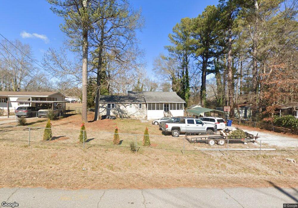
7451 Corn Crib Loop S Douglasville, GA 30134
Winston NeighborhoodEstimated Value: $130,000 - $178,147
3
Beds
2
Baths
1,404
Sq Ft
$116/Sq Ft
Est. Value
About This Home
This home is located at 7451 Corn Crib Loop S, Douglasville, GA 30134 and is currently estimated at $163,537, approximately $116 per square foot. 7451 Corn Crib Loop S is a home located in Douglas County with nearby schools including Winston Elementary School, Mason Creek Middle School, and Douglas County High School.
Ownership History
Date
Name
Owned For
Owner Type
Purchase Details
Closed on
Jul 17, 2015
Sold by
Fdic
Bought by
Hudgins Don
Current Estimated Value
Purchase Details
Closed on
Nov 6, 2012
Sold by
Douglas County Bank
Bought by
Douglas County Bank
Purchase Details
Closed on
Feb 17, 2012
Sold by
Barrett Amanda Katie
Bought by
Barrett Jody James
Purchase Details
Closed on
Nov 3, 2006
Sold by
Douglas Cnty Bk
Bought by
Barrett Jody J and Barrett Amanda K
Home Financials for this Owner
Home Financials are based on the most recent Mortgage that was taken out on this home.
Original Mortgage
$60,550
Interest Rate
6.27%
Purchase Details
Closed on
May 23, 2001
Sold by
Hudson Buford and Hudson Anita
Bought by
Jones Billy W
Home Financials for this Owner
Home Financials are based on the most recent Mortgage that was taken out on this home.
Original Mortgage
$32,000
Interest Rate
7.08%
Create a Home Valuation Report for This Property
The Home Valuation Report is an in-depth analysis detailing your home's value as well as a comparison with similar homes in the area
Home Values in the Area
Average Home Value in this Area
Purchase History
| Date | Buyer | Sale Price | Title Company |
|---|---|---|---|
| Hudgins Don | $25,000 | -- | |
| Douglas County Bank | $55,000 | -- | |
| Barrett Jody James | -- | -- | |
| Barrett Jody J | $60,600 | -- | |
| Jones Billy W | $35,000 | -- |
Source: Public Records
Mortgage History
| Date | Status | Borrower | Loan Amount |
|---|---|---|---|
| Previous Owner | Barrett Jody J | $60,550 | |
| Previous Owner | Jones Billy W | $32,000 |
Source: Public Records
Tax History
| Year | Tax Paid | Tax Assessment Tax Assessment Total Assessment is a certain percentage of the fair market value that is determined by local assessors to be the total taxable value of land and additions on the property. | Land | Improvement |
|---|---|---|---|---|
| 2025 | $870 | $27,680 | $8,640 | $19,040 |
| 2024 | $871 | $27,680 | $8,640 | $19,040 |
| 2023 | $871 | $27,680 | $8,640 | $19,040 |
| 2022 | $782 | $24,000 | $5,590 | $18,410 |
| 2021 | $783 | $24,000 | $5,590 | $18,410 |
| 2020 | $842 | $29,880 | $6,960 | $22,920 |
| 2019 | $495 | $16,000 | $4,000 | $12,000 |
| 2018 | $498 | $16,000 | $4,000 | $12,000 |
| 2017 | $689 | $25,560 | $6,960 | $18,600 |
| 2016 | $323 | $10,000 | $2,882 | $7,118 |
| 2015 | $869 | $26,360 | $7,600 | $18,760 |
| 2014 | $781 | $23,240 | $7,200 | $16,040 |
| 2013 | -- | $22,920 | $7,200 | $15,720 |
Source: Public Records
Map
Nearby Homes
- 1795 Hampton Pass
- 1660 Cedar Hill
- 1837 Independence Dr
- 2133 Mann Rd
- 1680 Harvest Hill
- 1670 Harvest Hill Unit 2
- 1751 Jefferson Ln Unit 3
- 0 Richardson Rd Unit 6979235
- 6022 Southbend Ct
- 2840 Ward Dr
- 2575 Hamrick Rd
- 6854 John West Rd
- 6054 Locklear Way
- 3096 Campground Rd
- 6074 Locklear Way
- 6995 Pine Shadow Way
- 1855 S Flat Rock Rd
- 2940 Rolling Ln
- 2960 Rolling Ln Unit 1
- 1267 Austing Bridge Rd
- 7450 Indian Trail
- 7460 Indian Trail
- 7430 Indian Trail
- 7481 Corn Crib Loop S
- 7476 Corn Crib Loop S
- 7480 Indian Trail
- 7416 Corn Crib Loop S
- 7490 Indian Trail
- 7376 Corn Crib Loop S
- 7506 Corn Crib Loop S
- 7444 Hiawatha Dr
- 7505 Indian Trail
- 2089 Delta Dr
- 7515 Indian Trail
- 7459 Hiawatha Dr
- 7371 Benson Ave
- 7489 Hiawatha Dr
- 2060 Delta Dr
- 7550 Indian Trail
- 7556 Corn Crib Loop S
Your Personal Tour Guide
Ask me questions while you tour the home.