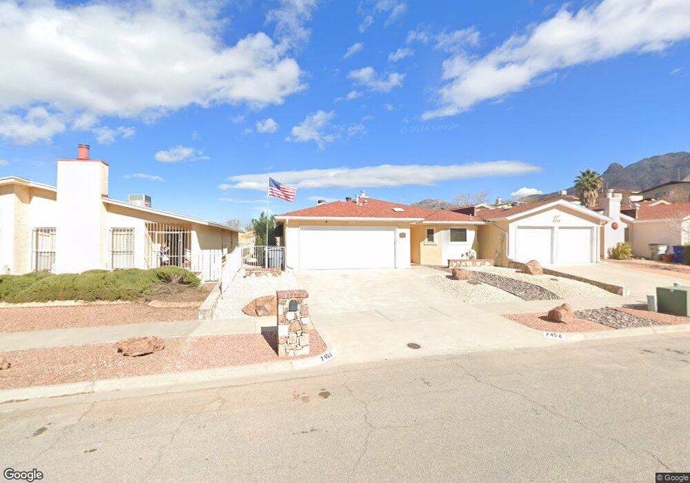
745a Espada Dr Unit A El Paso, TX 79912
Chaparral Park North NeighborhoodEstimated Value: $256,000 - $288,000
2
Beds
2
Baths
1,552
Sq Ft
$176/Sq Ft
Est. Value
About This Home
This home is located at 745a Espada Dr Unit A, El Paso, TX 79912 and is currently estimated at $273,333, approximately $176 per square foot. 745a Espada Dr Unit A is a home located in El Paso County with nearby schools including Rivera Elementary School, Coronado High School, and Howard Burnham Elementary School.
Ownership History
Date
Name
Owned For
Owner Type
Purchase Details
Closed on
Jun 18, 2012
Sold by
Bandy Rose E
Bought by
Brown David Wayne and Brown Jane Ann
Current Estimated Value
Purchase Details
Closed on
Sep 30, 2009
Sold by
Kurtyka Nancy S and Kurtyka Gerald J
Bought by
Bandy Rose E
Purchase Details
Closed on
Feb 24, 2000
Sold by
Zabriskie Mandeville H and Zabriskie Jean L
Bought by
Hayes Christopher F
Home Financials for this Owner
Home Financials are based on the most recent Mortgage that was taken out on this home.
Original Mortgage
$80,000
Interest Rate
8.19%
Create a Home Valuation Report for This Property
The Home Valuation Report is an in-depth analysis detailing your home's value as well as a comparison with similar homes in the area
Home Values in the Area
Average Home Value in this Area
Purchase History
| Date | Buyer | Sale Price | Title Company |
|---|---|---|---|
| Brown David Wayne | -- | None Available | |
| Bandy Rose E | -- | None Available | |
| Hayes Christopher F | -- | -- |
Source: Public Records
Mortgage History
| Date | Status | Borrower | Loan Amount |
|---|---|---|---|
| Previous Owner | Hayes Christopher F | $80,000 | |
| Closed | Hayes Christopher F | $15,000 |
Source: Public Records
Tax History
| Year | Tax Paid | Tax Assessment Tax Assessment Total Assessment is a certain percentage of the fair market value that is determined by local assessors to be the total taxable value of land and additions on the property. | Land | Improvement |
|---|---|---|---|---|
| 2025 | $2,348 | $202,725 | -- | -- |
| 2024 | $2,348 | $184,295 | -- | -- |
| 2023 | $2,282 | $167,541 | $0 | $0 |
| 2022 | $4,509 | $152,310 | $0 | $0 |
| 2021 | $4,323 | $166,562 | $32,790 | $133,772 |
| 2020 | $3,869 | $125,876 | $25,780 | $100,096 |
| 2018 | $3,726 | $125,876 | $25,780 | $100,096 |
| 2017 | $3,798 | $134,824 | $25,780 | $109,044 |
| 2016 | $3,798 | $134,824 | $25,780 | $109,044 |
| 2015 | $3,689 | $134,824 | $25,780 | $109,044 |
| 2014 | $3,689 | $134,824 | $25,780 | $109,044 |
Source: Public Records
Map
Nearby Homes
- 730 Espada Dr Unit C
- 6201 Escondido Dr Unit 17E
- 6201 Escondido Dr Unit 19H
- 508 Satellite Dr
- 6460 Snowheights Ct
- 6230 Escondido Dr Unit A
- 516 Satellite Dr
- 608 Spring Crest Dr
- 6350 Escondido Dr Unit D-31
- 500 Thunderbird Dr Unit 86
- 6006 Balcones Ct Unit 19
- 6253 Westwind Dr
- 350 Thunderbird Dr Unit 17
- 350 Thunderbird Dr Unit 50
- 350 Thunderbird Dr Unit 26
- 6413 Pino Real Dr
- 1077 Los Jardines Cir
- 301 Northwind Dr
- 6504 La Cadena Dr
- 6315 Escondido Dr Unit J
- 745 Espada Dr Unit C
- 745 Espada Dr Unit B
- 745 Espada Dr Unit D
- 745 Espada Dr
- 745 Espada Dr
- 739 Espada Dr
- 739 Espada Dr Unit C
- 739 Espada Dr Unit B
- 739 Espada Dr
- 739 Espada Dr Unit D
- 739 Espada Dr Unit A
- 6138 Los Robles Dr
- 6136 Los Robles Dr
- 739a Espada Dr Unit A
- 763 Espada Dr Unit C
- 763 Espada Dr Unit A
- 763 Espada Dr Unit B
- 763 Espada Dr Unit D
- 763 Espada Dr
Your Personal Tour Guide
Ask me questions while you tour the home.