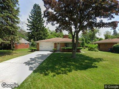
746 MacKow Dr Toledo, OH 43607
Scott Park NeighborhoodEstimated Value: $130,000 - $199,000
3
Beds
2
Baths
1,729
Sq Ft
$91/Sq Ft
Est. Value
About This Home
This home is located at 746 MacKow Dr, Toledo, OH 43607 and is currently estimated at $157,833, approximately $91 per square foot. 746 MacKow Dr is a home located in Lucas County with nearby schools including Keyser Elementary School, Rogers High School, and Victory Academy of Toledo.
Ownership History
Date
Name
Owned For
Owner Type
Purchase Details
Closed on
Apr 30, 2015
Sold by
Salmon Ernest Eugene
Bought by
King Michael D and King Debra J
Current Estimated Value
Home Financials for this Owner
Home Financials are based on the most recent Mortgage that was taken out on this home.
Original Mortgage
$72,166
Interest Rate
3.87%
Mortgage Type
FHA
Purchase Details
Closed on
Feb 9, 2000
Sold by
Salmon Ernest Eugene and Salmon Margaret Joyce
Bought by
Salmon Ernest Eugene and Salmon Margaret Joyce
Create a Home Valuation Report for This Property
The Home Valuation Report is an in-depth analysis detailing your home's value as well as a comparison with similar homes in the area
Home Values in the Area
Average Home Value in this Area
Purchase History
| Date | Buyer | Sale Price | Title Company |
|---|---|---|---|
| King Michael D | $73,500 | None Available | |
| Salmon Ernest Eugene | -- | -- |
Source: Public Records
Mortgage History
| Date | Status | Borrower | Loan Amount |
|---|---|---|---|
| Closed | King Michael D | $72,166 |
Source: Public Records
Tax History Compared to Growth
Tax History
| Year | Tax Paid | Tax Assessment Tax Assessment Total Assessment is a certain percentage of the fair market value that is determined by local assessors to be the total taxable value of land and additions on the property. | Land | Improvement |
|---|---|---|---|---|
| 2024 | $949 | $29,330 | $6,545 | $22,785 |
| 2023 | $1,815 | $26,880 | $3,885 | $22,995 |
| 2022 | $1,799 | $26,880 | $3,885 | $22,995 |
| 2021 | $1,861 | $26,880 | $3,885 | $22,995 |
| 2020 | $2,023 | $25,865 | $3,745 | $22,120 |
| 2019 | $1,956 | $25,865 | $3,745 | $22,120 |
| 2018 | $1,684 | $25,865 | $3,745 | $22,120 |
| 2017 | $1,987 | $25,305 | $3,675 | $21,630 |
| 2016 | $1,995 | $72,300 | $10,500 | $61,800 |
| 2015 | $1,406 | $72,300 | $10,500 | $61,800 |
| 2014 | $1,041 | $25,310 | $3,680 | $21,630 |
| 2013 | $1,041 | $25,310 | $3,680 | $21,630 |
Source: Public Records
Map
Nearby Homes
- 813 Searles Rd
- 3306 Nebraska Ave
- 1105 Elysian Ave
- 3753 Whitegate Dr
- 841 Southbriar Rd
- 837 Burke Glen Rd
- 3516 Ridgewood Rd
- 822 Independence Rd
- 3533 Edgevale Rd
- 3155 Kylemore Rd
- 243 Arco Dr
- 326 Independence Rd
- 806 Clifton Blvd
- 401 Dickens Dr
- 526 Clifton Blvd
- 1735 Perth St
- 1920 Kensington Rd
- 1720 Perth St
- 3405 Chestnut Hill Rd
- 41 Dickens Dr
- 746 MacKow Dr
- 736 MacKow Dr
- 810 MacKow Dr
- 805 Underwood Ave
- 807 Underwood Ave
- 801 Underwood Ave
- 732 MacKow Dr
- 816 MacKow Dr
- 811 Underwood Ave
- 745 MacKow Dr
- 739 MacKow Dr
- 819 Underwood Ave
- 729 Underwood Ave
- 820 MacKow Dr
- 3120 Victory Ave
- 809 MacKow Dr
- 825 Underwood Ave
- 725 Underwood Ave
- 731 MacKow Dr
- 815 MacKow Dr