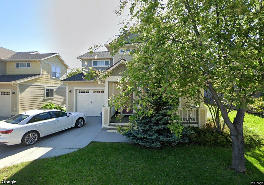
746 Matheson Way Bozeman, MT 59715
North Bozeman NeighborhoodEstimated Value: $620,000 - $740,000
3
Beds
3
Baths
1,867
Sq Ft
$372/Sq Ft
Est. Value
About This Home
This home is located at 746 Matheson Way, Bozeman, MT 59715 and is currently estimated at $694,039, approximately $371 per square foot. 746 Matheson Way is a home located in Gallatin County with nearby schools including Lincoln Titus Elementary School, Whittier School, and Van Cortlandtville School.
Ownership History
Date
Name
Owned For
Owner Type
Purchase Details
Closed on
Jun 7, 2016
Sold by
Alexander Helen I
Bought by
Alexander Helen I and Toussaint Shelley Alexander
Current Estimated Value
Purchase Details
Closed on
Dec 18, 2006
Sold by
Upton Homes Inc
Bought by
Alexander Marvin and Alexander Helen I
Purchase Details
Closed on
Dec 12, 2006
Sold by
Lee Paul N and Lee Sandra S
Bought by
Upton Homes Inc
Purchase Details
Closed on
Aug 30, 2005
Sold by
Durston Development Corp
Bought by
Lee Paul N and Lee Sandra S
Create a Home Valuation Report for This Property
The Home Valuation Report is an in-depth analysis detailing your home's value as well as a comparison with similar homes in the area
Home Values in the Area
Average Home Value in this Area
Purchase History
| Date | Buyer | Sale Price | Title Company |
|---|---|---|---|
| Alexander Helen I | -- | None Available | |
| Alexander Marvin | -- | American Land Title Company | |
| Upton Homes Inc | -- | American Land Title Company | |
| Lee Paul N | -- | American Land Title Company |
Source: Public Records
Tax History Compared to Growth
Tax History
| Year | Tax Paid | Tax Assessment Tax Assessment Total Assessment is a certain percentage of the fair market value that is determined by local assessors to be the total taxable value of land and additions on the property. | Land | Improvement |
|---|---|---|---|---|
| 2025 | $2,960 | $654,800 | $0 | $0 |
| 2024 | $4,517 | $678,500 | $0 | $0 |
| 2023 | $4,370 | $678,500 | $0 | $0 |
| 2022 | $3,272 | $426,700 | $0 | $0 |
| 2021 | $3,610 | $426,700 | $0 | $0 |
| 2020 | $3,007 | $351,800 | $0 | $0 |
| 2019 | $3,075 | $351,800 | $0 | $0 |
| 2018 | $3,006 | $318,700 | $0 | $0 |
| 2017 | $2,811 | $318,700 | $0 | $0 |
| 2016 | $2,601 | $275,600 | $0 | $0 |
| 2015 | $2,604 | $275,600 | $0 | $0 |
| 2014 | $2,355 | $146,651 | $0 | $0 |
Source: Public Records
Map
Nearby Homes
- 818 Matheson Way
- 854 Matheson Way
- 1406 Juniper St
- 1460 Juniper St
- 1033 N 14th Ave
- 1036 N 15th Ave
- 1283 Crabapple Dr
- 907 N 17th Ave
- 526 N 10th Ave
- 152 Laager Loop
- 304 N 16th Ave
- TBD N 19th Ave
- 403 N 18th Ave
- 163 Wagon Train Trail
- 402 & 404 N 19th Ave
- 1608 W Beall St Unit C
- 1610 W Beall St Unit C
- 318 & 320 N 19th
- 1233 N 8th Ave
- 928 Mountain Ash Ave
- 758 Matheson Way
- 722 Matheson Way
- 770 Matheson Way
- 714 Matheson Way
- 792 Matheson Way
- 710 Matheson Way
- 753 Matheson Way
- 749 Matheson Way
- 761 Matheson Way
- 785 Matheson Way
- 727 Matheson Way
- 1413 Mae St
- 702 Matheson Way
- 1429 Mae St
- 1437 Mae St
- 680 Matheson Way
- 832 Matheson Way
- 798 N 15th Ave
- 786 N 15th Ave
- 806 N 15th Ave