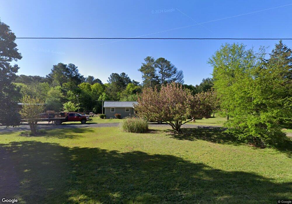
746 Perry Rd Bethlehem, GA 30620
Estimated Value: $205,000 - $319,000
3
Beds
1
Bath
1,544
Sq Ft
$169/Sq Ft
Est. Value
About This Home
This home is located at 746 Perry Rd, Bethlehem, GA 30620 and is currently estimated at $261,222, approximately $169 per square foot. 746 Perry Rd is a home located in Barrow County with nearby schools including Yargo Elementary School, Haymon-Morris Middle School, and Apalachee High School.
Ownership History
Date
Name
Owned For
Owner Type
Purchase Details
Closed on
Feb 23, 2001
Sold by
Morris Vallie M
Bought by
Barnette Sammy C
Current Estimated Value
Home Financials for this Owner
Home Financials are based on the most recent Mortgage that was taken out on this home.
Original Mortgage
$45,000
Interest Rate
6.91%
Mortgage Type
New Conventional
Purchase Details
Closed on
Oct 1, 1976
Bought by
Morris H C
Create a Home Valuation Report for This Property
The Home Valuation Report is an in-depth analysis detailing your home's value as well as a comparison with similar homes in the area
Home Values in the Area
Average Home Value in this Area
Purchase History
| Date | Buyer | Sale Price | Title Company |
|---|---|---|---|
| Barnette Sammy C | $65,000 | -- | |
| Morris H C | $1,000 | -- |
Source: Public Records
Mortgage History
| Date | Status | Borrower | Loan Amount |
|---|---|---|---|
| Closed | Barnette Sammy C | $45,000 |
Source: Public Records
Tax History
| Year | Tax Paid | Tax Assessment Tax Assessment Total Assessment is a certain percentage of the fair market value that is determined by local assessors to be the total taxable value of land and additions on the property. | Land | Improvement |
|---|---|---|---|---|
| 2025 | $1,411 | $57,506 | $20,000 | $37,506 |
| 2024 | $1,417 | $56,569 | $20,000 | $36,569 |
| 2023 | $1,409 | $56,569 | $20,000 | $36,569 |
| 2022 | $1,280 | $44,022 | $20,000 | $24,022 |
| 2021 | $1,061 | $34,440 | $12,600 | $21,840 |
| 2020 | $1,064 | $34,440 | $12,600 | $21,840 |
| 2019 | $1,083 | $34,440 | $12,600 | $21,840 |
| 2018 | $1,066 | $34,440 | $12,600 | $21,840 |
| 2017 | $925 | $31,783 | $12,600 | $19,183 |
| 2016 | $976 | $31,783 | $12,600 | $19,183 |
| 2015 | $981 | $31,783 | $12,600 | $19,183 |
| 2014 | $813 | $25,357 | $6,174 | $19,183 |
| 2013 | -- | $24,414 | $6,174 | $18,240 |
Source: Public Records
Map
Nearby Homes
- 1309 Tom Miller Rd
- 732 Ridgeland Rd
- 1256 Loganville Hwy
- 1129 Loganville Hwy
- 253 Meadows Dr
- 286 Meadows Dr
- 308 Meadows Dr
- 631 Saddle Ridge Dr
- 1202 Benton Ct
- 73 Silverleaf Trail
- 85 Silverleaf Trail
- 611 Mcdowell Ln
- 1111 Otis Dr
- 64 Silverleaf Trail
- 78 Silverleaf Trail
- 209 Angie Way
- 226 Silverleaf Trail
- 268 Silverleaf Trail
- 280 Silverleaf Trail
- 48 Silverleaf Trail
- 1300 Tom Miller Rd
- 736 Perry Rd
- 0 Perry Rd Unit 7602725
- 1007 Carrick Ct
- 728 Perry Rd
- 1005 Carrick Ct
- 1005 Carrick Ct Unit 1
- 1006 Carrick Ct
- 1257 Loganville Hwy
- 1003 Carrick Ct
- 1247 Loganville Hwy
- 1004 Carrick Ct
- 1231 Loganville Hwy
- 1002 Carrick Ct
- 1295 Tom Miller Rd
- 1271 Tom Miller Rd
- 1001 Carrick Ct
- 918 Lochwolde Ln
- 920 Lochwolde Ln
- 922 Lochwolde Ln
Your Personal Tour Guide
Ask me questions while you tour the home.