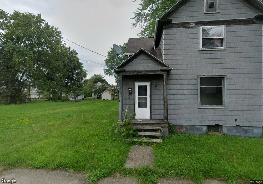
746 Wade Ave Alliance, OH 44601
Estimated Value: $85,000 - $161,000
Studio
1
Bath
--
Sq Ft
5,401
Sq Ft Lot
About This Home
This home is located at 746 Wade Ave, Alliance, OH 44601 and is currently estimated at $133,000. 746 Wade Ave is a home located in Stark County with nearby schools including Alliance Intermediate School at Northside, Alliance Elementary School at Rockhill, and Alliance Middle School.
Ownership History
Date
Name
Owned For
Owner Type
Purchase Details
Closed on
Mar 10, 2022
Sold by
Alliance Land Reutilization Program
Bought by
Brenson Curtis
Current Estimated Value
Purchase Details
Closed on
Feb 22, 2021
Sold by
Stark County Land Reutilization Corp
Bought by
City Of Alliance Land Reutilization Prog
Purchase Details
Closed on
Nov 30, 2016
Sold by
Hill Jerome and Hill Jerome
Bought by
Stark County Reutilization Corp
Create a Home Valuation Report for This Property
The Home Valuation Report is an in-depth analysis detailing your home's value as well as a comparison with similar homes in the area
Home Values in the Area
Average Home Value in this Area
Purchase History
| Date | Buyer | Sale Price | Title Company |
|---|---|---|---|
| Brenson Curtis | -- | None Listed On Document | |
| City Of Alliance Land Reutilization Prog | -- | None Available | |
| Stark County Reutilization Corp | -- | None Available |
Source: Public Records
Tax History
| Year | Tax Paid | Tax Assessment Tax Assessment Total Assessment is a certain percentage of the fair market value that is determined by local assessors to be the total taxable value of land and additions on the property. | Land | Improvement |
|---|---|---|---|---|
| 2025 | $118 | $1,680 | $1,680 | -- |
| 2024 | $44 | $1,680 | $1,680 | -- |
| 2023 | $117 | $1,720 | $1,720 | -- |
| 2022 | $71 | $1,720 | $1,720 | $0 |
| 2021 | $162 | $1,470 | $1,470 | $0 |
| 2020 | $200 | $1,510 | $1,510 | $0 |
| 2019 | $200 | $1,510 | $1,510 | $0 |
Source: Public Records
Map
Nearby Homes
- 955 E Summit St
- 935 S Morgan Ave
- 442 S Liberty Ave
- 22862 Norman Ave
- 452 E Summit St
- V/L S Freedom Ave
- 726 S Arch Ave
- 234 Rosenberry St
- 226 Milner St
- 834 Devine St
- 1608 S Liberty Ave
- 167 11th St
- 134 11th St
- 361 E Main St
- 46 Rosenberry St
- 224 Shadyside Ct
- 62 E High St
- 233 Shadyside Ct
- 1226 Noble St
- 314 Oak Ave