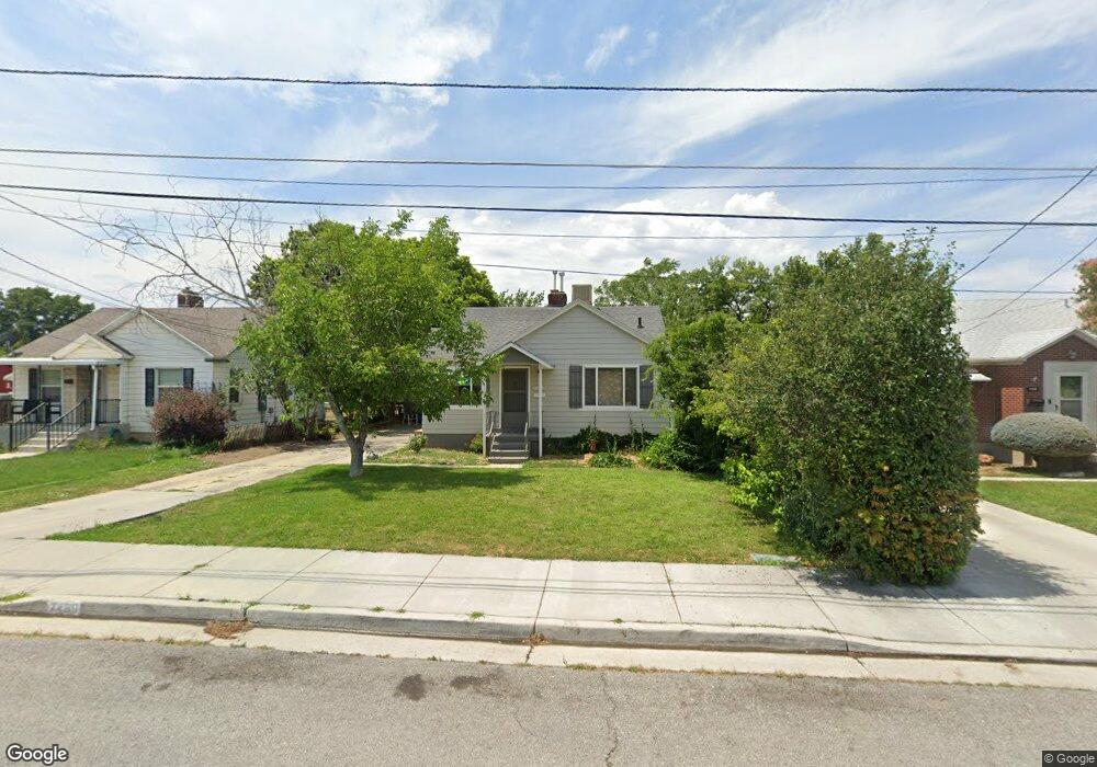
7460 Maple St Midvale, UT 84047
Estimated Value: $408,464 - $484,000
2
Beds
2
Baths
769
Sq Ft
$588/Sq Ft
Est. Value
About This Home
This home is located at 7460 Maple St, Midvale, UT 84047 and is currently estimated at $452,366, approximately $588 per square foot. 7460 Maple St is a home located in Salt Lake County with nearby schools including East Midvale Elementary School, Midvale Middle School, and Hillcrest High School.
Ownership History
Date
Name
Owned For
Owner Type
Purchase Details
Closed on
Dec 13, 2022
Sold by
Evans Mary Ellen Howell
Bought by
Banana Stand Trust
Current Estimated Value
Purchase Details
Closed on
Sep 28, 2001
Sold by
Taylor Mark David and Howell Mary E
Bought by
Howell Mary E
Purchase Details
Closed on
Aug 5, 1999
Sold by
Askew J Scott
Bought by
Taylor Mark David and Howell Mary E
Home Financials for this Owner
Home Financials are based on the most recent Mortgage that was taken out on this home.
Original Mortgage
$121,278
Interest Rate
7.64%
Mortgage Type
VA
Purchase Details
Closed on
Jul 29, 1994
Sold by
Wolsey Athalie
Bought by
Askew J Scott
Home Financials for this Owner
Home Financials are based on the most recent Mortgage that was taken out on this home.
Original Mortgage
$48,000
Interest Rate
8.38%
Create a Home Valuation Report for This Property
The Home Valuation Report is an in-depth analysis detailing your home's value as well as a comparison with similar homes in the area
Home Values in the Area
Average Home Value in this Area
Purchase History
| Date | Buyer | Sale Price | Title Company |
|---|---|---|---|
| Banana Stand Trust | -- | -- | |
| Howell Mary E | -- | Backman Stewart Title Servic | |
| Taylor Mark David | -- | Backman Stewart Title Servic | |
| Askew J Scott | -- | -- | |
| Wolsey Athalie | -- | -- |
Source: Public Records
Mortgage History
| Date | Status | Borrower | Loan Amount |
|---|---|---|---|
| Previous Owner | Taylor Mark David | $121,278 | |
| Previous Owner | Askew J Scott | $48,000 |
Source: Public Records
Tax History
| Year | Tax Paid | Tax Assessment Tax Assessment Total Assessment is a certain percentage of the fair market value that is determined by local assessors to be the total taxable value of land and additions on the property. | Land | Improvement |
|---|---|---|---|---|
| 2025 | $2,182 | $395,300 | $138,200 | $257,100 |
| 2024 | $2,182 | $358,200 | $131,200 | $227,000 |
| 2023 | $2,089 | $339,800 | $124,700 | $215,100 |
| 2022 | $2,183 | $346,900 | $122,300 | $224,600 |
| 2021 | $1,941 | $263,800 | $112,100 | $151,700 |
| 2020 | $1,838 | $236,400 | $81,500 | $154,900 |
| 2019 | $1,539 | $192,800 | $72,800 | $120,000 |
| 2016 | $1,413 | $166,900 | $72,800 | $94,100 |
Source: Public Records
Map
Nearby Homes
- 150 W 7500 S Unit 55
- 150 W 7500 S Unit 29
- 150 W 7500 S Unit 53
- 7571 S Blisswood Dr #20 Dr Unit 20
- 30 W 7500 S Unit 18
- 108 W Ryker Ln Unit 16
- 7373 S Wood Lily Ct Unit 24
- 222 W Center St
- 7369 S Wood Lily Ct Unit 23
- 7365 S Wood Lily Ct Unit 22
- 7361 S Wood Lily Ct Unit 21
- 7357 S Wood Lily Ct Unit 20
- 7353 S Wood Lily Ct Unit 19
- 72 E 7320 S
- 7344 S Seven Tree Ln Unit 78
- 7331 S Seven Tree Ln Unit 84
- 7333 S Seven Tree Ln Unit 83
- 7338 S Seven Tree Ln Unit 75
- 7334 S Seven Tree Ln Unit 74
- 7375 S Dewmar Ct Unit 36
Your Personal Tour Guide
Ask me questions while you tour the home.