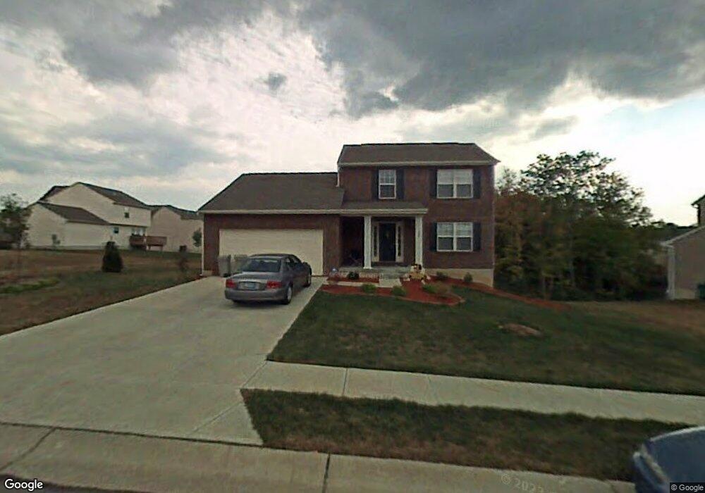
747 Berlander Dr Unit L-375 Independence, KY 41051
Estimated Value: $285,000 - $323,000
3
Beds
3
Baths
1,632
Sq Ft
$185/Sq Ft
Est. Value
About This Home
This home is located at 747 Berlander Dr Unit L-375, Independence, KY 41051 and is currently estimated at $302,408, approximately $185 per square foot. 747 Berlander Dr Unit L-375 is a home located in Kenton County with nearby schools including Beechgrove Elementary School, Twenhofel Middle School, and Simon Kenton High School.
Ownership History
Date
Name
Owned For
Owner Type
Purchase Details
Closed on
Jun 6, 2006
Sold by
Parkland Homes Inc
Bought by
Bystry Joshua D and Bystry Kristi Sandel
Current Estimated Value
Home Financials for this Owner
Home Financials are based on the most recent Mortgage that was taken out on this home.
Original Mortgage
$163,000
Outstanding Balance
$95,455
Interest Rate
6.5%
Mortgage Type
Fannie Mae Freddie Mac
Estimated Equity
$206,953
Purchase Details
Closed on
Oct 31, 2005
Sold by
Glenhurst Development Llc
Bought by
Parkland Homes Inc
Home Financials for this Owner
Home Financials are based on the most recent Mortgage that was taken out on this home.
Original Mortgage
$115,600
Interest Rate
5.71%
Mortgage Type
Construction
Create a Home Valuation Report for This Property
The Home Valuation Report is an in-depth analysis detailing your home's value as well as a comparison with similar homes in the area
Home Values in the Area
Average Home Value in this Area
Purchase History
| Date | Buyer | Sale Price | Title Company |
|---|---|---|---|
| Bystry Joshua D | $163,000 | Kentucky Land Title Agency | |
| Parkland Homes Inc | $174,000 | Kentucky Land Title Agency |
Source: Public Records
Mortgage History
| Date | Status | Borrower | Loan Amount |
|---|---|---|---|
| Open | Bystry Joshua D | $163,000 | |
| Previous Owner | Parkland Homes Inc | $115,600 |
Source: Public Records
Tax History Compared to Growth
Tax History
| Year | Tax Paid | Tax Assessment Tax Assessment Total Assessment is a certain percentage of the fair market value that is determined by local assessors to be the total taxable value of land and additions on the property. | Land | Improvement |
|---|---|---|---|---|
| 2024 | $2,418 | $197,400 | $30,000 | $167,400 |
| 2023 | $2,491 | $197,400 | $30,000 | $167,400 |
| 2022 | $2,551 | $197,400 | $30,000 | $167,400 |
| 2021 | $2,589 | $197,400 | $30,000 | $167,400 |
| 2020 | $2,196 | $163,000 | $25,000 | $138,000 |
| 2019 | $2,202 | $163,000 | $25,000 | $138,000 |
| 2018 | $2,213 | $163,000 | $25,000 | $138,000 |
| 2017 | $2,153 | $163,000 | $25,000 | $138,000 |
| 2015 | $2,090 | $163,000 | $34,800 | $128,200 |
| 2014 | $2,061 | $163,000 | $34,800 | $128,200 |
Source: Public Records
Map
Nearby Homes
- 10720 Hanover Ct
- 660 Ackerly Dr
- 604 Astoria Ct
- 611 Berlander Dr
- 10694 Melbury Ct Unit 306GL
- 10690 Melbury Ct Unit 305GL
- 10724 Melbury Ct Unit 287GL
- 603 Branch Ct
- 586 Cutter Ln
- The Westchester Plan at The Greens of Glenhurst
- The Ella Marie Plan at The Greens of Glenhurst
- The Jefferson Plan at The Greens of Glenhurst
- The Leighann Plan at The Greens of Glenhurst
- The Waterson Plan at The Greens of Glenhurst
- The Lancaster Plan at The Greens of Glenhurst
- The Austin Plan at The Greens of Glenhurst
- The Morgan Plan at The Greens of Glenhurst
- The Marietta Plan at The Greens of Glenhurst
- The Camden Plan at The Greens of Glenhurst
- The Lincoln Plan at The Greens of Glenhurst
- 747 Berlander Dr
- 743 Berlander Dr
- 743 Berlander Dr Unit 374
- 10700 Fremont Dr
- 10704 Fremont Dr
- 110 Berlander Dr
- 112 Berlander Dr
- 113 Berlander Dr
- 104 Berlander Dr
- 105 Berlander Dr
- 100 Berlander Dr
- 103 Berlander Dr
- 108 Berlander Dr
- 98 Berlander Dr
- 102 Berlander Dr
- 10708 Fremont Dr
- 748 Berlander Dr
- 748 Berlander Dr Unit 401
- 766 Ackerly Dr
- 766 Ackerly Dr Unit 372