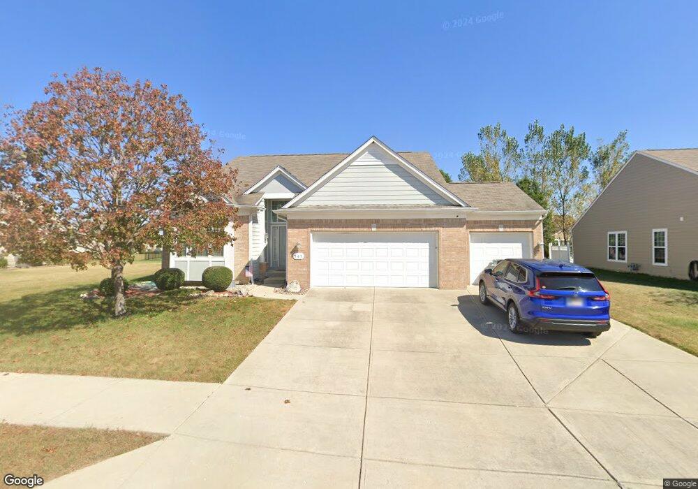
747 King Fisher Dr Brownsburg, IN 46112
Estimated Value: $395,000 - $433,000
3
Beds
3
Baths
1,900
Sq Ft
$220/Sq Ft
Est. Value
About This Home
This home is located at 747 King Fisher Dr, Brownsburg, IN 46112 and is currently estimated at $417,856, approximately $219 per square foot. 747 King Fisher Dr is a home located in Hendricks County with nearby schools including Eagle Elementary School, Brownsburg West Middle School, and Brownsburg High School.
Ownership History
Date
Name
Owned For
Owner Type
Purchase Details
Closed on
Feb 22, 2010
Sold by
Pulte Homes Of Indiana Llc
Bought by
George Eric and George Mandy
Current Estimated Value
Home Financials for this Owner
Home Financials are based on the most recent Mortgage that was taken out on this home.
Original Mortgage
$206,947
Outstanding Balance
$135,863
Interest Rate
4.87%
Mortgage Type
FHA
Estimated Equity
$281,993
Create a Home Valuation Report for This Property
The Home Valuation Report is an in-depth analysis detailing your home's value as well as a comparison with similar homes in the area
Home Values in the Area
Average Home Value in this Area
Purchase History
| Date | Buyer | Sale Price | Title Company |
|---|---|---|---|
| George Eric | -- | None Available |
Source: Public Records
Mortgage History
| Date | Status | Borrower | Loan Amount |
|---|---|---|---|
| Open | George Eric | $206,947 |
Source: Public Records
Tax History Compared to Growth
Tax History
| Year | Tax Paid | Tax Assessment Tax Assessment Total Assessment is a certain percentage of the fair market value that is determined by local assessors to be the total taxable value of land and additions on the property. | Land | Improvement |
|---|---|---|---|---|
| 2024 | $3,783 | $378,300 | $63,200 | $315,100 |
| 2023 | $3,636 | $363,600 | $60,200 | $303,400 |
| 2022 | $3,225 | $322,500 | $58,300 | $264,200 |
| 2021 | $2,801 | $280,100 | $58,300 | $221,800 |
| 2020 | $2,738 | $273,800 | $58,300 | $215,500 |
| 2019 | $2,600 | $260,000 | $56,300 | $203,700 |
| 2018 | $2,490 | $249,000 | $56,300 | $192,700 |
| 2017 | $2,359 | $235,900 | $53,600 | $182,300 |
| 2016 | $2,293 | $229,300 | $53,600 | $175,700 |
| 2014 | $2,226 | $222,600 | $52,000 | $170,600 |
Source: Public Records
Map
Nearby Homes
- Glacier II Plan at Auburn Ridge - Legacy Series
- Ainsley II Plan at Auburn Ridge - Prestige Series
- Berkeley Basement Plan at Auburn Ridge - Prestige Series
- Kentmore Basement Plan at Auburn Ridge - Prestige Series
- Ainsley II Basement Plan at Auburn Ridge - Prestige Series
- Glendale Basement Plan at Auburn Ridge - Prestige Series
- Columbia Basement Plan at Auburn Ridge - Prestige Series
- Andes II Plan at Auburn Ridge - Legacy Series
- Cheswicke II Plan at Auburn Ridge - Prestige Series
- Drake Plan at Auburn Ridge - Prestige Series
- Olympic II Plan at Auburn Ridge - Legacy Series
- Cascade II Plan at Auburn Ridge - Legacy Series
- Drake Basement Plan at Auburn Ridge - Prestige Series
- Glendale Plan at Auburn Ridge - Prestige Series
- Kensington Plan at Auburn Ridge - Prestige Series
- Cheswicke II Basement Plan at Auburn Ridge - Prestige Series
- Kensington Basement Plan at Auburn Ridge - Prestige Series
- Kentmore Plan at Auburn Ridge - Prestige Series
- 4986 Carmine Ct
- 5037 Carmine St
- 753 King Fisher Dr
- 741 King Fisher Dr
- 738 Fish Hawk Ct
- 750 Fish Hawk Ct
- 744 Fish Hawk Ct
- 746 King Fisher Dr
- 735 King Fisher Dr
- 740 King Fisher Dr
- 732 Fish Hawk Ct
- 1790 Harris Hawk Ct
- 752 King Fisher Dr
- 1780 Harris Hawk Ct
- 1770 Harris Hawk Ct
- 751 Fish Hawk Ct
- 758 King Fisher Dr
- 729 King Fisher Dr
- 745 Fish Hawk Ct
- 1791 Harris Hawk Ct
- 1781 Harris Hawk Ct
- 739 Fish Hawk Ct