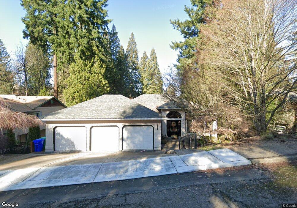
747 SE 27th St Unit 27 Gresham, OR 97080
Gresham Butte NeighborhoodEstimated Value: $690,000 - $1,289,000
3
Beds
4
Baths
4,040
Sq Ft
$210/Sq Ft
Est. Value
About This Home
This home is located at 747 SE 27th St Unit 27, Gresham, OR 97080 and is currently estimated at $849,869, approximately $210 per square foot. 747 SE 27th St Unit 27 is a home located in Multnomah County with nearby schools including East Gresham Elementary School, Dexter McCarty Middle School, and Gresham High School.
Ownership History
Date
Name
Owned For
Owner Type
Purchase Details
Closed on
Sep 3, 2013
Sold by
Powers John T
Bought by
Powers John T and Powers Carol M
Current Estimated Value
Purchase Details
Closed on
Apr 4, 2006
Sold by
Blondheim Earl M
Bought by
Powers John T and Powers Carol
Home Financials for this Owner
Home Financials are based on the most recent Mortgage that was taken out on this home.
Original Mortgage
$300,000
Outstanding Balance
$167,453
Interest Rate
6.25%
Mortgage Type
Fannie Mae Freddie Mac
Estimated Equity
$682,416
Create a Home Valuation Report for This Property
The Home Valuation Report is an in-depth analysis detailing your home's value as well as a comparison with similar homes in the area
Home Values in the Area
Average Home Value in this Area
Purchase History
| Date | Buyer | Sale Price | Title Company |
|---|---|---|---|
| Powers John T | -- | None Available | |
| Powers John T | $499,500 | First American Title Insuran |
Source: Public Records
Mortgage History
| Date | Status | Borrower | Loan Amount |
|---|---|---|---|
| Open | Powers John T | $300,000 |
Source: Public Records
Map
Nearby Homes
- 2440 SE Regner Rd
- 2581 SE Morlan Way
- 242 SE 29th St
- 2909 SE Liberty Place
- 2024 SE Spruce Ave
- 1696 SE 26th Dr
- 1918 SE Regner Rd
- 2678 SE Myrtlewood Way
- 2925 SE Cleveland Dr
- 3544 SE Deer Creek Way
- 640 SE 40th Terrace
- 511 SE 15th St
- 1414 SE Beech Place
- 0 SW Miller Ct Unit 470855683
- 350 SW 37th Terrace
- 55 SW Lovhar Dr
- 2125 SE 18th Aly
- 50 SE Avondale Ct
- 4640 SE Honors Dr
- 2137 SE 15th Aly
- 747 SE 27th St
- 717 SE 27th St
- 797 SE 27th St
- 827 SE 27th St
- 711 SE 27th St
- 740 SE 25th St
- 760 SE 25th St
- 786 SE 27th St
- 857 SE 27th St
- 836 SE 27th St
- 722 SE 27th St
- 860 SE 27th St
- 712 SE 27th St
- 730 SE 25th St
- 774 SE 25th St
- 887 SE 27th St
- 2592 SE Elliott Dr
- 2536 SE Elliott Dr
- 2502 SE Elliott Dr
- 884 SE 27th St
Your Personal Tour Guide
Ask me questions while you tour the home.