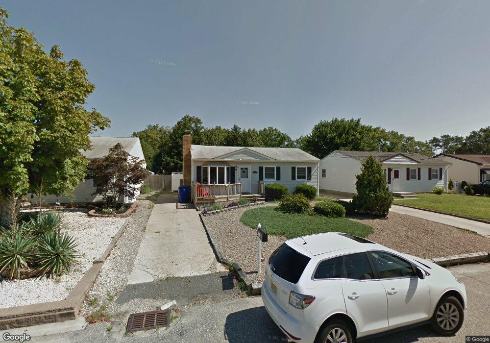
747 Tunney Point Dr Toms River, NJ 08753
Estimated Value: $432,000 - $499,000
3
Beds
1
Bath
1,066
Sq Ft
$428/Sq Ft
Est. Value
About This Home
This home is located at 747 Tunney Point Dr, Toms River, NJ 08753 and is currently estimated at $456,416, approximately $428 per square foot. 747 Tunney Point Dr is a home located in Ocean County.
Ownership History
Date
Name
Owned For
Owner Type
Purchase Details
Closed on
Nov 21, 2017
Sold by
Dishon William
Bought by
Dishon Charles
Current Estimated Value
Purchase Details
Closed on
Jun 1, 2010
Sold by
Alvarez Cynthia Robin and Alvarez Francisco
Bought by
Dishon William
Home Financials for this Owner
Home Financials are based on the most recent Mortgage that was taken out on this home.
Original Mortgage
$216,015
Interest Rate
5.11%
Mortgage Type
FHA
Purchase Details
Closed on
Dec 15, 2006
Sold by
Lagomarsino Cynthia Robin and Losey Jean
Bought by
Lagomarsino Cynthia Robin
Create a Home Valuation Report for This Property
The Home Valuation Report is an in-depth analysis detailing your home's value as well as a comparison with similar homes in the area
Home Values in the Area
Average Home Value in this Area
Purchase History
| Date | Buyer | Sale Price | Title Company |
|---|---|---|---|
| Dishon Charles | $220,000 | -- | |
| Dishon William | $220,000 | Stewart Title Guaranty Co | |
| Lagomarsino Cynthia Robin | -- | None Available |
Source: Public Records
Mortgage History
| Date | Status | Borrower | Loan Amount |
|---|---|---|---|
| Previous Owner | Dishon William | $216,015 |
Source: Public Records
Tax History Compared to Growth
Tax History
| Year | Tax Paid | Tax Assessment Tax Assessment Total Assessment is a certain percentage of the fair market value that is determined by local assessors to be the total taxable value of land and additions on the property. | Land | Improvement |
|---|---|---|---|---|
| 2025 | $5,485 | $301,200 | $127,000 | $174,200 |
| 2024 | $4,964 | $301,200 | $127,000 | $174,200 |
| 2023 | $5,027 | $301,200 | $127,000 | $174,200 |
| 2022 | $5,027 | $301,200 | $127,000 | $174,200 |
| 2021 | $4,246 | $169,500 | $87,800 | $81,700 |
| 2020 | $4,227 | $169,500 | $87,800 | $81,700 |
| 2019 | $4,044 | $169,500 | $87,800 | $81,700 |
| 2018 | $3,990 | $169,500 | $87,800 | $81,700 |
| 2017 | $3,956 | $169,500 | $87,800 | $81,700 |
| 2016 | $3,853 | $169,500 | $87,800 | $81,700 |
| 2015 | $3,707 | $169,500 | $87,800 | $81,700 |
| 2014 | $3,529 | $169,500 | $87,800 | $81,700 |
Source: Public Records
Map
Nearby Homes
- 1309 Bay Ave
- 2570 Balfrey Dr
- 4 Jamaica Ave
- 786 Garfield Ave
- 657 Ellicott Ave Unit 101
- 6 Cayman Ave
- 663 Beachwood Ave
- 103 Mermaid Rd
- 1417 Delaware Ave
- 3158 Windsor Ave
- 213 Hamilton Dr
- 3138 Windsor Ave
- 3129 Windsor Ave
- 625 N End Ave
- 590 Garfield Ave
- 975 Hunt Dr
- 804 Neville St
- 19 Maryann Place
- 3 Cove Point Rd
- 5 Cove Point Rd
- 745 Tunney Point Dr
- 749 Tunney Point Dr
- 743 Tunney Point Dr
- 1303 Linda Dr
- 753 Tunney Point Dr
- 1305 Linda Dr
- 1301 Linda Dr
- 746 Tunney Point Dr
- 744 Tunney Point Dr
- 741 Tunney Point Dr
- 750 Tunney Point Dr
- 1307 Linda Dr
- 1299 Linda Dr
- 740 Tunney Point Dr
- 755 Tunney Point Dr
- 752 Tunney Point Dr
- 739 Tunney Point Dr
- 736 Tunney Point Dr
- 1309 Linda Dr
- 757 Tunney Point Dr