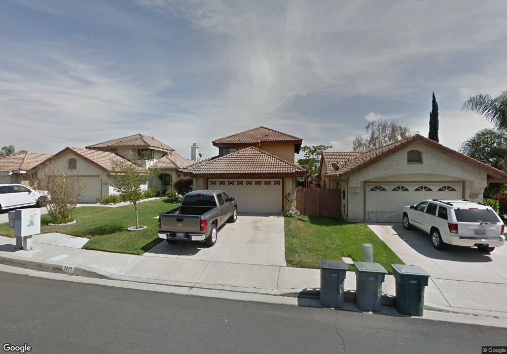
7471 Brookside Rd Rancho Cucamonga, CA 91730
Terra Vista NeighborhoodEstimated Value: $654,695 - $752,000
3
Beds
2
Baths
1,420
Sq Ft
$502/Sq Ft
Est. Value
About This Home
This home is located at 7471 Brookside Rd, Rancho Cucamonga, CA 91730 and is currently estimated at $713,174, approximately $502 per square foot. 7471 Brookside Rd is a home located in San Bernardino County with nearby schools including Ruth Musser Middle, Coyote Canyon Elementary, and Rancho Cucamonga High School.
Ownership History
Date
Name
Owned For
Owner Type
Purchase Details
Closed on
Dec 14, 2011
Sold by
Ellis Jack W
Bought by
The Ellis Family Living Trust
Current Estimated Value
Purchase Details
Closed on
May 14, 2003
Sold by
Cox Beverly
Bought by
Ellis Jack W and Ellis Cynthia M
Home Financials for this Owner
Home Financials are based on the most recent Mortgage that was taken out on this home.
Original Mortgage
$130,000
Outstanding Balance
$56,336
Interest Rate
5.75%
Mortgage Type
Purchase Money Mortgage
Estimated Equity
$656,838
Purchase Details
Closed on
Jan 28, 1997
Sold by
Schultz Daniel J
Bought by
Cox Beverly
Home Financials for this Owner
Home Financials are based on the most recent Mortgage that was taken out on this home.
Original Mortgage
$130,164
Interest Rate
7.81%
Mortgage Type
FHA
Create a Home Valuation Report for This Property
The Home Valuation Report is an in-depth analysis detailing your home's value as well as a comparison with similar homes in the area
Home Values in the Area
Average Home Value in this Area
Purchase History
| Date | Buyer | Sale Price | Title Company |
|---|---|---|---|
| The Ellis Family Living Trust | -- | None Available | |
| Ellis Jack W | $249,000 | First American | |
| Cox Beverly | $131,500 | Old Republic Title Company |
Source: Public Records
Mortgage History
| Date | Status | Borrower | Loan Amount |
|---|---|---|---|
| Open | Ellis Jack W | $130,000 | |
| Previous Owner | Cox Beverly | $130,164 |
Source: Public Records
Tax History
| Year | Tax Paid | Tax Assessment Tax Assessment Total Assessment is a certain percentage of the fair market value that is determined by local assessors to be the total taxable value of land and additions on the property. | Land | Improvement |
|---|---|---|---|---|
| 2025 | $4,681 | $360,637 | $90,158 | $270,479 |
| 2024 | $4,550 | $353,565 | $88,390 | $265,175 |
| 2023 | $4,433 | $346,632 | $86,657 | $259,975 |
| 2022 | $4,342 | $339,835 | $84,958 | $254,877 |
| 2021 | $4,342 | $333,171 | $83,292 | $249,879 |
| 2020 | $4,234 | $329,755 | $82,438 | $247,317 |
| 2019 | $4,217 | $323,290 | $80,822 | $242,468 |
| 2018 | $4,114 | $316,951 | $79,237 | $237,714 |
| 2017 | $4,051 | $310,736 | $77,683 | $233,053 |
| 2016 | $4,030 | $304,643 | $76,160 | $228,483 |
| 2015 | $3,984 | $300,067 | $75,016 | $225,051 |
| 2014 | $3,979 | $294,190 | $73,547 | $220,643 |
Source: Public Records
Map
Nearby Homes
- 7407 Ambrosia Rd
- 7613 Haven Ave Unit B
- 10751 Spyglass Dr
- 10634 Countryside Dr
- 7323 Ambrosia Rd
- 10438 Palo Alto St
- 10430 Palo Alto St
- 10453 Ironwood St
- 7297 Meadowlark Place
- 10554 Cannon Dr
- 10532 Wilding Dr
- 7774 Haywood Place
- 7803 Paxton Place
- 10591 Huxley Dr
- 10375 Church St
- 10375 Church St Unit 124
- 10350 Base Line Rd Unit 128
- 7552 Paramount Ct
- 10350 Baseline Rd Unit 55
- 7034 Mendocino Place
- 7465 Brookside Rd
- 7477 Brookside Rd
- 7459 Brookside Rd
- 7483 Brookside Rd
- 10621 Sunburst Dr
- 7489 Brookside Rd
- 7476 Brookside Rd
- 7493 Brookside Rd
- 10617 Sunburst Dr
- 7453 Brookside Rd
- 7482 Brookside Rd
- 7449 Brookside Rd
- 10636 Sunburst Dr
- 10593 Sunburst Dr
- 7492 Plymouth Way
- 7500 Plymouth Way
- 7488 Brookside Rd
- 7499 Brookside Rd
- 7484 Plymouth Way
- 10632 Sunburst Dr
Your Personal Tour Guide
Ask me questions while you tour the home.