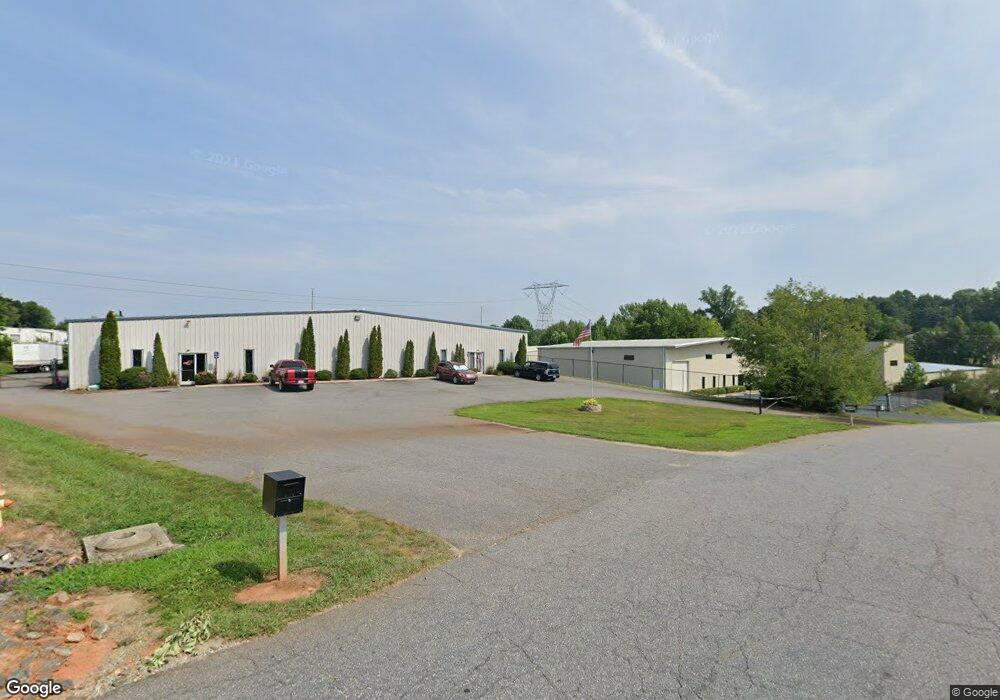
748 Crosspoint Dr Unit A & B Denver, NC 28037
Estimated Value: $1,005,303
--
Bed
--
Bath
6,080
Sq Ft
$165/Sq Ft
Est. Value
About This Home
This home is located at 748 Crosspoint Dr Unit A & B, Denver, NC 28037 and is currently estimated at $1,005,303, approximately $165 per square foot. 748 Crosspoint Dr Unit A & B is a home located in Lincoln County with nearby schools including Catawba Springs Elementary School, East Lincoln Middle School, and East Lincoln High School.
Ownership History
Date
Name
Owned For
Owner Type
Purchase Details
Closed on
Mar 10, 2005
Sold by
Pedrick Brain B and Pedrick Katherine A
Bought by
Chalmers Investments Llc
Current Estimated Value
Home Financials for this Owner
Home Financials are based on the most recent Mortgage that was taken out on this home.
Original Mortgage
$210,000
Outstanding Balance
$106,394
Interest Rate
5.6%
Mortgage Type
Commercial
Estimated Equity
$898,909
Purchase Details
Closed on
Oct 9, 2001
Bought by
Pedrick Brian B and Pedrick Katherine A
Purchase Details
Closed on
Apr 18, 2001
Bought by
Mcbride Alton L and Mcbri Alton L
Purchase Details
Closed on
Jan 21, 1998
Bought by
Ebco Properties Inc
Create a Home Valuation Report for This Property
The Home Valuation Report is an in-depth analysis detailing your home's value as well as a comparison with similar homes in the area
Home Values in the Area
Average Home Value in this Area
Purchase History
| Date | Buyer | Sale Price | Title Company |
|---|---|---|---|
| Chalmers Investments Llc | $325,000 | None Available | |
| Pedrick Brian B | $54,000 | -- | |
| Mcbride Alton L | $52,500 | -- | |
| Ebco Properties Inc | $35,000 | -- |
Source: Public Records
Mortgage History
| Date | Status | Borrower | Loan Amount |
|---|---|---|---|
| Open | Chalmers Investments Llc | $210,000 |
Source: Public Records
Tax History Compared to Growth
Tax History
| Year | Tax Paid | Tax Assessment Tax Assessment Total Assessment is a certain percentage of the fair market value that is determined by local assessors to be the total taxable value of land and additions on the property. | Land | Improvement |
|---|---|---|---|---|
| 2025 | $5,035 | $787,323 | $80,888 | $706,435 |
| 2024 | $4,975 | $787,323 | $80,888 | $706,435 |
| 2023 | $4,965 | $787,323 | $80,888 | $706,435 |
| 2022 | $4,233 | $541,675 | $101,186 | $440,489 |
| 2021 | $4,260 | $541,675 | $101,186 | $440,489 |
| 2020 | $3,775 | $541,675 | $101,186 | $440,489 |
| 2019 | $3,775 | $541,675 | $101,186 | $440,489 |
| 2018 | $3,837 | $519,340 | $96,186 | $423,154 |
| 2017 | $3,635 | $519,340 | $96,186 | $423,154 |
| 2016 | $3,620 | $519,340 | $96,186 | $423,154 |
| 2015 | $3,880 | $519,340 | $96,186 | $423,154 |
| 2014 | $4,368 | $612,675 | $126,482 | $486,193 |
Source: Public Records
Map
Nearby Homes
- 6242 Ashton Park Dr
- 6273 Ashton Park Dr
- 7536 Forest Oak Dr
- 532 N Pilot Knob Rd
- 4178 Millstream Rd
- 4168 Millstream Rd
- St. Andrews Plan at Wildbrook
- Pinehurst Plan at Wildbrook
- Muirfield Plan at Wildbrook
- Augusta Plan at Wildbrook
- Bethpage Plan at Wildbrook
- 1358 Cedardale Ln
- 000 Millstream Rd Unit 149
- 1378 Cedardale Ln
- 1374 Cedardale Ln Unit 33
- 1364 Cedardale Ln
- 0 Rufus Rd
- 8150 Malibu Pointe Ln
- 274/294 N Pilot Knob Rd
- 1219 Foxlaire Dr
- 911 Dove Ct
- 7576 Townsend Dr Unit 19
- Lot#32 Townsend Dr
- Lot 32 Townsend Dr
- 4998 Twin River Dr
- 5018 Twin River Dr
- 914 Dove Ct
- 5026 Twin River Dr
- 5030 Twin River Dr
- 5034 Twin River Dr
- 5002 Twin River Dr
- 5006 Twin River Dr
- 5038 Twin River Dr
- 5029 Twin River Dr
- 5042 Twin River Dr
- 5033 Twin River Dr
- 5046 Twin River Dr
- 0000 Deer Track Dr Unit 15B
- 0000 Deer Track Dr Unit 15A
- 0000 Deer Track Dr Unit 14