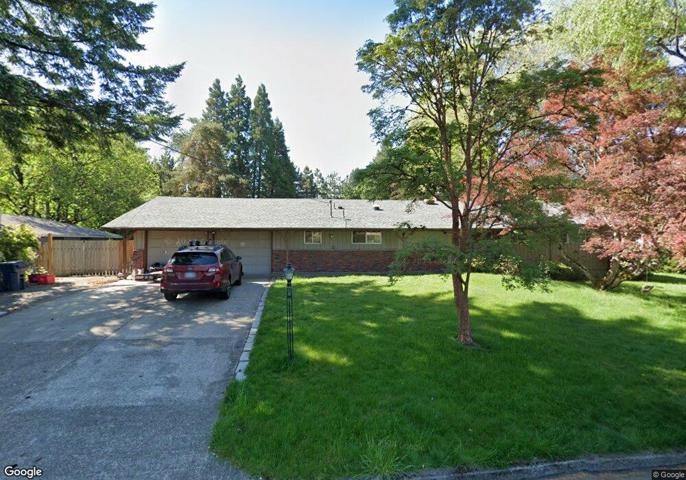
7480 SW Varns St Portland, OR 97223
Tigard Triangle NeighborhoodEstimated Value: $601,000 - $644,000
4
Beds
2
Baths
1,576
Sq Ft
$396/Sq Ft
Est. Value
About This Home
This home is located at 7480 SW Varns St, Portland, OR 97223 and is currently estimated at $624,760, approximately $396 per square foot. 7480 SW Varns St is a home located in Washington County with nearby schools including Durham Elementary School, Thomas R. Fowler Middle School, and Tigard High School.
Ownership History
Date
Name
Owned For
Owner Type
Purchase Details
Closed on
Nov 9, 2007
Sold by
Swanson Richard C and Swanson Jessie K
Bought by
Gillette Reed T and Gillette Andrea L
Current Estimated Value
Home Financials for this Owner
Home Financials are based on the most recent Mortgage that was taken out on this home.
Original Mortgage
$315,000
Outstanding Balance
$192,165
Interest Rate
5.87%
Mortgage Type
Unknown
Estimated Equity
$432,595
Create a Home Valuation Report for This Property
The Home Valuation Report is an in-depth analysis detailing your home's value as well as a comparison with similar homes in the area
Home Values in the Area
Average Home Value in this Area
Purchase History
| Date | Buyer | Sale Price | Title Company |
|---|---|---|---|
| Gillette Reed T | $350,000 | Western Title & Escrow Co |
Source: Public Records
Mortgage History
| Date | Status | Borrower | Loan Amount |
|---|---|---|---|
| Open | Gillette Reed T | $315,000 |
Source: Public Records
Tax History Compared to Growth
Tax History
| Year | Tax Paid | Tax Assessment Tax Assessment Total Assessment is a certain percentage of the fair market value that is determined by local assessors to be the total taxable value of land and additions on the property. | Land | Improvement |
|---|---|---|---|---|
| 2026 | $5,187 | $313,380 | -- | -- |
| 2025 | $5,187 | $304,260 | -- | -- |
| 2024 | $5,048 | $295,400 | -- | -- |
| 2023 | $5,048 | $286,800 | $0 | $0 |
| 2022 | $4,903 | $286,800 | $0 | $0 |
| 2021 | $4,780 | $270,340 | $0 | $0 |
| 2020 | $4,637 | $262,470 | $0 | $0 |
| 2019 | $4,436 | $254,830 | $0 | $0 |
| 2018 | $4,256 | $247,410 | $0 | $0 |
| 2017 | $3,957 | $231,690 | $0 | $0 |
| 2016 | $3,778 | $224,950 | $0 | $0 |
| 2015 | $3,632 | $218,400 | $0 | $0 |
| 2014 | $3,524 | $212,040 | $0 | $0 |
Source: Public Records
Map
Nearby Homes
- 7945 SW Fanno Creek Dr Unit 3
- 7817 SW Brookline Ln
- 14134 SW Fanno Creek Place
- 13541 SW 63rd Place
- 7754 SW Bonita Rd
- 7762 SW Bonita Rd
- 7750 SW Bonita Rd
- 7758 SW Bonita Rd
- 14655 SW 76th Ave Unit 14
- 14670 SW 78th Ave
- 9096 SW Omara St
- 9085 SW Edgewood St
- 13002 Sierra Vista Dr
- 8620 SW Inez St
- 14964 SW Belvoir Ct
- 0 SW McDonald St Unit 24040062
- 9270 SW Edgewood St
- 0 SW Elrose Ct
- 5845 Ridgetop Ct
- 9010 SW Inez St
- 7430 SW Varns St
- 7530 SW Varns St
- 13280 SW 76th Ave
- 7475 SW Varns St
- 7525 SW Varns St
- 7425 SW Varns St
- 7380 SW Varns St
- 13320 SW 76th Ave
- 13235 SW 76th Ave
- 7375 SW Varns St
- 13275 SW 76th Ave
- 7575 SW Varns St
- 7500 SW Crestview St
- 13360 SW 76th Ave
- 7330 SW Varns St
- 13315 SW 76th Ave
- 7540 SW Crestview St
- 7320 SW Hunziker St Unit 106
- 13301 SW 72nd Ave
- 7325 SW Varns St