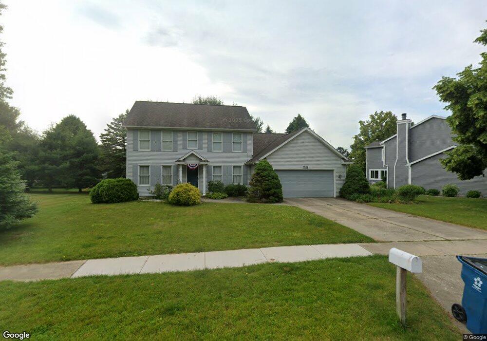
7485 Saint George Cir Portage, MI 49024
Estimated Value: $364,881 - $449,000
4
Beds
3
Baths
2,032
Sq Ft
$203/Sq Ft
Est. Value
About This Home
This home is located at 7485 Saint George Cir, Portage, MI 49024 and is currently estimated at $412,970, approximately $203 per square foot. 7485 Saint George Cir is a home located in Kalamazoo County with nearby schools including Moorsbridge Elementary School, Portage West Middle School, and Portage Central High School.
Ownership History
Date
Name
Owned For
Owner Type
Purchase Details
Closed on
Jan 27, 2010
Sold by
Susan Justin W and Susan Amy A
Bought by
Spence Kris E and Erlandson Karn A
Current Estimated Value
Home Financials for this Owner
Home Financials are based on the most recent Mortgage that was taken out on this home.
Original Mortgage
$189,000
Outstanding Balance
$124,898
Interest Rate
5%
Mortgage Type
New Conventional
Estimated Equity
$288,072
Create a Home Valuation Report for This Property
The Home Valuation Report is an in-depth analysis detailing your home's value as well as a comparison with similar homes in the area
Home Values in the Area
Average Home Value in this Area
Purchase History
| Date | Buyer | Sale Price | Title Company |
|---|---|---|---|
| Spence Kris E | $210,000 | Chicago Title |
Source: Public Records
Mortgage History
| Date | Status | Borrower | Loan Amount |
|---|---|---|---|
| Open | Spence Kris E | $189,000 |
Source: Public Records
Tax History Compared to Growth
Tax History
| Year | Tax Paid | Tax Assessment Tax Assessment Total Assessment is a certain percentage of the fair market value that is determined by local assessors to be the total taxable value of land and additions on the property. | Land | Improvement |
|---|---|---|---|---|
| 2025 | $6,064 | $170,500 | $0 | $0 |
| 2024 | $5,338 | $156,800 | $0 | $0 |
| 2023 | $4,934 | $143,400 | $0 | $0 |
| 2022 | $4,934 | $134,100 | $0 | $0 |
| 2021 | $4,934 | $133,700 | $0 | $0 |
| 2020 | $5,198 | $123,100 | $0 | $0 |
| 2019 | $468 | $122,000 | $0 | $0 |
| 2018 | $0 | $116,200 | $0 | $0 |
| 2017 | $0 | $113,800 | $0 | $0 |
| 2016 | -- | $113,100 | $0 | $0 |
| 2015 | -- | $107,300 | $0 | $0 |
| 2014 | -- | $110,700 | $0 | $0 |
Source: Public Records
Map
Nearby Homes
- 7464 Saint George Cir
- 7481 Turnberry Ct
- 7639 Dunross Dr
- 3653 Tartan Cir
- 7236 Hampstead Ln Unit 18
- 7922 Kilmory Cir
- 2076 Lion Gate Dr
- 2600 W Centre Ave Unit +/- 1 Acre
- 2351 W Centre Ave
- 7961 Kilmory Cir
- 8030 Wimbledon Dr Unit 35
- 3320 Scots Pine Way Unit 2
- 1902 W Centre Ave
- 7160 Crown Pointe Cir
- 3522 Bellflower Dr
- 2604 Radcliffe Ave
- 6876 Towhee St
- 7337 Starbrook St
- 3318 Davcliff Ave
- 2801 Daventry Ave
- 7485 Saint George Cir
- 7497 St George Cr
- 7497 Saint George Cir
- 7471 Saint George Cir
- 7590 Dunross Dr
- 7480 Saint George Cir
- 7572 Dunross Dr
- 7501 Saint George Cir
- 7501 Saint George Cir
- 3002 Muirfield Dr
- 7554 Dunross Dr
- 7457 Saint George Cir
- 7604 Dunross Dr
- 7596 Carnoustie St
- 7505 Saint George Cir
- 7536 Dunross Dr
- 1 Dunross Dr
- 19 Dunross Dr
- 0 Dunross Dr
- 7523 Turnberry Ct