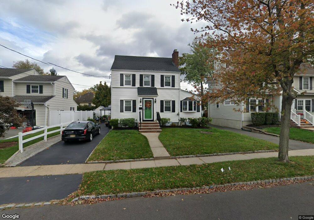
749 Austin St Westfield, NJ 07090
Estimated Value: $872,419 - $1,091,000
--
Bed
--
Bath
2,009
Sq Ft
$502/Sq Ft
Est. Value
About This Home
This home is located at 749 Austin St, Westfield, NJ 07090 and is currently estimated at $1,007,855, approximately $501 per square foot. 749 Austin St is a home located in Union County with nearby schools including McKinley Elementary School, Westfield Senior High School, and Holy Trinity School.
Ownership History
Date
Name
Owned For
Owner Type
Purchase Details
Closed on
Dec 9, 2015
Sold by
Defazio Fred and Defazio Susan
Bought by
Defazio Susan L
Current Estimated Value
Create a Home Valuation Report for This Property
The Home Valuation Report is an in-depth analysis detailing your home's value as well as a comparison with similar homes in the area
Home Values in the Area
Average Home Value in this Area
Purchase History
| Date | Buyer | Sale Price | Title Company |
|---|---|---|---|
| Defazio Susan L | -- | -- |
Source: Public Records
Tax History Compared to Growth
Tax History
| Year | Tax Paid | Tax Assessment Tax Assessment Total Assessment is a certain percentage of the fair market value that is determined by local assessors to be the total taxable value of land and additions on the property. | Land | Improvement |
|---|---|---|---|---|
| 2025 | $12,598 | $559,400 | $316,400 | $243,000 |
| 2024 | $12,340 | $559,400 | $316,400 | $243,000 |
| 2023 | $12,340 | $559,400 | $316,400 | $243,000 |
| 2022 | $12,083 | $559,400 | $316,400 | $243,000 |
| 2021 | $12,100 | $559,400 | $316,400 | $243,000 |
| 2020 | $12,072 | $559,400 | $316,400 | $243,000 |
| 2019 | $12,027 | $559,400 | $316,400 | $243,000 |
| 2018 | $13,936 | $149,900 | $51,200 | $98,700 |
| 2017 | $13,860 | $149,900 | $51,200 | $98,700 |
| 2016 | $13,534 | $149,900 | $51,200 | $98,700 |
| 2015 | $13,265 | $149,900 | $51,200 | $98,700 |
| 2014 | $12,827 | $149,900 | $51,200 | $98,700 |
Source: Public Records
Map
Nearby Homes
- 314 Highgate Ave
- 119 Lamberts Mill Rd
- 1466 Lamberts Mill Rd
- 2154 W Broad St
- 525 Edgar Rd
- 524 Edgar Rd
- 614 Dorian Rd
- 2 Brookside Ct
- 2116 Newark Ave
- 724 South Ave W Unit 724A
- 538 Westfield Ave
- 1933 W Broad St
- 350 W Dudley Ave
- 1933 Mary Ellen Ln
- 676 Vermont St
- 522 Boulevard
- 2 Dutch Ln
- 2314 Longfellow Ave
- 215 Ross Place Unit J
- 203 Ross Place