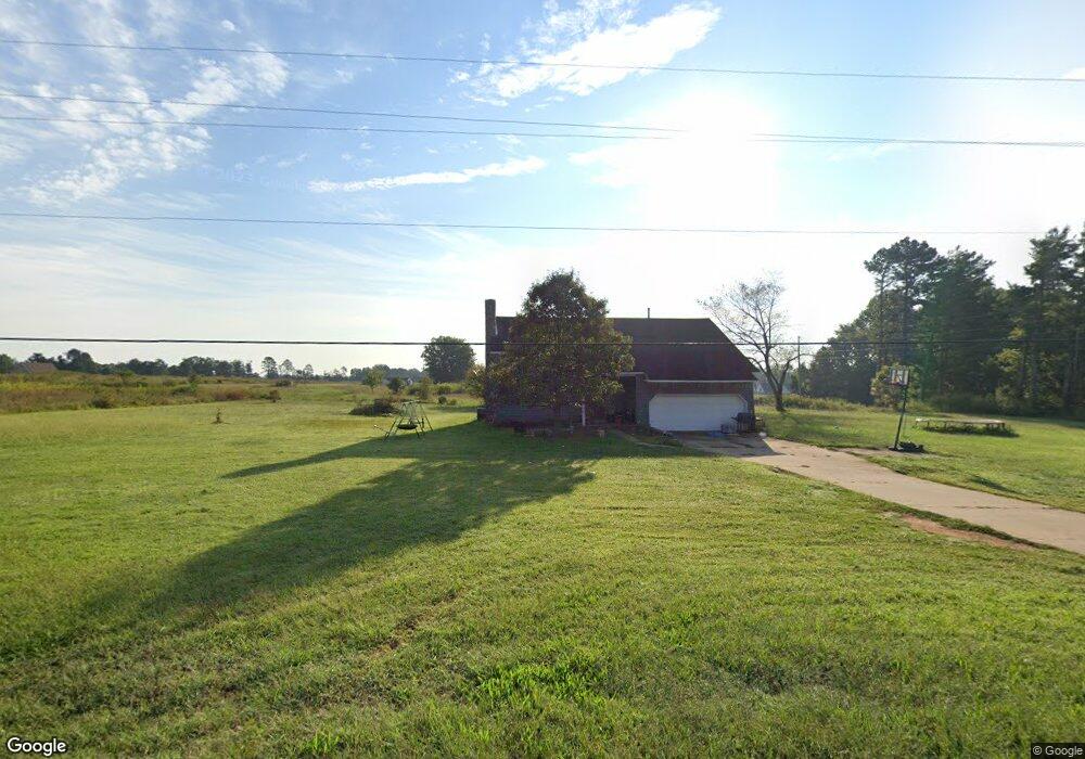
749 Shoal Rd Lincolnton, NC 28092
Estimated Value: $300,000 - $429,000
4
Beds
3
Baths
2,118
Sq Ft
$174/Sq Ft
Est. Value
About This Home
This home is located at 749 Shoal Rd, Lincolnton, NC 28092 and is currently estimated at $369,490, approximately $174 per square foot. 749 Shoal Rd is a home located in Lincoln County with nearby schools including Union Elementary School, West Lincoln Middle, and West Lincoln High School.
Ownership History
Date
Name
Owned For
Owner Type
Purchase Details
Closed on
Apr 15, 2016
Sold by
Weaver James Michael and Weaver Linda Darlene
Bought by
Williams Stephen P
Current Estimated Value
Home Financials for this Owner
Home Financials are based on the most recent Mortgage that was taken out on this home.
Original Mortgage
$134,000
Outstanding Balance
$106,629
Interest Rate
3.73%
Mortgage Type
VA
Estimated Equity
$262,861
Purchase Details
Closed on
Oct 11, 2007
Sold by
Houser Jeffery S and Houser Tina T
Bought by
Weaver James Michael and Weaver Linda D
Home Financials for this Owner
Home Financials are based on the most recent Mortgage that was taken out on this home.
Original Mortgage
$113,000
Interest Rate
6.41%
Mortgage Type
New Conventional
Create a Home Valuation Report for This Property
The Home Valuation Report is an in-depth analysis detailing your home's value as well as a comparison with similar homes in the area
Home Values in the Area
Average Home Value in this Area
Purchase History
| Date | Buyer | Sale Price | Title Company |
|---|---|---|---|
| Williams Stephen P | $134,000 | None Available | |
| Weaver James Michael | $142,000 | None Available |
Source: Public Records
Mortgage History
| Date | Status | Borrower | Loan Amount |
|---|---|---|---|
| Open | Williams Stephen P | $134,000 | |
| Previous Owner | Weaver James Michael | $113,000 |
Source: Public Records
Tax History Compared to Growth
Tax History
| Year | Tax Paid | Tax Assessment Tax Assessment Total Assessment is a certain percentage of the fair market value that is determined by local assessors to be the total taxable value of land and additions on the property. | Land | Improvement |
|---|---|---|---|---|
| 2025 | $2,006 | $294,069 | $29,815 | $264,254 |
| 2024 | $1,986 | $294,069 | $29,815 | $264,254 |
| 2023 | $1,981 | $294,069 | $29,815 | $264,254 |
| 2022 | $1,423 | $173,407 | $23,320 | $150,087 |
| 2021 | $1,423 | $173,407 | $23,320 | $150,087 |
| 2020 | $1,274 | $173,407 | $23,320 | $150,087 |
| 2019 | $1,274 | $173,407 | $23,320 | $150,087 |
| 2018 | $1,229 | $153,759 | $21,792 | $131,967 |
| 2017 | $1,128 | $153,759 | $21,792 | $131,967 |
| 2016 | $1,128 | $153,759 | $21,792 | $131,967 |
| 2015 | $1,188 | $153,759 | $21,792 | $131,967 |
| 2014 | $1,237 | $164,269 | $22,875 | $141,394 |
Source: Public Records
Map
Nearby Homes
- 508 Shoal Rd
- 00 Flay Rd
- 4832 Gideon Dr
- 00 McCurry Farm Ln Unit F1 & F2
- 4850 Gideon Dr
- 00 Westwinds Rd Unit F3
- 4773 Westwinds Rd
- 5118 Flay Rd
- 3987 W Highway 27
- 00 Wilson Ct Unit 15
- 00 Wilson Ct Unit 13
- 00 Wilson Ct Unit 12
- 5199 Helms End of Trail
- 3243 Wilson Ct Unit 11
- 5790 Summer Ln
- 142 Alf Hoover Rd
- 5958 Hoover Elmore Rd
- 2124 Shoal Rd
- 2449 Leonhardt Rd
- 5740 Crouse Rd