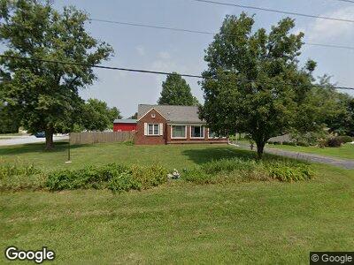
7490 W Main St Decatur, IL 62522
Estimated Value: $112,686 - $174,000
--
Bed
--
Bath
1,008
Sq Ft
$128/Sq Ft
Est. Value
About This Home
This home is located at 7490 W Main St, Decatur, IL 62522 and is currently estimated at $128,672, approximately $127 per square foot. 7490 W Main St is a home located in Macon County.
Ownership History
Date
Name
Owned For
Owner Type
Purchase Details
Closed on
Feb 24, 2012
Sold by
Peters Nathaniel B
Bought by
Perry Michelle
Current Estimated Value
Home Financials for this Owner
Home Financials are based on the most recent Mortgage that was taken out on this home.
Original Mortgage
$76,500
Interest Rate
3.87%
Mortgage Type
Purchase Money Mortgage
Purchase Details
Closed on
May 1, 2003
Create a Home Valuation Report for This Property
The Home Valuation Report is an in-depth analysis detailing your home's value as well as a comparison with similar homes in the area
Home Values in the Area
Average Home Value in this Area
Purchase History
| Date | Buyer | Sale Price | Title Company |
|---|---|---|---|
| Perry Michelle | $90,000 | None Available | |
| -- | $85,000 | -- |
Source: Public Records
Mortgage History
| Date | Status | Borrower | Loan Amount |
|---|---|---|---|
| Closed | Perry Michelle | $76,500 |
Source: Public Records
Tax History Compared to Growth
Tax History
| Year | Tax Paid | Tax Assessment Tax Assessment Total Assessment is a certain percentage of the fair market value that is determined by local assessors to be the total taxable value of land and additions on the property. | Land | Improvement |
|---|---|---|---|---|
| 2023 | $2,421 | $44,467 | $3,625 | $40,842 |
| 2022 | $2,260 | $41,121 | $3,352 | $37,769 |
| 2021 | $2,167 | $39,059 | $3,184 | $35,875 |
| 2020 | $2,033 | $30,980 | $3,001 | $27,979 |
| 2019 | $2,033 | $30,980 | $3,001 | $27,979 |
| 2018 | $1,969 | $30,245 | $2,930 | $27,315 |
| 2017 | $2,007 | $30,372 | $2,942 | $27,430 |
| 2016 | $2,026 | $30,335 | $2,938 | $27,397 |
| 2015 | $1,924 | $29,451 | $2,852 | $26,599 |
| 2014 | $1,849 | $29,160 | $2,824 | $26,336 |
| 2013 | $1,997 | $29,160 | $2,824 | $26,336 |
Source: Public Records
Map
Nearby Homes
- 205 N Camp St
- 0 W Wood St
- 275 N Camp St
- 0 W Harristown Blvd Unit 6251050
- 5232 W Main St
- 888 S Mckinney Ln
- 0 W Rock Springs Rd
- 655 Scovill Ct
- 1720 N Sunnyside Rd
- 3525 W Center St
- 170 S Hillcrest Blvd
- 10864 Cornish Rd
- 3102 W Westminster Ave
- 159 S Elder Ln
- 219 S Austin Ave
- 2540 W Macon St
- 6044 W Elwin Rd
- 1717 N Florian Ave
- 2315 W Hunt St
- 363 S Glencoe Ave