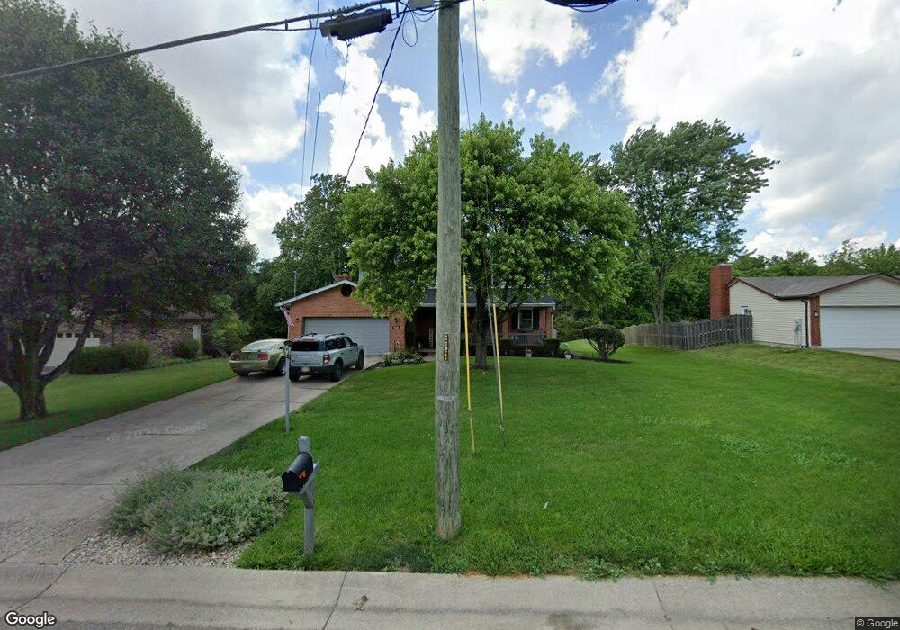
7495 Vinnedge Rd Fairfield, OH 45011
Fairfield Township NeighborhoodEstimated Value: $361,000 - $386,000
4
Beds
3
Baths
2,012
Sq Ft
$184/Sq Ft
Est. Value
About This Home
This home is located at 7495 Vinnedge Rd, Fairfield, OH 45011 and is currently estimated at $370,651, approximately $184 per square foot. 7495 Vinnedge Rd is a home located in Butler County with nearby schools including Compass Elementary School, Creekside Middle School, and Fairfield Senior High School.
Ownership History
Date
Name
Owned For
Owner Type
Purchase Details
Closed on
May 30, 2001
Sold by
Neyer Paul C and Neyer Stephanie E
Bought by
House James D and House Mary L
Current Estimated Value
Home Financials for this Owner
Home Financials are based on the most recent Mortgage that was taken out on this home.
Original Mortgage
$125,500
Outstanding Balance
$48,120
Interest Rate
7.23%
Estimated Equity
$322,531
Purchase Details
Closed on
Jan 5, 1996
Sold by
Weeks Raymond P
Bought by
Neyer Paul C
Home Financials for this Owner
Home Financials are based on the most recent Mortgage that was taken out on this home.
Original Mortgage
$112,000
Interest Rate
7.41%
Mortgage Type
Balloon
Purchase Details
Closed on
Feb 1, 1988
Create a Home Valuation Report for This Property
The Home Valuation Report is an in-depth analysis detailing your home's value as well as a comparison with similar homes in the area
Home Values in the Area
Average Home Value in this Area
Purchase History
| Date | Buyer | Sale Price | Title Company |
|---|---|---|---|
| House James D | $147,750 | -- | |
| Neyer Paul C | $124,500 | -- | |
| -- | $95,900 | -- |
Source: Public Records
Mortgage History
| Date | Status | Borrower | Loan Amount |
|---|---|---|---|
| Open | House James D | $125,500 | |
| Closed | Neyer Paul C | $112,000 |
Source: Public Records
Tax History Compared to Growth
Tax History
| Year | Tax Paid | Tax Assessment Tax Assessment Total Assessment is a certain percentage of the fair market value that is determined by local assessors to be the total taxable value of land and additions on the property. | Land | Improvement |
|---|---|---|---|---|
| 2024 | $3,714 | $100,200 | $13,460 | $86,740 |
| 2023 | $3,683 | $103,810 | $13,460 | $90,350 |
| 2022 | $3,339 | $66,510 | $13,460 | $53,050 |
| 2021 | $2,987 | $63,510 | $13,460 | $50,050 |
| 2020 | $3,094 | $63,510 | $13,460 | $50,050 |
| 2019 | $5,565 | $59,210 | $13,360 | $45,850 |
| 2018 | $3,283 | $59,210 | $13,360 | $45,850 |
| 2017 | $3,312 | $59,210 | $13,360 | $45,850 |
| 2016 | $3,257 | $55,160 | $13,360 | $41,800 |
| 2015 | $3,243 | $55,160 | $13,360 | $41,800 |
| 2014 | $2,691 | $55,160 | $13,360 | $41,800 |
| 2013 | $2,691 | $50,900 | $13,360 | $37,540 |
Source: Public Records
Map
Nearby Homes
- 7587 Vinnedge Rd
- 4101 Jamie Dr
- 7397 Chateauguay Dr
- 7075 Ashwood Knolls Dr
- 3946 Hamilton Mason Rd
- 4257 Primary Colors
- 4224 College Dictionary
- 4401 E Observatory
- 4210 Tylers Estates Dr
- 7010 Morris Rd
- 7795 Rock Port Way
- 7903 Jessies Way Unit 21-304
- 7920 Jessies Way
- 7918 Jessies Way
- 7918 Jessies Way Unit 304
- 4387 Tylers Estates Dr
- 7912 Jessies Way
- 7066 Hearthside Ct
- 7611 Tylers Hill Ct
- 7487 Vinnedge Rd
- 7503 Vinnedge Rd
- 7479 Vinnedge Rd
- 7515 Vinnedge Rd
- 7528 Evans Ct
- 7510 Vinnedge Rd
- 7463 Vinnedge Rd
- 7525 Vinnedge Rd
- 7538 Evans Ct
- 7487 Newkirk Dr
- 7524 Vinnedge Rd
- 7455 Vinnedge Rd
- 3912 Niemoeller Dr
- 7543 Evans Ct
- 7495 Newkirk Dr
- 7548 Evans Ct
- 7378 Dust Commander Ct
- 7368 Dust Commander Ct
- 7447 Vinnedge Rd
- 7534 Vinnedge Rd