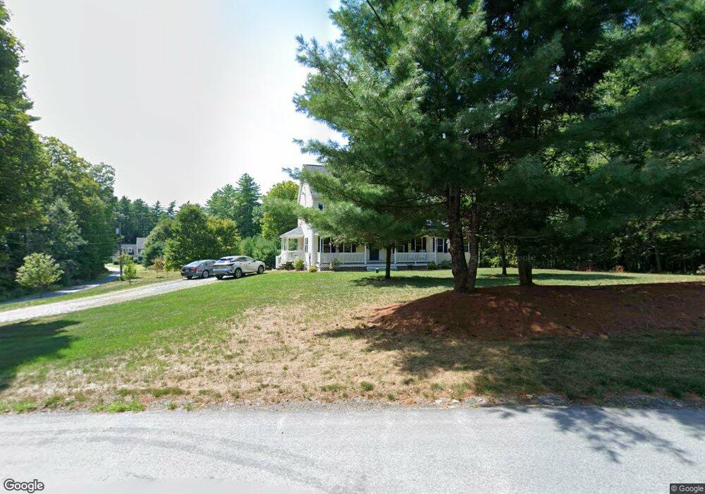
74B Averill Rd Brookline, NH 03033
Estimated Value: $661,000 - $724,000
4
Beds
3
Baths
2,937
Sq Ft
$236/Sq Ft
Est. Value
About This Home
This home is located at 74B Averill Rd, Brookline, NH 03033 and is currently estimated at $692,016, approximately $235 per square foot. 74B Averill Rd is a home with nearby schools including Richard Maghakian Memorial School, Captain Samuel Douglass Academy, and Hollis-Brookline Middle School.
Ownership History
Date
Name
Owned For
Owner Type
Purchase Details
Closed on
Sep 28, 2012
Sold by
Hultz Paul B and Hultz Angela M
Bought by
Hultz Paul B and Hultz Ngela M
Current Estimated Value
Purchase Details
Closed on
Oct 2, 2003
Sold by
Sinclair John A and Sinclair Shannon M
Bought by
Hultz Paul B and Hultz Angela M
Home Financials for this Owner
Home Financials are based on the most recent Mortgage that was taken out on this home.
Original Mortgage
$276,000
Interest Rate
6.25%
Create a Home Valuation Report for This Property
The Home Valuation Report is an in-depth analysis detailing your home's value as well as a comparison with similar homes in the area
Home Values in the Area
Average Home Value in this Area
Purchase History
| Date | Buyer | Sale Price | Title Company |
|---|---|---|---|
| Hultz Paul B | -- | -- | |
| Hultz Paul B | -- | -- | |
| Hultz Paul B | $345,000 | -- |
Source: Public Records
Mortgage History
| Date | Status | Borrower | Loan Amount |
|---|---|---|---|
| Previous Owner | Hultz Paul B | $311,000 | |
| Previous Owner | Hultz Paul B | $40,000 | |
| Previous Owner | Hultz Paul B | $276,000 |
Source: Public Records
Tax History Compared to Growth
Tax History
| Year | Tax Paid | Tax Assessment Tax Assessment Total Assessment is a certain percentage of the fair market value that is determined by local assessors to be the total taxable value of land and additions on the property. | Land | Improvement |
|---|---|---|---|---|
| 2024 | $13,600 | $601,500 | $179,800 | $421,700 |
| 2023 | $12,499 | $601,500 | $179,800 | $421,700 |
| 2022 | $10,845 | $364,900 | $108,300 | $256,600 |
| 2021 | $10,429 | $364,900 | $108,300 | $256,600 |
| 2020 | $10,144 | $364,900 | $108,300 | $256,600 |
| 2019 | $10,900 | $364,900 | $108,300 | $256,600 |
| 2018 | $9,503 | $365,000 | $108,300 | $256,700 |
| 2017 | $9,444 | $286,700 | $87,500 | $199,200 |
| 2016 | $9,136 | $280,600 | $81,200 | $199,400 |
| 2015 | $8,713 | $280,600 | $81,200 | $199,400 |
| 2014 | $9,218 | $280,600 | $81,200 | $199,400 |
| 2013 | $8,875 | $280,600 | $81,200 | $199,400 |
Source: Public Records
Map
Nearby Homes
- 9 Winterberry Rd
- 7 Winterberry Rd
- 15 N End Rd
- 364 Townsend Hill Rd
- 1235 Townsend Rd
- 0 Brookline St
- 46 Oak Hill Rd
- 55 Oak Hill Rd
- 64 Meadow Rd
- 167 Route 13
- 6 High Oaks Path
- 22 Hobart Hill Rd
- 6 Flint Meadow Dr
- 28A Rocky Pond Rd
- 21 Cranberry St
- 5 Carons Way
- 91 Highland St
- 75 Highland St
- 10 Stearns Ave
- 11 Fox Run
- 74a Averill Rd
- 72 Averill Rd
- 76 Averill Rd
- 70 Averill Rd
- 73 Averill Rd
- 69 Averill Rd
- 68 Averill Rd
- 0 Averill Rd
- 79 Averill Rd
- 66 Averill Rd
- 9 Beaver Pond Dr
- 5 Wallace Brook Rd
- 4 Talbot Rd
- 65 Averill Rd
- 7 Beaver Pond Dr
- 0 Cleveland Hill Rd
- 74 Cleveland Hill Rd
- 7 Wallace Brook Rd
- 63 Averill Rd
- 5 Beaver Pond Dr