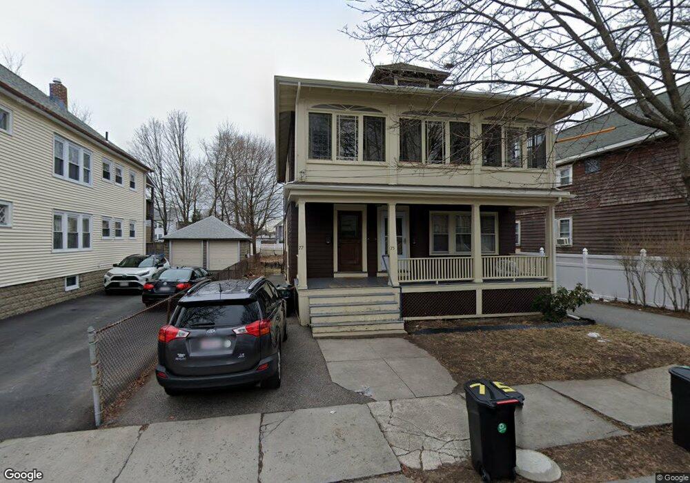
75 Allen St Unit 77 Arlington, MA 02474
East Arlington NeighborhoodEstimated Value: $1,234,000 - $1,363,000
4
Beds
2
Baths
2,376
Sq Ft
$543/Sq Ft
Est. Value
About This Home
This home is located at 75 Allen St Unit 77, Arlington, MA 02474 and is currently estimated at $1,289,703, approximately $542 per square foot. 75 Allen St Unit 77 is a home located in Middlesex County with nearby schools including Thompson School, Ottoson Middle School, and Arlington High School.
Ownership History
Date
Name
Owned For
Owner Type
Purchase Details
Closed on
Oct 10, 2003
Sold by
Houghton Amanda D and Houghton Mark L
Bought by
Amanda D Houghton T D and Amanda Houghton
Current Estimated Value
Home Financials for this Owner
Home Financials are based on the most recent Mortgage that was taken out on this home.
Original Mortgage
$413,100
Interest Rate
5.52%
Mortgage Type
Purchase Money Mortgage
Purchase Details
Closed on
Aug 25, 2003
Sold by
Olivier Thomas T and Olivier Linda Kilner
Bought by
Houghton Amanda D and Houghton Mark L
Home Financials for this Owner
Home Financials are based on the most recent Mortgage that was taken out on this home.
Original Mortgage
$413,100
Interest Rate
5.52%
Mortgage Type
Purchase Money Mortgage
Create a Home Valuation Report for This Property
The Home Valuation Report is an in-depth analysis detailing your home's value as well as a comparison with similar homes in the area
Home Values in the Area
Average Home Value in this Area
Purchase History
| Date | Buyer | Sale Price | Title Company |
|---|---|---|---|
| Amanda D Houghton T D | -- | -- | |
| Houghton Amanda D | $570,000 | -- |
Source: Public Records
Mortgage History
| Date | Status | Borrower | Loan Amount |
|---|---|---|---|
| Previous Owner | Houghton Amanda D | $413,100 |
Source: Public Records
Tax History Compared to Growth
Tax History
| Year | Tax Paid | Tax Assessment Tax Assessment Total Assessment is a certain percentage of the fair market value that is determined by local assessors to be the total taxable value of land and additions on the property. | Land | Improvement |
|---|---|---|---|---|
| 2025 | $11,362 | $1,055,000 | $602,200 | $452,800 |
| 2024 | $10,518 | $993,200 | $573,300 | $419,900 |
| 2023 | $10,452 | $932,400 | $480,600 | $451,800 |
| 2022 | $10,402 | $910,900 | $463,200 | $447,700 |
| 2021 | $10,098 | $890,500 | $463,200 | $427,300 |
| 2020 | $9,850 | $890,600 | $463,200 | $427,400 |
| 2019 | $9,278 | $824,000 | $492,200 | $331,800 |
| 2018 | $8,379 | $690,800 | $359,000 | $331,800 |
| 2017 | $7,836 | $623,900 | $312,700 | $311,200 |
| 2016 | $7,393 | $577,600 | $266,400 | $311,200 |
| 2015 | $7,289 | $537,900 | $260,600 | $277,300 |
Source: Public Records
Map
Nearby Homes
- 41 Palmer St Unit 43
- 42-44 Warren St Unit 42
- 94 Rawson Rd Unit 94
- 29 Dartmouth St Unit 29
- 25-27 Adams St
- 132 Rawson Rd Unit 132
- 167 Franklin St Unit 167
- 23 Yale Rd
- 18 Belknap St Unit 2
- 18 Belknap St Unit 1
- 69 Arlington St
- 34 Hamilton Rd Unit 302
- 230 Massachusetts Ave Unit 6
- 6 Gordon Rd
- 22 Hamilton Rd Unit 206
- 215 Massachusetts Ave Unit 19 (34)
- 97 Mystic St Unit B
- 166 Arlington St
- 0 Jerome St Unit 72734260
- 31 Sharon St
- 71 Allen St Unit 73
- 79 Allen St Unit 81
- 79 Allen St Unit 79
- 79 Allen St Unit 1
- 213 Broadway
- 219 Broadway Unit 221
- 219 Broadway Unit 3
- 219 Broadway Unit 2
- 221 Broadway Unit 3
- 221 Broadway Unit 2
- 221 Broadway Unit 1
- 215-217 Broadway
- 74 Allen St Unit 76
- 74 Allen St Unit 1
- 80 Allen St
- 70 Allen St Unit 72
- 66 Warren St Unit 68
- 70 Warren St Unit 72
- 60 Warren St
- 215 Broadway Unit 217