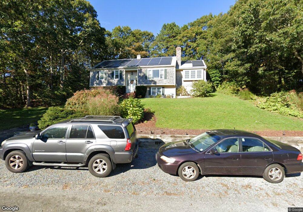
75 Capn Crosby Rd Centerville, MA 02632
Centerville NeighborhoodEstimated Value: $580,000 - $732,000
3
Beds
3
Baths
1,220
Sq Ft
$527/Sq Ft
Est. Value
About This Home
This home is located at 75 Capn Crosby Rd, Centerville, MA 02632 and is currently estimated at $642,788, approximately $526 per square foot. 75 Capn Crosby Rd is a home located in Barnstable County with nearby schools including Barnstable United Elementary School, Centerville Elementary School, and Barnstable Intermediate School.
Ownership History
Date
Name
Owned For
Owner Type
Purchase Details
Closed on
May 22, 2018
Sold by
Sawyer Richard H and Sawyer Shirley K
Bought by
Framson Elizabeth G
Current Estimated Value
Home Financials for this Owner
Home Financials are based on the most recent Mortgage that was taken out on this home.
Original Mortgage
$373,117
Outstanding Balance
$321,140
Interest Rate
4.75%
Mortgage Type
FHA
Estimated Equity
$321,648
Purchase Details
Closed on
Jun 23, 1999
Sold by
Vellante Rt and Vellante Sylvia B
Bought by
Sawyer Richard H and Sawyer Shirley K
Home Financials for this Owner
Home Financials are based on the most recent Mortgage that was taken out on this home.
Original Mortgage
$156,560
Interest Rate
7.09%
Mortgage Type
Purchase Money Mortgage
Purchase Details
Closed on
Mar 26, 1991
Sold by
Berkshire Cty Sb
Bought by
Villante William A
Purchase Details
Closed on
Feb 11, 1991
Sold by
Andris Charles F
Bought by
Berkshire Cty Svgs Bk
Create a Home Valuation Report for This Property
The Home Valuation Report is an in-depth analysis detailing your home's value as well as a comparison with similar homes in the area
Home Values in the Area
Average Home Value in this Area
Purchase History
| Date | Buyer | Sale Price | Title Company |
|---|---|---|---|
| Framson Elizabeth G | $380,000 | -- | |
| Sawyer Richard H | $152,000 | -- | |
| Villante William A | $114,000 | -- | |
| Berkshire Cty Svgs Bk | $105,000 | -- |
Source: Public Records
Mortgage History
| Date | Status | Borrower | Loan Amount |
|---|---|---|---|
| Open | Framson Elizabeth G | $373,117 | |
| Previous Owner | Berkshire Cty Svgs Bk | $155,600 | |
| Previous Owner | Berkshire Cty Svgs Bk | $153,500 | |
| Previous Owner | Berkshire Cty Svgs Bk | $156,560 |
Source: Public Records
Tax History
| Year | Tax Paid | Tax Assessment Tax Assessment Total Assessment is a certain percentage of the fair market value that is determined by local assessors to be the total taxable value of land and additions on the property. | Land | Improvement |
|---|---|---|---|---|
| 2025 | $4,360 | $538,900 | $152,900 | $386,000 |
| 2024 | $4,287 | $548,900 | $152,900 | $396,000 |
| 2023 | $4,005 | $480,200 | $139,000 | $341,200 |
| 2022 | $3,754 | $389,400 | $103,000 | $286,400 |
| 2021 | $3,713 | $354,000 | $103,000 | $251,000 |
| 2020 | $3,852 | $351,500 | $103,000 | $248,500 |
| 2019 | $3,579 | $317,300 | $103,000 | $214,300 |
| 2018 | $3,238 | $288,600 | $108,400 | $180,200 |
| 2017 | $3,044 | $282,900 | $108,400 | $174,500 |
| 2016 | $3,437 | $315,300 | $109,300 | $206,000 |
| 2015 | $3,066 | $282,600 | $106,000 | $176,600 |
Source: Public Records
Map
Nearby Homes
- 324 Patriot Way
- 66 Tern Ln
- 73 Tern Ln
- 900 Old Stage Rd
- 29 Appaloosa Way
- 74 Saddler Ln
- 296 Buckskin Path
- 350 Plum St
- 87 Foxglove Rd
- 367 Plum St
- 315 Prince Hinckley Rd
- 169 Cedric Rd
- 282 Parker Rd
- 97 Yacht Club Rd
- 82 Yacht Club Rd
- 5 Chickadee Ln
- 159 Willow Run Dr
- 352 Nye Rd
- 481 Lakeside Dr W
- 80 Branch Terrace
- 75 Captain Crosby Rd
- 75 Cap'N Crosby Rd
- 100 Cap'N Carlton
- 65 Longboat Dr
- 57 Longboat Dr
- 89 Capn Crosby Rd
- 69 Cap'N Crosby Rd
- 69 Capn Crosby Rd
- 6 Gorham Ln
- 15 Gorham Ln
- 153 Cap'N Crosby Rd
- 153 Capn Crosby Rd
- 75 Longboat Dr
- 47 Longboat Dr
- 14 Gorham Ln
- 51 Capn Crosby Rd
- 161 Capn Crosby Rd
- 70 Longboat Dr
- 54 Longboat Dr
- 37 Longboat Dr
Your Personal Tour Guide
Ask me questions while you tour the home.