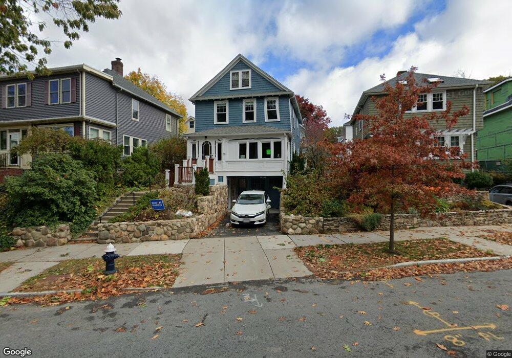
75 Eliot St Chestnut Hill, MA 02467
Chestnut Hill NeighborhoodEstimated Value: $1,223,000 - $1,514,000
4
Beds
1
Bath
1,320
Sq Ft
$1,034/Sq Ft
Est. Value
About This Home
This home is located at 75 Eliot St, Chestnut Hill, MA 02467 and is currently estimated at $1,364,296, approximately $1,033 per square foot. 75 Eliot St is a home located in Norfolk County with nearby schools including Heath Elementary School, Maimonides School, and Brimmer & May School.
Ownership History
Date
Name
Owned For
Owner Type
Purchase Details
Closed on
Mar 30, 2006
Sold by
Dash Stuart D and Dash Robin R
Bought by
Martino Andrew P and Martino Lisa
Current Estimated Value
Create a Home Valuation Report for This Property
The Home Valuation Report is an in-depth analysis detailing your home's value as well as a comparison with similar homes in the area
Home Values in the Area
Average Home Value in this Area
Purchase History
| Date | Buyer | Sale Price | Title Company |
|---|---|---|---|
| Martino Andrew P | $560,000 | -- |
Source: Public Records
Tax History Compared to Growth
Tax History
| Year | Tax Paid | Tax Assessment Tax Assessment Total Assessment is a certain percentage of the fair market value that is determined by local assessors to be the total taxable value of land and additions on the property. | Land | Improvement |
|---|---|---|---|---|
| 2025 | $11,288 | $1,143,700 | $670,200 | $473,500 |
| 2024 | $10,731 | $1,098,400 | $644,500 | $453,900 |
| 2023 | $10,265 | $1,029,600 | $584,500 | $445,100 |
| 2022 | $9,605 | $942,600 | $556,600 | $386,000 |
| 2021 | $8,162 | $832,900 | $535,200 | $297,700 |
| 2020 | $7,365 | $779,400 | $486,600 | $292,800 |
| 2019 | $6,955 | $742,300 | $463,400 | $278,900 |
| 2018 | $6,935 | $733,100 | $459,600 | $273,500 |
| 2017 | $6,833 | $691,600 | $433,600 | $258,000 |
| 2016 | $6,628 | $636,100 | $405,200 | $230,900 |
| 2015 | $6,349 | $594,500 | $378,700 | $215,800 |
| 2014 | $6,324 | $555,200 | $344,200 | $211,000 |
Source: Public Records
Map
Nearby Homes
- 30 Ackers Ave
- 59 Ackers Ave Unit 1
- 675 Chestnut Hill Ave
- 55 Reservoir Rd Unit 2
- 540 Chestnut Hill Ave
- 88 Cutler Ln
- 120 Seaver St Unit A103
- 120 Seaver St Unit C-102
- 55 Leicester St
- 9 Willard Rd
- 142 Crafts Rd
- 130 Cabot St
- 372 Warren St
- 39 Clyde St
- 80 Dudley St
- 8 Strathmore Rd Unit G
- 17 Strathmore Rd Unit 2
- 2400 Beacon St Unit 112
- 1014 Boylston St
- 333 Clark Rd
- 77 Eliot St
- 77 Eliot St Unit SFR
- 71 Eliot St
- 79 Eliot St
- 39 Loveland Rd
- 35 Loveland Rd
- 43 Loveland Rd
- 67 Eliot St
- 67 Eliot St Unit B
- 67 Eliot St Unit A
- 67 Eliot St Unit 2
- 67 Eliot St Unit 1
- 83 Eliot St
- 31 Loveland Rd
- 31 Loveland Rd Unit 1
- 29 Loveland Rd
- 27 Loveland Rd Unit 1
- 85 Eliot St
- 91 Eliot St
- 0 Loveland Rd