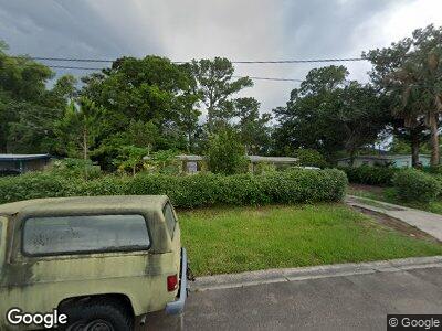
75 Forrestal Cir S Atlantic Beach, FL 32233
Estimated Value: $297,000 - $438,000
3
Beds
2
Baths
925
Sq Ft
$403/Sq Ft
Est. Value
About This Home
This home is located at 75 Forrestal Cir S, Atlantic Beach, FL 32233 and is currently estimated at $373,209, approximately $403 per square foot. 75 Forrestal Cir S is a home located in Duval County with nearby schools including Atlantic Beach Elementary School, Mayport Middle School, and Duncan U. Fletcher High School.
Ownership History
Date
Name
Owned For
Owner Type
Purchase Details
Closed on
Sep 30, 2004
Sold by
Bird Paul D and Bird Elena
Bought by
Daye Leif A and Daye Sarah
Current Estimated Value
Home Financials for this Owner
Home Financials are based on the most recent Mortgage that was taken out on this home.
Original Mortgage
$134,900
Interest Rate
6.99%
Mortgage Type
Stand Alone First
Purchase Details
Closed on
Feb 9, 2000
Sold by
Ware Charles H
Bought by
Bird Paul D
Home Financials for this Owner
Home Financials are based on the most recent Mortgage that was taken out on this home.
Original Mortgage
$36,000
Interest Rate
8.11%
Purchase Details
Closed on
Sep 30, 1999
Sold by
Ware Charles E
Bought by
Estate Katherine M Ware
Create a Home Valuation Report for This Property
The Home Valuation Report is an in-depth analysis detailing your home's value as well as a comparison with similar homes in the area
Home Values in the Area
Average Home Value in this Area
Purchase History
| Date | Buyer | Sale Price | Title Company |
|---|---|---|---|
| Daye Leif A | $142,000 | Estate Title & Trust | |
| Bird Paul D | $48,000 | -- | |
| Estate Katherine M Ware | $100 | -- |
Source: Public Records
Mortgage History
| Date | Status | Borrower | Loan Amount |
|---|---|---|---|
| Open | Daye Leif A | $139,100 | |
| Closed | Daye Leif A | $134,900 | |
| Previous Owner | Bird Paul D | $36,000 |
Source: Public Records
Tax History Compared to Growth
Tax History
| Year | Tax Paid | Tax Assessment Tax Assessment Total Assessment is a certain percentage of the fair market value that is determined by local assessors to be the total taxable value of land and additions on the property. | Land | Improvement |
|---|---|---|---|---|
| 2025 | $1,434 | $126,827 | -- | -- |
| 2024 | $1,380 | $123,253 | -- | -- |
| 2023 | $1,380 | $119,664 | $0 | $0 |
| 2022 | $1,252 | $116,179 | $0 | $0 |
| 2021 | $1,240 | $112,796 | $0 | $0 |
| 2020 | $1,222 | $111,239 | $0 | $0 |
| 2019 | $1,199 | $108,739 | $0 | $0 |
| 2018 | $1,176 | $106,712 | $0 | $0 |
| 2017 | $1,153 | $104,518 | $0 | $0 |
| 2016 | $1,139 | $102,369 | $0 | $0 |
| 2015 | $1,156 | $101,658 | $0 | $0 |
| 2014 | $1,355 | $111,249 | $0 | $0 |
Source: Public Records
Map
Nearby Homes
- 106 Saratoga Cir S
- 1099 Cornell Ln
- 1103 Cornell Ln
- 567 Aquatic Dr
- 67 W 9th St
- 931 Calypso Way Unit LOT 15
- 756 Aquatic Dr
- 0 West Plaza
- 663 Stocks St
- 156 Sandy Beach Ln
- 452 Sargo Rd
- 800 Stocks St
- 451 Sargo Rd
- 954 Stocks St
- 423 Royal Palms Dr
- 66 W 14th St
- 95 W 13th St
- 571 Camelia St
- 1282 Hibiscus St
- 1522 Sand Dollar Cir
- 75 Forrestal Cir S
- 71 Forrestal Cir S
- 79 Forrestal Cir S
- 15 Saratoga Cir N
- 67 Forrestal Cir S
- 19 Saratoga Cir N
- 78 Forrestal Cir S
- 67 Forrestal Cir S
- 83 Forrestal Cir S
- 74 Forrestal Cir S
- 11 Saratoga Cir N Unit 2
- 82 Forrestal Cir S
- 23 Saratoga Cir N
- 70 Forrestal Cir S
- 63 Forrestal Cir S
- 86 Forrestal Cir S
- 63 Forrestal Cir S
- 87 S Forrestal Cr
- 87 Forrestal Cir S
- 27 Saratoga Cir N